Last weekend I kicked off my autumn hiking season with a long weekend at Seoraksan National Park. My favorite time of the year has arrived in Korea and I intended to enjoy the beautiful nature to the fullest. I have a whole season full of hiking planned at national parks throughout Korea. I have been to Seoraksan National Park the last time I lived in Korea, but that was actually only one day of hiking, so I wanted to enjoy it more and hike many different trails in the park. Seoraksan National Park is one of the most popular national parks in Korea, for good reason. The hiking is amazing and the scenery is so beautiful. It’s nice any time of the year, but its true charm comes out when the fall colors ablaze everywhere. It’s also when the crowds come out, but that is just something you just deal with to enjoy yourself.
It’s very easy to reach Seoraksan National Park. The nearest large city is Sokcho and there are numerous busses departing from the Dong Seoul bus station and Seoul Express Bus Terminal (about every 30 minutes during the day). The trip only takes about three hours, so I took an evening bus to Seoraksan Thursday night, so I could start hiking early Friday morning before the crowds hit. To make it easy for hiking, I chose to stay at a motel (The Seorak Morning Inn) in the village of Seorak-dong, which is about a 1.5 km easy, pleasant walk or short bus ride to the park entrance.
I picked Seoraksan as my first hiking weekend, both because I had a long weekend to do all the hikes I wanted in the time available, and it was also supposed to be the first national park to hit peak color for autumn foliage in the middle of October. I had visions of seeing the entire hills covered in red, orange and yellow. What I found was a bit different. Due to the warm weather this, the advent of fall seems to be delayed in Korea. It was the middle of October, and while there were leaves changing, it was not as much as I expected. But I valiantly set out in search of autumn colors.
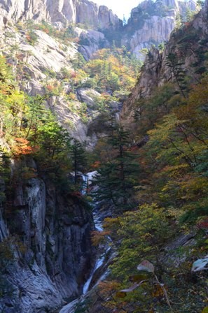
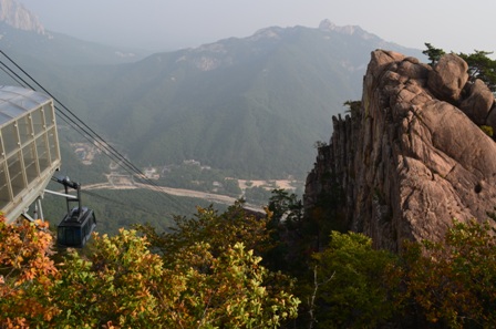
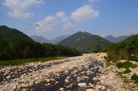
My first day in the park was a Friday, so while there were people there, it certainly wasn’t as crowded as it is on weekends. Of course it also helped that was I an early bird and arrived at the park shortly after it opened. The first thing I did when I got to the park (before the lines got too long) was take the cable car up to Gwongeumseong (Gwongeum Fortress) which is the ruin site of an old castle. The cable car ride is only about six minutes up, and it takes you to a hill with a beautiful view over the valley below and the mountains surrounding the hill.

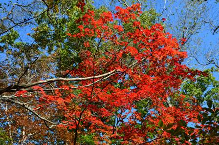
The weather was a bit hazy at first, since it was early morning. But I could see patches of orange and yellow among the abundance of green trees.

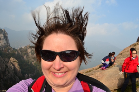
It was SUPER windy at the top of the hill. See the picture below for just a hint at how windy it was. At times the gusts were so strong, I felt like I was going to be blown off the mountain if I lost my footing.

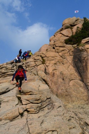
My ultimate goal was the top of Gwongeumseong, which was marked by the Korean national flag blowing in the wind. Getting up was interesting, because the path was a bit narrow in parts, and I had to pull myself along with a rope during parts of the ascent. And it was even windier on top of the mountain. Like always, I personally found it easier to ascend and climb up rather than descend and climb down. Coming off the mountain was an interesting journey. When you see nimble, able Korean hikers descending on their butt, you KNOW it is a bit treacherous for someone like me who is clumsy and decidedly not sure-footed. But I made it in one piece, ready for more hiking.

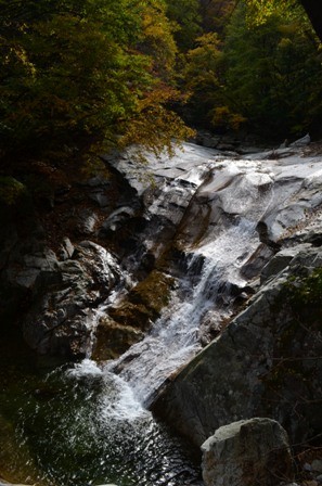
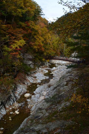
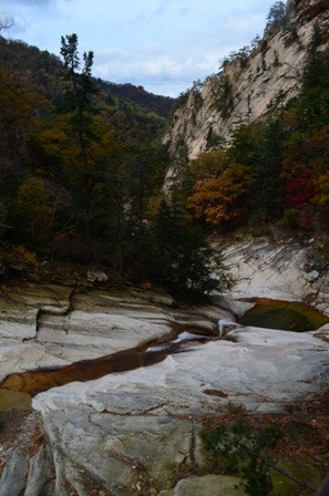
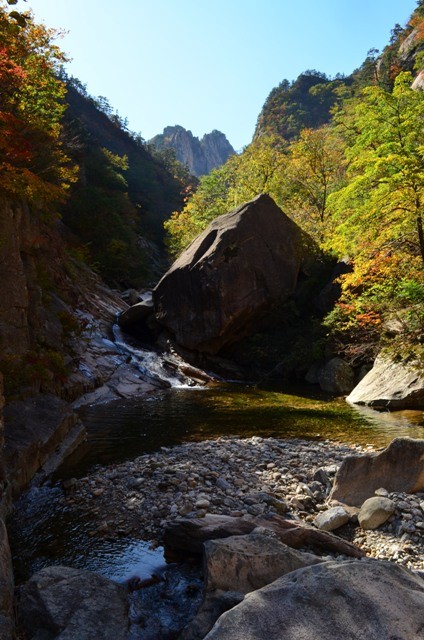
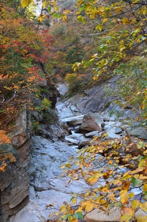
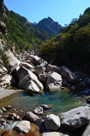
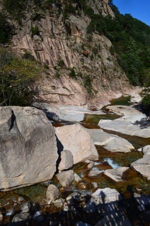
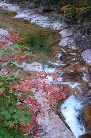
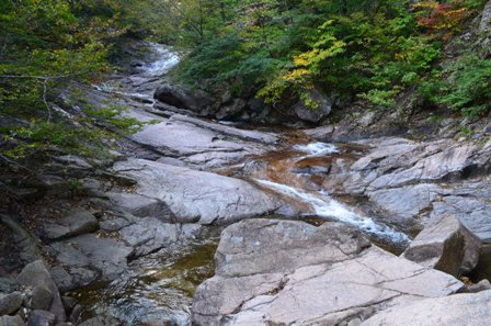
The second hike of the day was an easy hike to Biryong Falls. It was only 2.4 kilometers with no major uphills. Instead it was easy and pleasant to hike along the trail, enjoying the view around me. The hike starts a few hundred meters from the entrance to the cable car, and you can see the cable car ascend as you begin the hike.
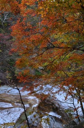
I was very charmed by the numerous, beautiful waterfalls and the colorful foliage during the course of the hike.
I even saw more hints of autumn color on the trail. It was beginning to feel a lot more like autumn.


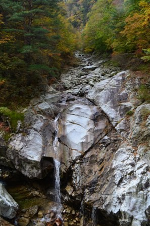
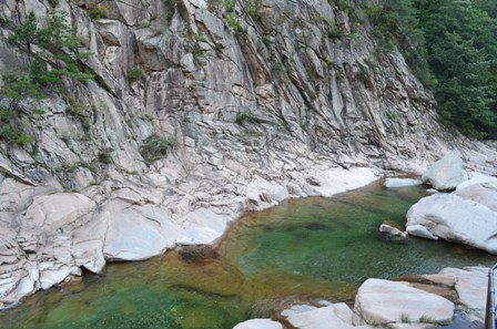
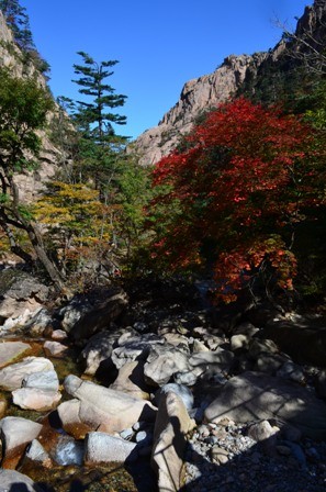
Even though the final destination was a waterfall, that doesn’t mean there was a shortage of waterfalls along the way, such as Youkdam Falls pictured below.

The sun kept peeking in and out from behind clouds and the trees during the walk. That highlighted the leaf colors, but it also produced interesting and beautiful effects on the rippling water.
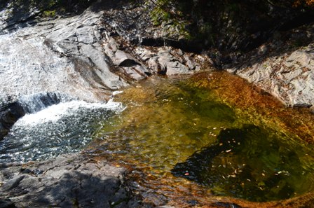
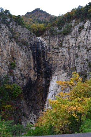
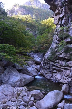
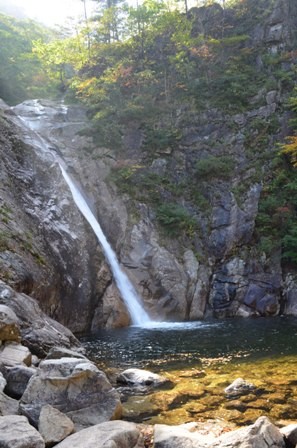
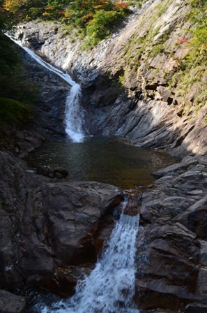
At the end of the hike is the 40m high Biryong Falls, which means “Flying Dragon”, because of the shape the water evokes. It’s a very pleasant place to sit by the water and silently take in the water and scenery or enjoy a picnic lunch with a group of other hikers, or at least partake in some of the food the very nice older women offered me.

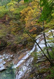
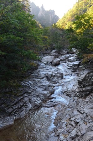
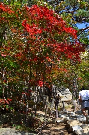
But as beautiful and peaceful Biryong Falls is, I didn’t relax, because I had one more hike planned for the day. And this hike is considered one of the most difficult hikes in Seoraksan National Park. It is also one of the popular ones, because of the beautiful, panoramic view from the top of the 876m high Ulsan Bawi. Because the first two hikes were pretty easy, I wasn’t really tired, which is good, because the Ulsan Bawi is an ass smoker, or more specifically, a thigh smoker. It starts out easy enough with beautiful scenery.

But soon enough the hike reveals its true difficulty. The hike gets steeper as it proceeds to the midway point of Gyeojo Hermitage. It’s a nice place to rest, enjoy the scenery and gather your strength for the final ascent to Ulsan Bawi. From the hermitage to the top, it is only 1 kilometer, but it took me about an hour to ascend because of the difficulty and the steepness of the trail. I didn’t realize this until later when I saw a map of the trail, but the final 1 km of the trail is a 30.8% gradient, so at times it felt you needed to climb it and not just hike it. I’m in reasonably good shape, but I had to take numerous short breaks to catch my breath and allow my poor thighs to rest. But even though I was focused on getting to the top, I still was able to enjoy the colorful foliage. The higher I went, the more red leaves I could see.
I did this hike during my last visit to Seoraksan, and it was interesting to contrast the hikes. Both times the hikes were strenuous, but the trail was much more uneven several years ago. I had to spend a good chunk of my hike with my eyes glued to the ground so I didn’t trip and fall. But in the intervening years, the trail has been improved so it’s not QUITE so uneven. Wooden blocks have been placed among the stones, so it is easier to find steps. The crowds were also much less this time around. During my last visit, it was on a Saturday afternoon, and there was literally a line waiting to reach the summit, since the summit is not that big and only so many people can fit up top. This time, there was no line, no wait. Maybe it was because it was Friday. Maybe it was because the leaves hadn’t fully changed colors. But either way, it made for a more pleasant journey. Plus a good chunk of the trail was steps, so it a BIT easier. However, when you are faced with a very long stairway UP, you just hope that your legs hold out.

But then, I hit the top. I got to the summit of Ulsan Bawi. I could see for miles around, all the way to the town of Sokcho and the East Sea. Sure it is windy as all get out, but it’s worth it, because I MADE IT. No, it’s not like summiting Everest or anything difficult like that. But my thighs were certainly shaking enough on the way down.

All told, I probably hiked over 10 km my first day at Seoraksan National Park. That doesn’t sound like a lot, and it’s really not since it’s only a little over six miles. But Korean hiking is no joke for the most part, particularly for someone short and clumsy like me. By the time I walked back to my hotel, I was ready for a hot bath and long snooze to get ready for day two of my Seoraksan hiking journey.

 Takao was my final stop on my autumn color extravaganza in Kyoto. I originally intended to visit the Jingoji Temple in the Takao area the night prior since it was open for night illuminations. However, I wussed out and decided to go shopping instead. It turns out it was a really good decision to go during the day, because Takao had the best autumn colors on this trip to Kyoto.
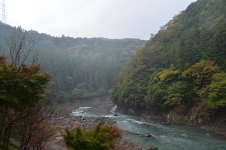
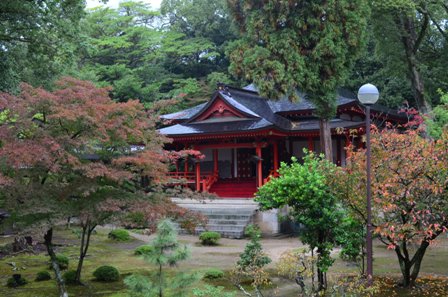
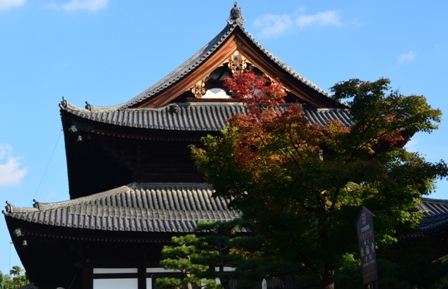
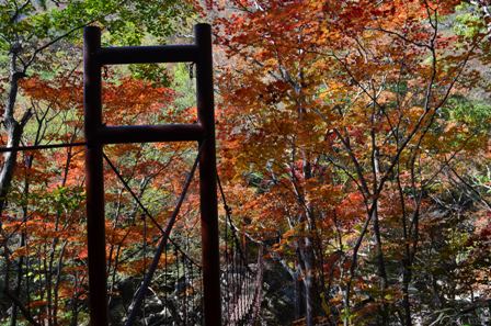
 Takao is sparsely populated in a mountainous area about an hour’s bus ride from Kyoto. The Takao area houses three temples: Kozanji, Jingoji and Saimyoji. Jingoji Temple is the most popular temple in the area, and was the only one I visited.
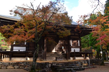
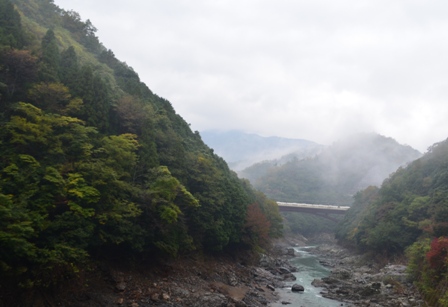
 Takao is pretty easy to reach from Kyoto. You can take one of two buses from Kyoto to Takao. The JR bus leaves from Kyoto Station (JR#3 stop). It costs roughly 500 yen one way. The other bus is Kyoto City Bus 8 that leaves from Shijo Karasuma.
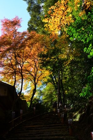
 It’s a roughly 20-30 minute walk from the Takao bus stop to Jingoji Temple. The trail goes sharply downhill and crosses a river. Follow the stairs up the hill and to the temple.

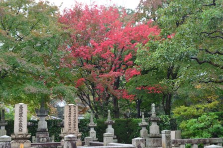
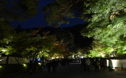
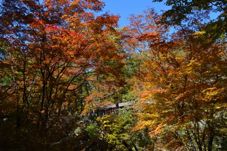
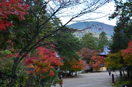
 The temple grounds are very wide open, and when I was there on a Monday morning, sparsely populated (I imagine it’s much more crowded on a weekend day).
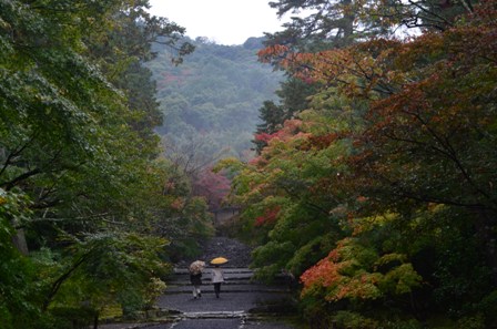
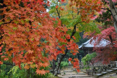
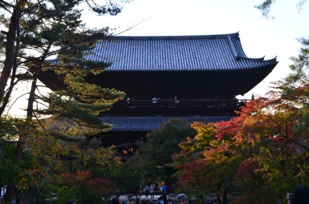
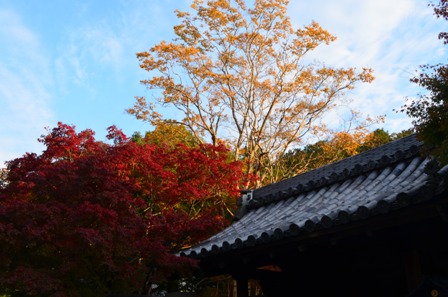
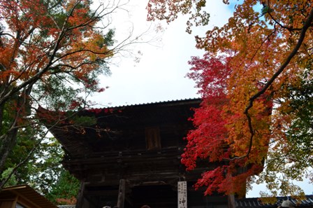
 The centerpiece of Jingoji Temple complex is a large Buddhist Temple. From the top of the stairs, the view down is quite colorful and spectacular (the title picture of this blog).
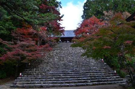
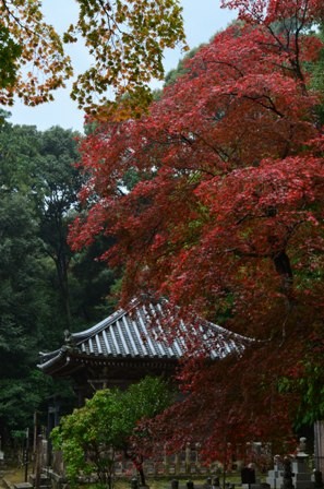
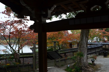
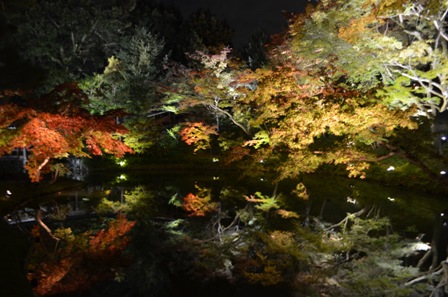
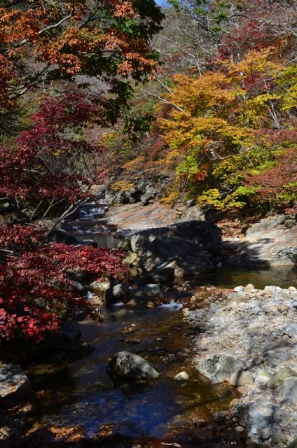
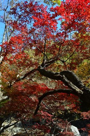
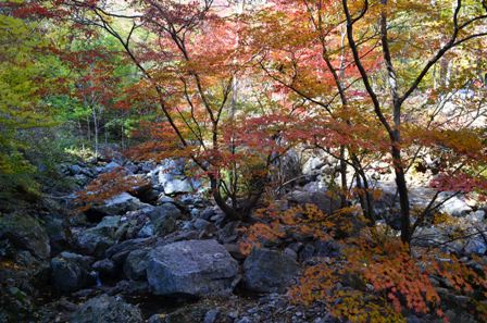
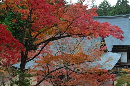 Takao is known for its blazing autumn colors, and it definitely didn’t disappoint. The area hits peak foliage a bit earlier than Kyoto proper, so I got a much bigger hint of what Kyoto looks like when its autumn is at its peak.
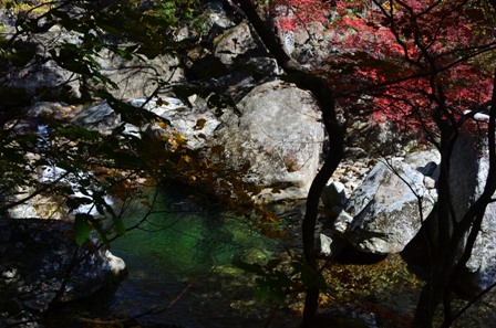
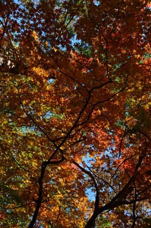
 Takao was probably my favorite stop on this trip to Kyoto. This provided everything I was looking for and more when it came to autumn foliage. Jingoji Temple is very peaceful and isolated, and that is by design. I thought it was very quiet, peaceful and well built to inspire contemplation, both inward and of the beautiful world around you.
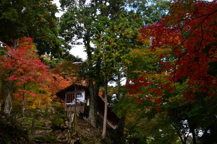

 If you visit Kyoto, particularly in the autumn season, I highly recommend a visit to the Takao region to see the temples. At a minimum, visit Jingoji Temple. You won’t regret it.