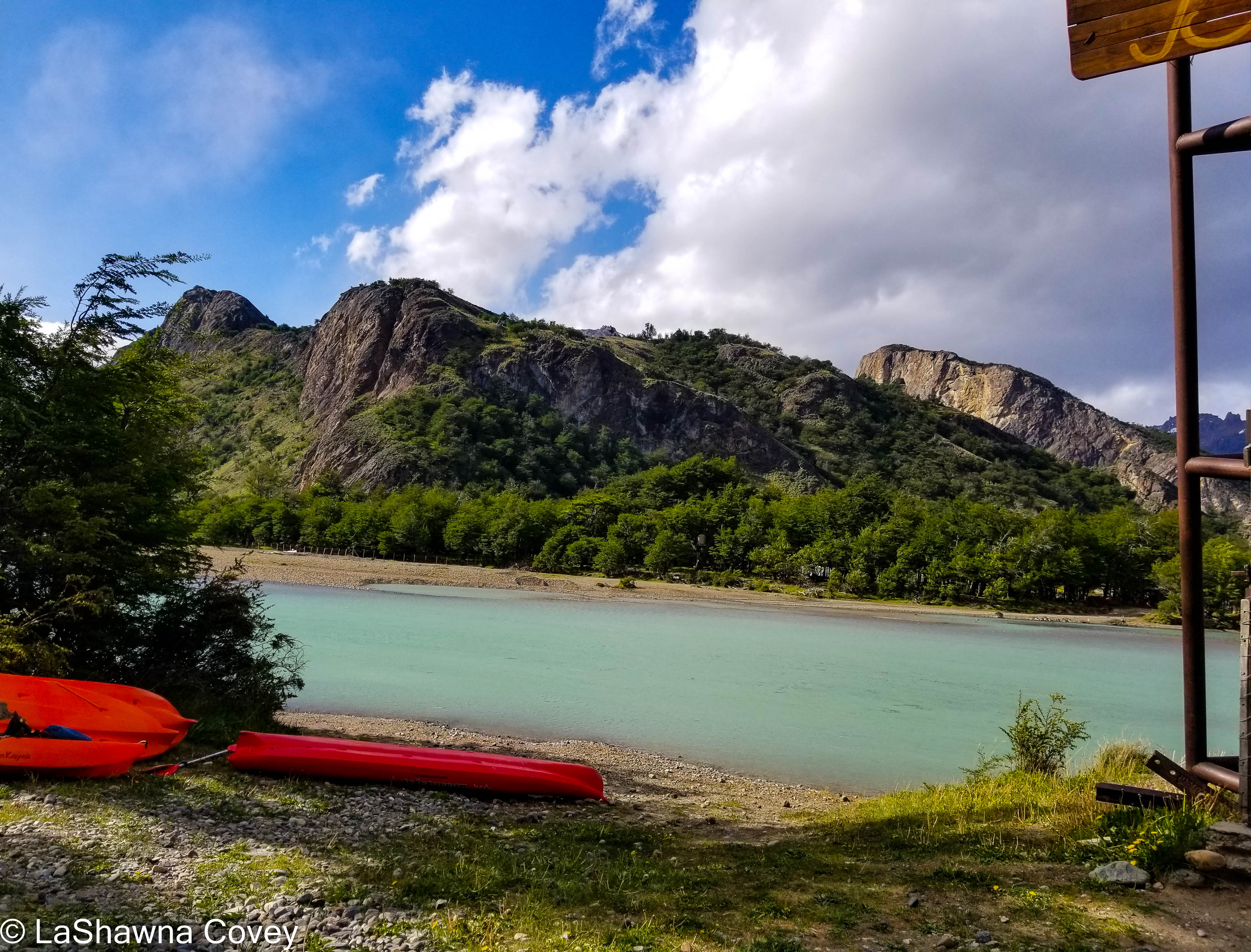
Even though El Chalten is the hiking capitol of Argentina (deservedly so), there are other activities you can do in the area. When I was doing my research, I saw that there were opportunities for guided kayak tours down the Rio de las Vueltas. There are all day kayaking trips, but also half day kayaking trips. I enjoy kayaking, and even though this was on a river, this wasn’t a white-water kayak, but rather the larger sea kayaks I was used to. My travel agent booked a guided half day kayak trip for my final day in El Chalten (though if I did it all over again, I would probably put the kayaking between my two long hikes, just to give my body a slight break).
I ended up with an afternoon kayak tour, though I had the guides to myself, because a group that had booked for this trip had canceled. So, it was me and two guides out on the river. The nice thing about that, is that I didn’t feel like I was holding the group back, even though I was slow. The start of the kayaking trip is not that far from where I started the Laguna de los Tres hike. The van took a long, slow, bumpy drive up to where we put in the kayaks. The entire kayak trip was supposed to be around 10 kilometers. The nice thing about this river is that it is pretty flat without strong rapids, at least where we kayaked. The bad thing is that due to geography, the vicious Patagonian winds can come barreling through the valley, as I was soon to discover.
Since I was the only tourist, I got to share one of the two person kayaks with a guide, thankfully. After suiting up in a wetsuit (the river water is chilly) and getting a quick tutorial in kayak paddling (again, I have kayaked before, so I was not out of my depth), we put into a lagoon and paddled out toward the river. The paddling was pretty smooth and calm, and my guide was giving directions on which way to paddle. The scenery was really nice, as I was blessed with three reasonably sunny and clear days in a row (which can be somewhat of a rarity in El Chalten).
The hardest part of the whole trip was the roughly 200-meter portage we had to do from the lagoon to put in at the river. The water is just too shallow to kayak, so we had to walk. What made it difficult is that the lagoon bottom was very soft mud, and I kept sinking and falling, to the point, where one of the guides basically had to hold me up as I stumbled and tripped until we got to the point where the kayaks would put in again.
The river was smooth, but fast in places, and a pleasantly milky gray blue, since the river water is fed from the nearby glaciers (the reason the water is so clear and clean to drink). For the most part, the paddling wasn’t too difficult. But there were places where the wind kicked up so much, I was afraid we wouldn’t be able to paddle down the river, because it kept pushing us toward the riverbed. But we were able to negotiate that, and for the most part, there were just nice peaceful views as we floated along. After the 10 kilometers, we got out at the camp where they run a lodge. Stripping out of the wet and cold wetsuit was certainly challenging, but soon enough I was back in my warm and dry clothes.
All told, it was a pleasant way to spend an afternoon. The weather wasn’t hot, but I don’t think it gets really hot in Patagonia. Dress warmly, prepare for wind (and possible rain, though we didn’t have that), and try not to stumble and fall too much in the soft mud. After days of hiking, it was nice to get a different view of the area. Definitely worth your time.
Let me start right out and say this post is NOT about the full and entire hike. I did a tremendous amount of research of on the El Chalten hikes, because I was getting mixed signals about the difficulty of the hikes. I read enough to realize that while the bulk of the Laguna de los Tres hike was within my capability, the final part of it (and what the hike is named for), was probably a bridge too far. It is true that the final part of the hike is only one kilometer with the hardest part being only about 400m, but it is SUPER steep (like around 45% angle), and the trail is highly uneven with loose stones, so it is easy to trip and fall. Plus it is often super windy at the top and it is not uncommon for clouds to obscure the view of the lakes and mountains. So even though I certainly read blog posts from older people who have completed the hike, I read enough to know that I was likely to struggle mightily on this part of the hike. And since so many people do this hike, I was afraid of basically holding everyone up, because there really isn’t a way around me. And I was afraid of falling, spraining an ankle, or otherwise hurting myself. So I felt comfortable stating that this part of the hike was not for me.
But once I made that decision, the next decision is where to start this hike. The traditional way of starting this hike (and the cheapest), is to start from the trailhead in El Chalten, which is at a parking lot where the paved road ends at the end of town. Since El Chalten is a very small town, it isn’t a far walk from anywhere. HOWEVER, that would make the trail an out and back trail, with roughly 12 miles hiking round trip. And since I had done the Laguna Torre hike the day before, my body was already sore, and my feet ached. BUT, there is an alternate way of starting this hike, though it involves (at least for me) an expensive cab ride to the start point. There is a shuttle bus that will take there fairly cheaply, but it was completely booked my entire time in El Chalten. I would rather spend the money to take a cab and do one long hike (though the distance was still shorter than if I had done the hike as a round trip). I am not a fan of out and back hikes, because I am seeing the same landscape twice, whereas a single trail provides a continuously changing view.
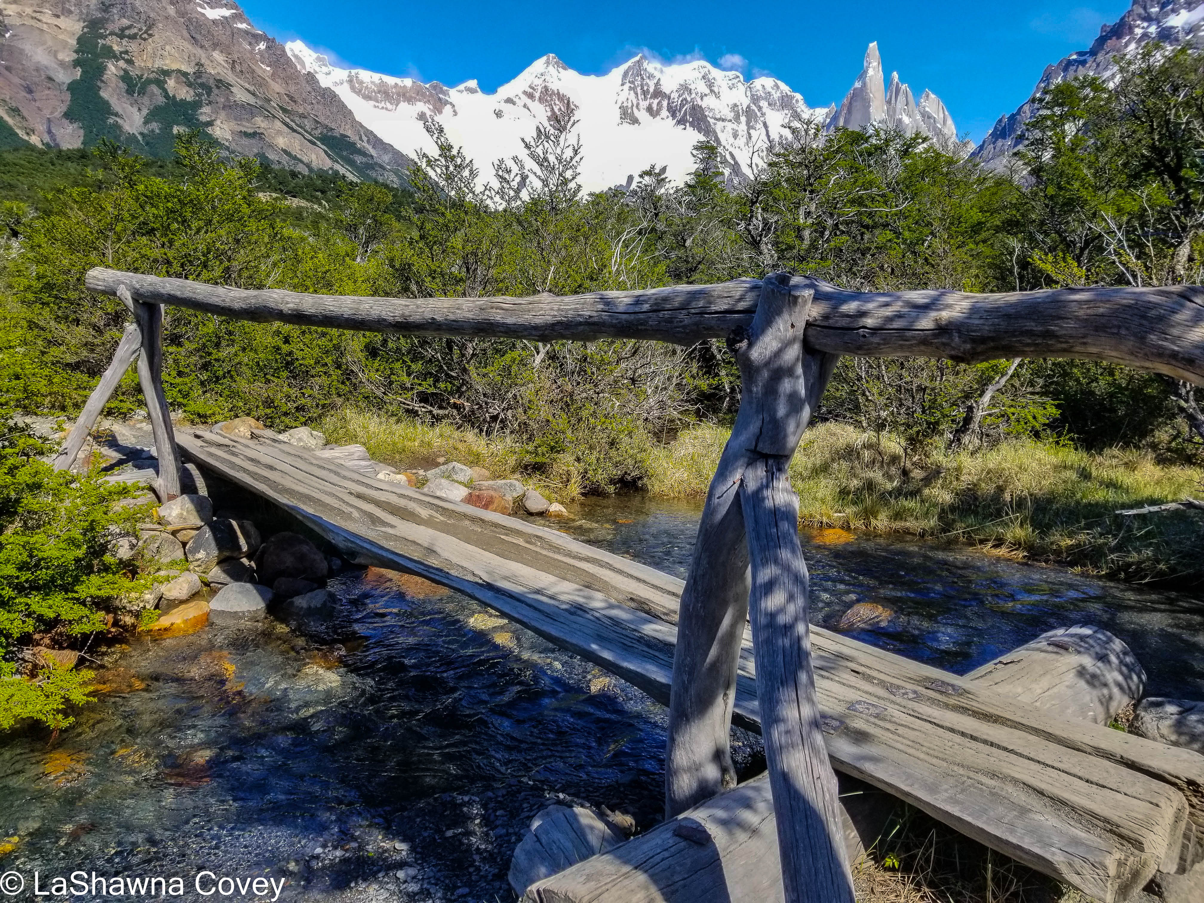
So, if you want a different view of the trail, you can take a shuttle bus or a taxi out near Hosteria El Pilar. This way will take you up a different trail, past some nice glacier viewpoint, and then intersect with the main Laguna de los Tres hiking trail shortly before the trail begins the final ascent to the top. This startpoint is about a 30-minute drive down a gravelly bumpy road that follows the river and passes other camps and hotels along the way. I knew I was getting close when I saw the sign for Hosteria El Pilar, but then was surprised when my taxi kept going a bit further down the road. At one point, the trailhead was basically on the property of the hosteria, but when I went, it was a bit off it. I am guessing the owners of the hosteria didn’t want a bunch of strangers tramping through their property, but I don’t know. Maybe there were some issues with the trail from the hosteria, and the way needed to be rerouted for a bit. My taxi driver dropped me off right by the bridge and pointed me in the right direction. The trail is marked with yellow markers every so often, just so you don’t wander off, because the terrain is open enough, where it could be easy to do since the trail isn’t always distinct. The view is pretty expansive at this point, and you are surrounded by mountains, trees, and river. It was a great way to start the morning, even if I was trailing a large group of hikers.
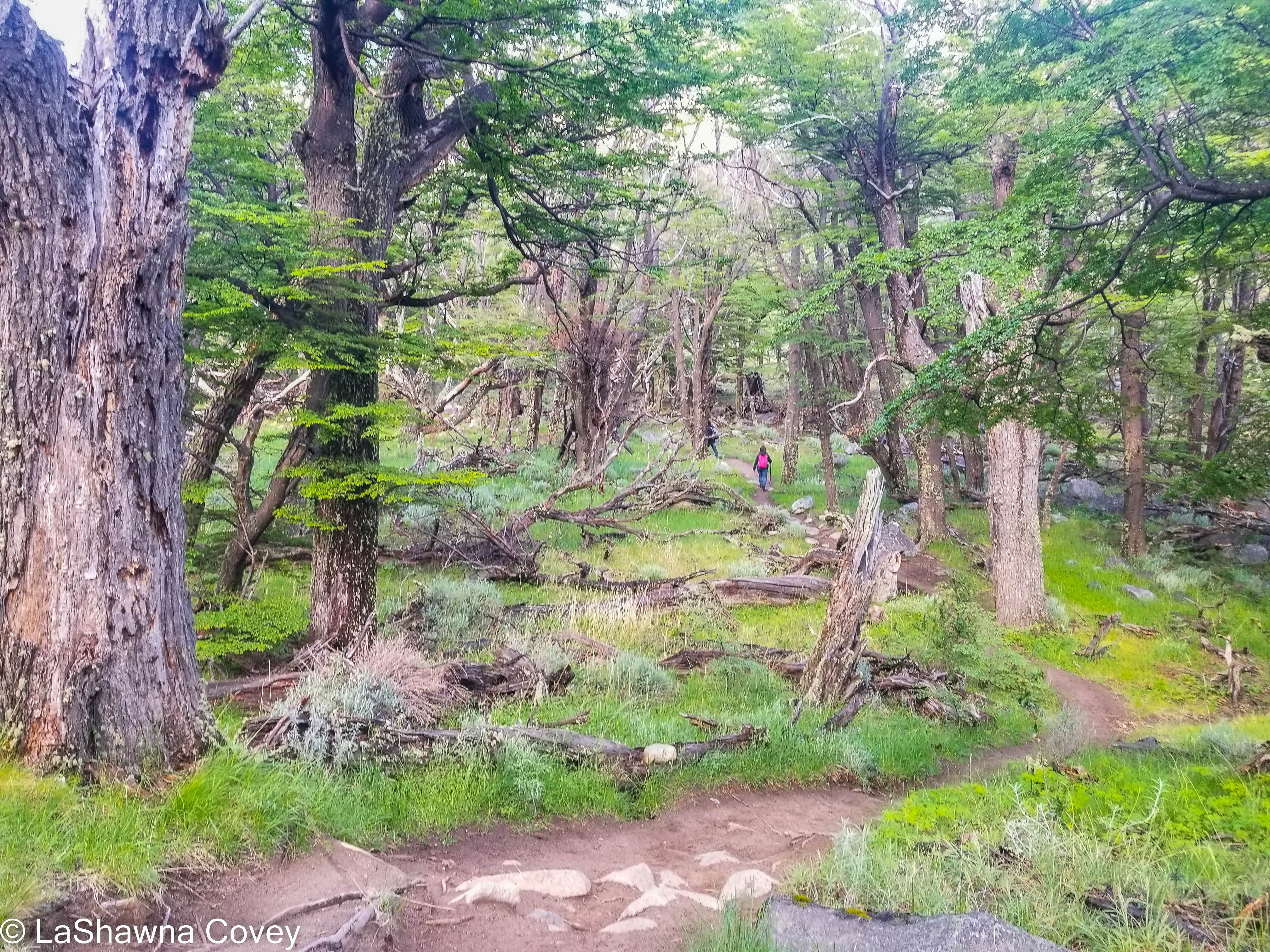
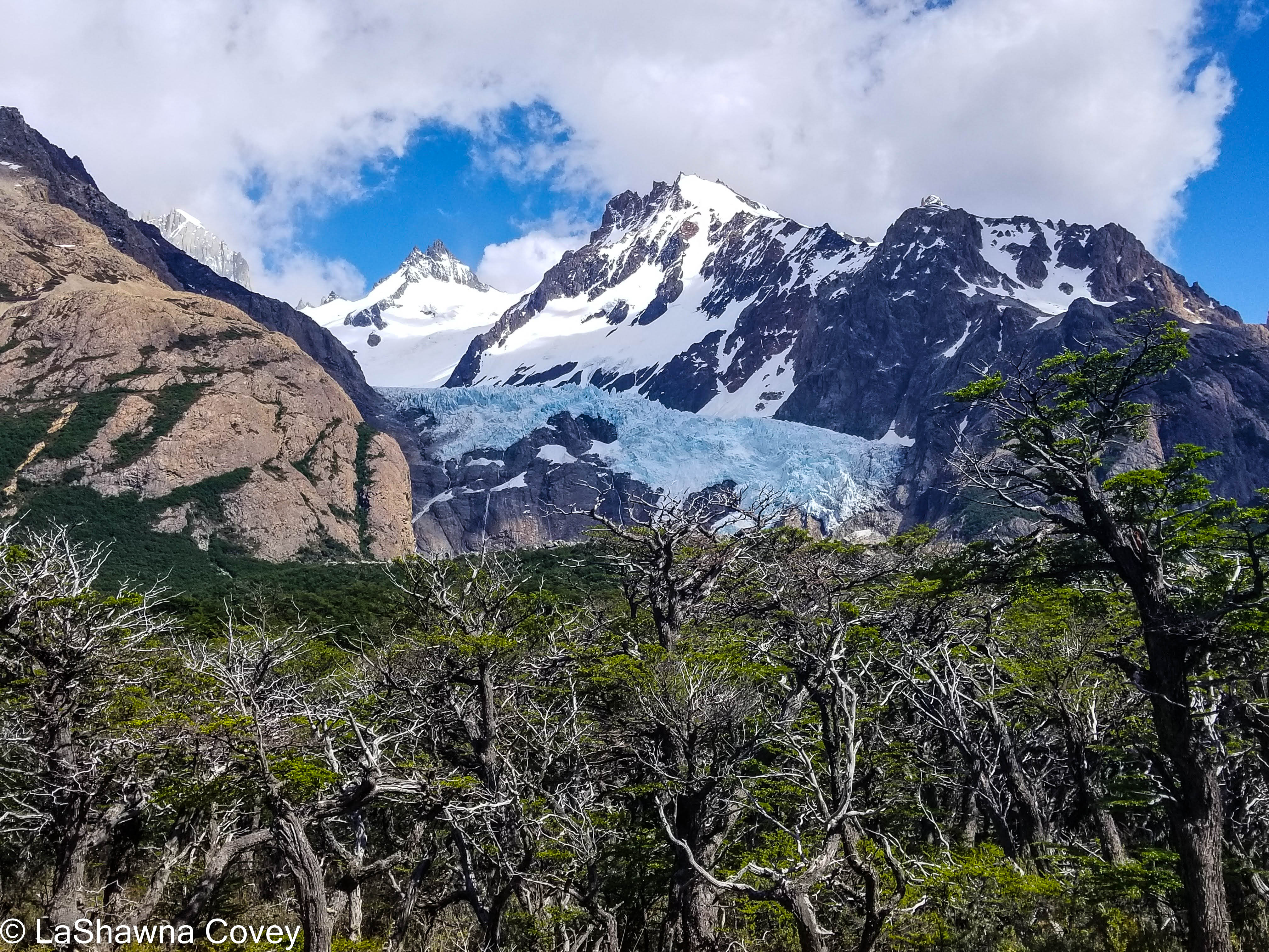
The first part of the hike wends its way through flat terrain and bushes near the river, but eventually crosses the river and turns up. After a short steep climb, I was back on the actual trail that started at Hosteria El Pilar. This trail is very clearly defined and marked with red markers. It climbs steadily upward, though I didn’t find the elevation gain too taxing. Sure I had to take breaks, but I wasn’t out of breath or anything. For this part of the trail, the view is nice forest, but it isn’t radically different from other forest hikes I have done. The first part where that changes is the viewpoint for Glacier Piedras Blancas and its lagoon. It is a small view, but it is a very nice view of the mountains, and a small glacier. By this point, tour groups were congregating on the trail, and I was trying to make sure that I had enough space to myself.
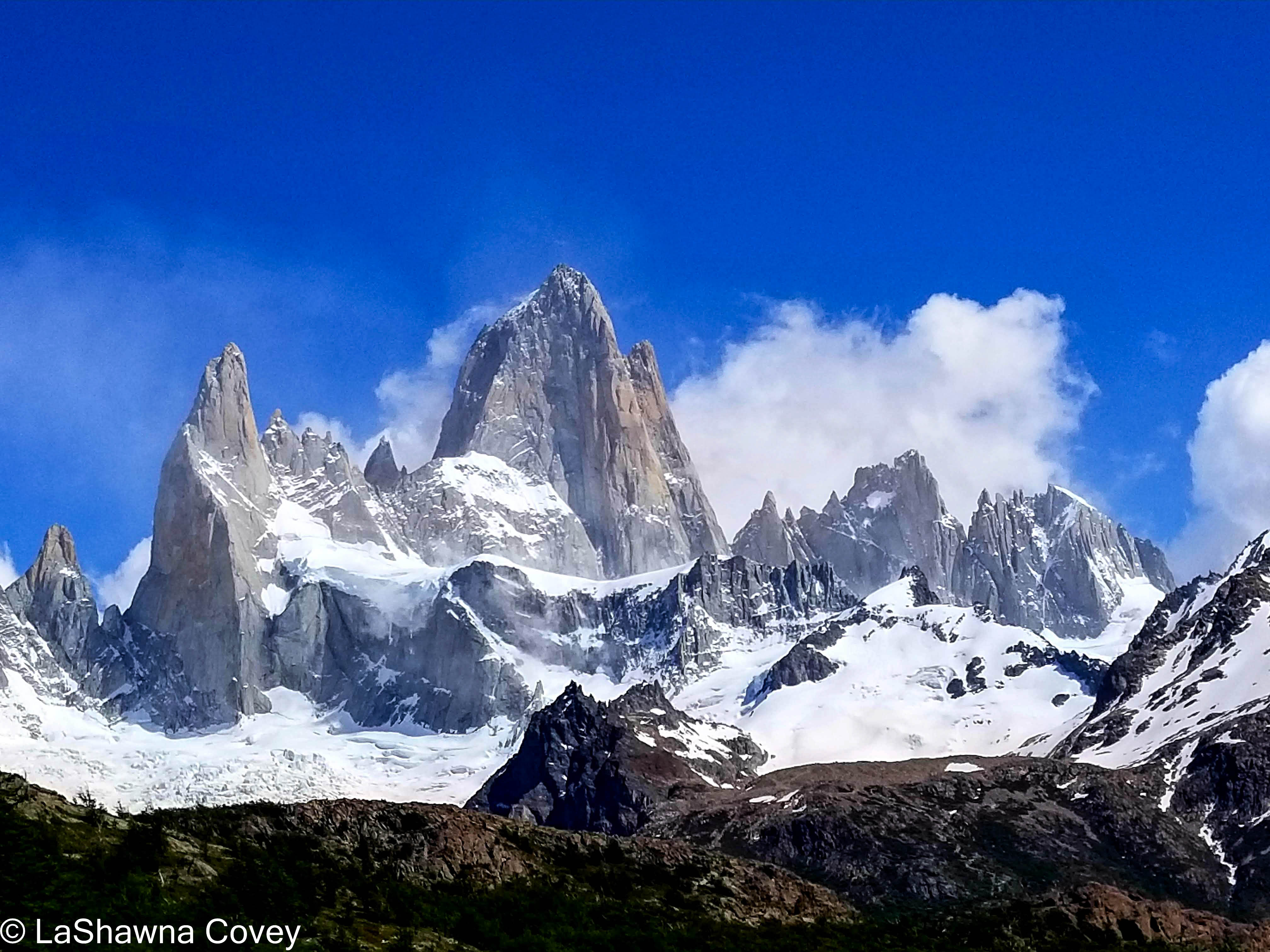
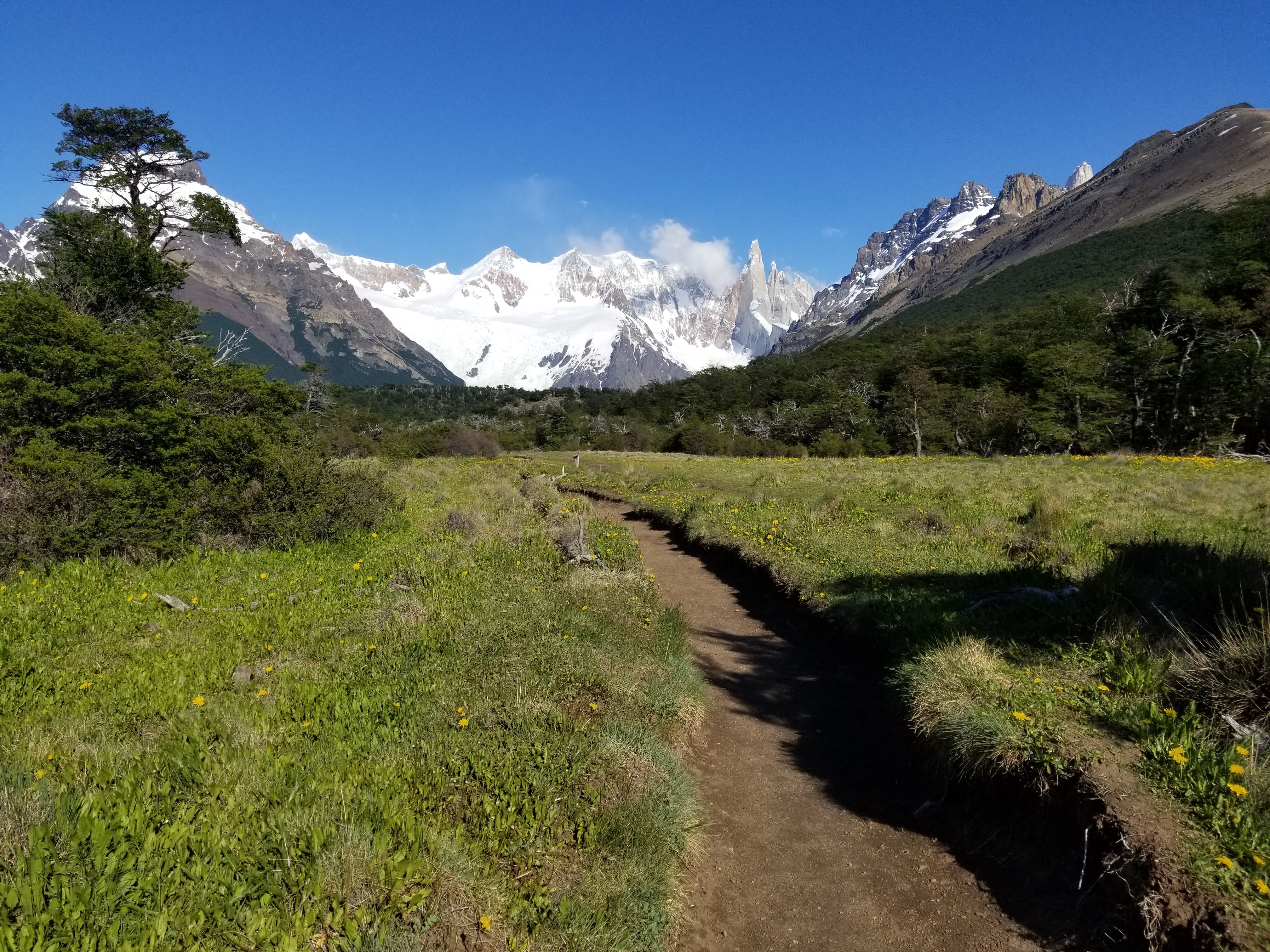
After the viewpoint, the trail keeps ascending, but again, the trail is not that steep. Eventually it flattens out and opens up in a wide field where I was able to get the first view of the mountaintop of Cerro Fitzroy (shrouded partly in clouds), and the surrounding landscape. The trail isn’t the most obvious at this point, but still navigable with the occasional red markers, and you know when you intersect with the main trail around the Rio Blanco checkpoint, not far from the Poincenot camping site. I took a long break letting my feet rest as I drank in the view of the mountains. The clouds weren’t thick that day, but they kept teasing me by hiding the top of Cerro Fitzroy for a while, and then briefly clearing to see its iconic spiky point. I wasn’t in any hurry, because I knew I just had to hike back to El Chalten. By this point, it was mid day, and the steady stream of hiking pairs and groups passed me as they were headed to the top.
Once I was rested enough, I took the main trail back to El Chalten. At this point, I only had about eight kilometers left, but my legs were definitely tired after yesterday’s long hike. Luckily the trail is fairly flat and level, so it was easy on the body. I made sure to turn around frequently, because the only bad part of hiking the trail the way I did, is that the mountain views were behind me and not in front. But I stopped enough to get my fill of the view before continuing down the trail. The wind at time was super fierce, and I was glad I was not at the top of the hike.
There are a couple points in the trip, where the trail diverges, and you can get different views, and then the trail reconnects. One of those points was the taking the trail toward Laguna Capri. The lake was only about four kilometers from the trailhead, so it is considered an easy hike compared to the more difficult destination of Laguna de Los Tres. Laguna Capri is a fairly large lake, and a great place to relax for a bit and have a snack or lunch. It is also one of the few places along the trail where you can camp. I still had good view of the mountain tops.
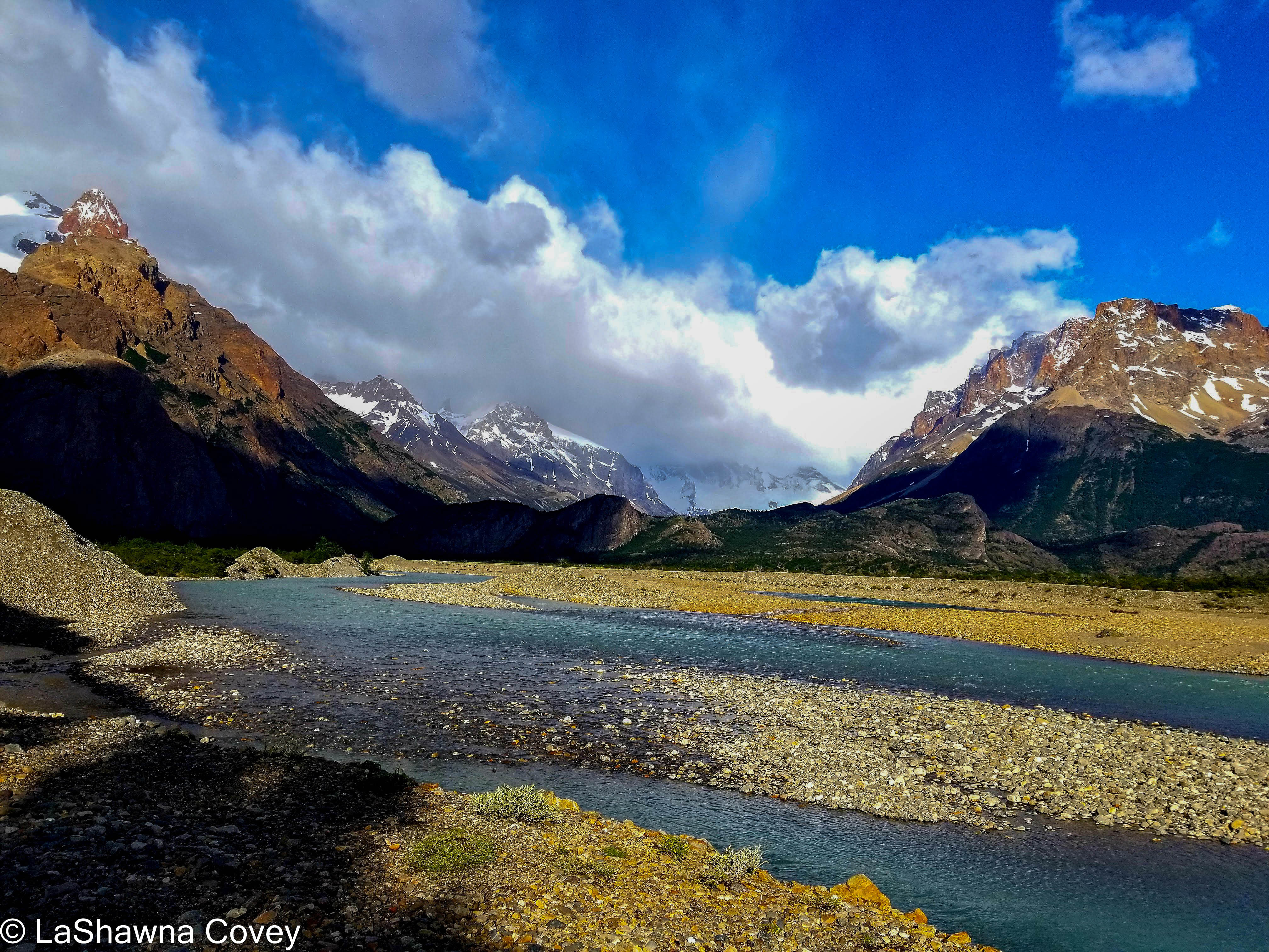
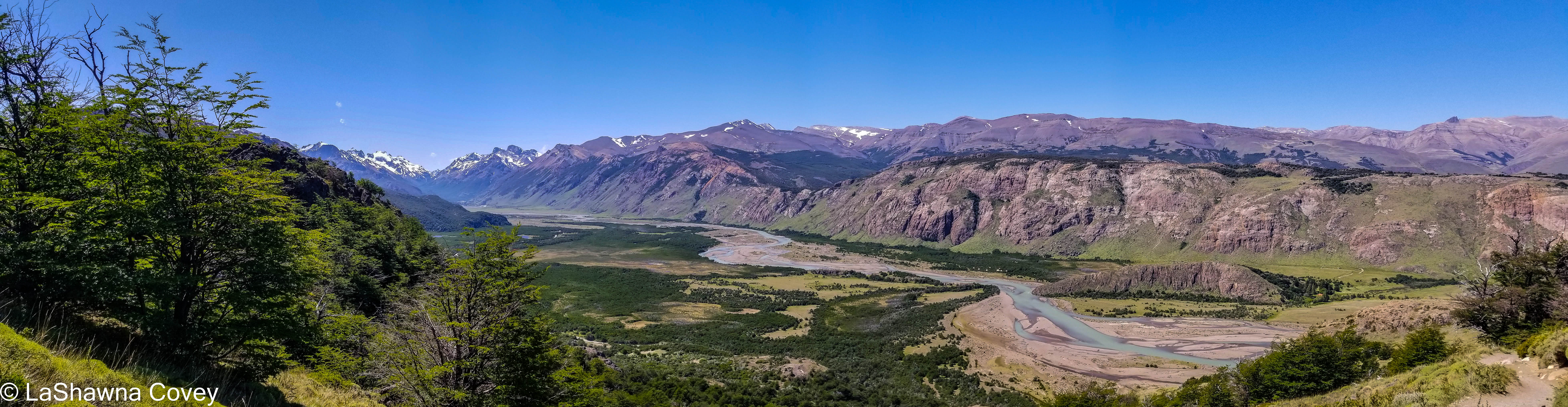
The rest of the hike was fairly easy, though as I was getting closer, I was starting to worry. I had read enough that the first part of the hike from the trailhead was fairly steep (one of the reasons why I wanted to take the alternate trail). I could see that the trail was slowly but surely heading downhill, though I was still fairly high up with not that many kilometers left to make a gentle descent. The trail was pretty good, if a bit narrow in spots, with some steep drop-offs. The final viewpoint for me is the first viewpoint for most people, as it provides a very expansive view of the river valley and the Rio de los Vueltas.
Much to my surprise and relief, the final part of the trail for me was fairly easy. The trail is very well maintained and achieves its elevation gain through manageable switchbacks. I wouldn’t have wanted to come up it if I didn’t have to, because it was a steady, continuous ascent for four kilometers, but descending it was much easier than I expected, and I soon found myself at the trailhead with a short walk back to my hotel. My feet were tired, and my body ached, but I had a sense of accomplishment, because I had done two long hikes back to back and lucky that I had wonderful weather (which can be fleeting in Patagonia) and spectacular views to show for it.
This is one of those hikes you can customize to your skill and fitness level. If you don’t mind a steady uphill climb for the first four kilometers, or an out and back hike, you can easily start at the El Chalten trailhead and save yourself some time and money. However, if you are like me, and prefer a straight through hike, when possible, you can take the shuttle bus or a taxi (a shuttle bus is much cheaper, but it may be fully booked on the day you want to do your hike) and start out near Hosteria El Pilar. The total amount of miles is actually less if you start at El Pilar. I personally think the amount of uphill is less, and you get a different view throughout the entire hike. Just be sure to turn around frequently on your return trip to El Chalten, because those mountain views are not to be missed. And while the view of the lagunas is supposed to be the highlight of the hike, it is rather strenuous and difficult to reach, so there is no shame in knowing your physical limits, and not doing that part of the hike. Trust me, there are plenty of other beautiful views to enjoy along this hike.
If you want to visit Argentina Patagonia, there are two main places to base yourself (though by no means the only places)- El Calafate and El Chalten. El Calafate is where you go if you want to enjoy glaciers, big lakes, estancias. El Chalten is where you go with you really want to get your hike on, and is about a three hour drive north from El Calafate. There are many hikes that are easily accessible from El Chalten, plus a variety of other outdoor activities, such as mountain climbing or river kayaking.
I did extensive research when prepping for this part of the trip. I knew I wanted to enjoy some hiking, BUT I also knew my own physical limits, and wanted to take that into account. I consider myself to be of moderate fitness, but I can struggle on long uphill hikes, especially ones that are already at elevation.
The two most celebrated hikes from El Chalten are the Laguna Torre hike and Laguna de los Tres hike. I read a lot of blog posts about individual experiences with hikes, trying to gauge how I would respond. I came to the conclusion that Laguna Torre is considered the “easier” of the two hikes, so I decided to hike that one first. The nice thing about most of the hikes in the area are they are easily accessible from the town of El Chalten. In fact, the trailhead for the Laguna Torre hike was only about 500 meters from my hotel.
I started out fairly early in the day (around 0730), because my research suggested that the trails get very crowded by 0800. Maybe that is true for the height of the summer season, but I was there in November, so it didn’t start getting crowded until mid-day when I was ready to hike back.
The Laguna Torre hike is an out and back hike, which are not my favorite type of hikes, and the combined mileage is around 11 miles, though I found differing distances listed in the different accounts I read. I knew based on my reading that the first three kilometers were the most strenuous of the hike, since it is mostly uphill. That is definitely true. The path can be flat and easy at times, but it also is the most uneven and precarious in the first part of the hike, and as I was ascending, I could see that I was going to struggle a bit with part of the trail on my return, just because of loose stones or dirt or other things that can make clumsy people trip and fall.
I was huffing and puffing on the first part of the hike, and inwardly wondering if this was going to be worth it. But I also enjoyed the mostly blissful solitude, since I saw very few people on this part of the trail. I was passed by two different pairs, but they quickly got ahead of me, and I felt like I had the whole trail to myself.
Those strenuous for me three kilometers were worth it when I arrived at the Mirador Laguna Torre, a viewpoint that gave me my first taste of the mountains, especially Cerro Torre off in the distance and the forest spread out before me. It was an inspiring sight to see, and the weather was perfect- sunny and clear. After taking it all in for several minutes, and wanting to stay ahead of the groups that were starting to catch up to me, I continued on. After climbing up for the first three kilometers of the hike, the trail after the viewpoint descends for about another kilometer, which I welcomed, though mindful that I would have to ascend the trail on the way back.
After the fourth kilometer, the trail gets markedly easier. It is pretty flat by this point, and easy to navigate. For the most part, the trail is pretty level, which means I could enjoy the view around me, and didn’t have to keep staring at the ground hoping I didn’t trip over something. That allowed me to really drink in the mountains as I was getting closer to them, and the surrounding forest.
The trail is fairly easy to follow most of the time, though sometimes when going through rock fields, you have to keep an eye on what is actually the trail. But it is near impossible to get lost on this trail, since there really aren’t other social trails drifting off any length of distance. I crossed a small creek, and I knew I was getting close. A very nice thing about this trail, is that it is clearly marked with signs every kilometer. It tells you what kilometer you are on, and how many kilometers in total to your destination (e.g. Kilometer 5 of 9). At the beginning, I found it somewhat demoralizing, only because I thought I was much farther on the trail, only to realize that I had only walked two kilometers of nine. But once the trail flattened out and became easier, the kilometer markings seemed to fly by, and it was heartening to see me getting closer.
The final part of the hike is a short hike up the rocks until you are overlooking Laguna Torre. That view makes any sort of huffing and puffing worth it. I knew this lake is not a brilliant blue like Laguna de Los Tres, but the spiky mountains look close enough to touch, and the lake had a wide variety of icebergs floating from the glacier by the lake. Truthfully I thought was even better than what I was expecting.
When I first arrived at the lake, there weren’t many people already there. I had only been passed a small number of times, much to my surprise. So at first I felt like I almost had the lake to myself. I just sat by the lake taking it all in. It was only about midday, and the only thing I had left was to walk back, so I was in no hurry to finish my lunch. Of course the longer I stayed there, the more and more people started arriving, especially those large walking groups.
Eventually I decided I had my fill of the view and was ready to return before the trail became clogged with hikers. By this time, my body was feeling the walk, and I knew I still had nine kilometers to go (a bit more when factoring in the walk from the trailhead back to my hotel). Thankfully the first five of those kilometers were the flat and easy part of the trail. Those parts flew by. Things started to slow down for me when I hit the fourth kilometer and I had the slow slog back up to the viewpoint.
After resting a bit, I finished the final three kilometers, but it was those three that were the hardest. This is the part of the trail I was getting passed left and right by spry, fit hikers as I was carefully placing my feet and maneuvering through uneven terrain, and by that point, I was tired and over the hike. But thankfully enough I found myself at the road without falling or twisting an ankle. From there, it was a slow walk back to my hotel where I could indulge in a welcome shower and a nap.
Overall, I am glad I did the hike, though part of me was cursing the hike as I was doing it. If I of moderate fitness could make it without my feet falling off, so can most people. If you can make it through the first three kilometers (and they aren’t THAT strenuous in the grand scheme of thins, but if you aren’t pretty fit, you will feel the uphill and the uneven terrain), the rest of it is a piece of cake. And of course, the views are worth it. Even though I have spent a fair amount of time in the mountains, the mountains of Patagonia look so different from the Cascade Mountains I am used to, that the view was an absolute delight.