Beautiful Views and Larch Trees on the Plain of Six Glaciers Hike

Plains of Six Glaciers-1

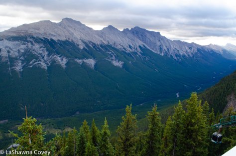
If there is one place tourists are likely to stop in Banff National Park, it is Lake Louise. I had to keep reminding myself that even though I was 30 minutes’ drive away from Banff town, I was still in the Banff National Park. I based myself out of Lake Louise for several days, because there is just so much to see and do in the area, and it’s just easier to cut down on driving. It also allows me to get ahead of the hordes of tourists. And it’s funny that I say hordes of tourists, because yes there were so many tourists when I visited in mid September, but I also know there are so many MORE in the summer time, which is one of the reasons I would never want to visit Banff in the heights of summer. 

Plains of Six Glaciers-2

The traffic is managed fairly well (though for some odd reason, they don’t have a light at a couple main intersections, and instead have actual people conducting traffic during daylight hours), and there are signs when you enter the area informing you of the parking situation (i.e. if the parking lots at the lake are full and you need to park and take the shuttle up there). The parking situation isn’t quite as dire as Lake Moraine, because the parking lot at Lake Louise is huge. But it is so popular, that while you might not need to be up at the lake by 0630 to get a good parking spot, you should be there by 0800, or it is liable to be full. There are plenty of paths that go from Lake Louise toward the village, so some people choose to park and walk, and you see groups of people walking back to their cars in the afternoon. 

Plains of Six Glaciers-12

When I was putting my itinerary together for the Lake Louise area, I originally had two different days scheduled for two different popular hikes in the area. But the weather was iffy for one of the days, and I again had to rethink my fitness level, since both hikes would involve over 1000 feet of elevation over a few miles. And both of them have similar, though not identical views. Then I thought maybe I could combine both hikes, since there is a connecting trail, and decided I’d play it by ear and see how my body felt during the hike. 

Plains of Six Glaciers-6

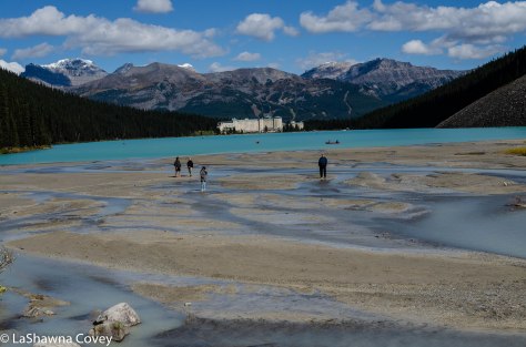
So having to choose which hike to start with (and thus being the only hike completed if my body rebelled), I decided to start with the Plain of the Six Glaciers Hike. The hike on its own is a little bit longer than the other one, with a bit less elevation gain. But if I had to choose just one hike, this one sounded like it was the one for me, because it starts by skirting Lake Louise and then climbing through the valley toward the glacier ice field, stopping at a tea house among gorgeous larch trees. I figured this hike would give me the most bang for my buck view wise. 

Plains of Six Glaciers-11

As always, I started relatively early, though there were plenty of people ahead of me that morning. The morning was clear and bright and the reflections of the mountains on the lake were just awe inspiring, since the lack of wind meant the lake surface looked like glass. The first couple miles of the hike are flat and easy, because it is along the lake shore.

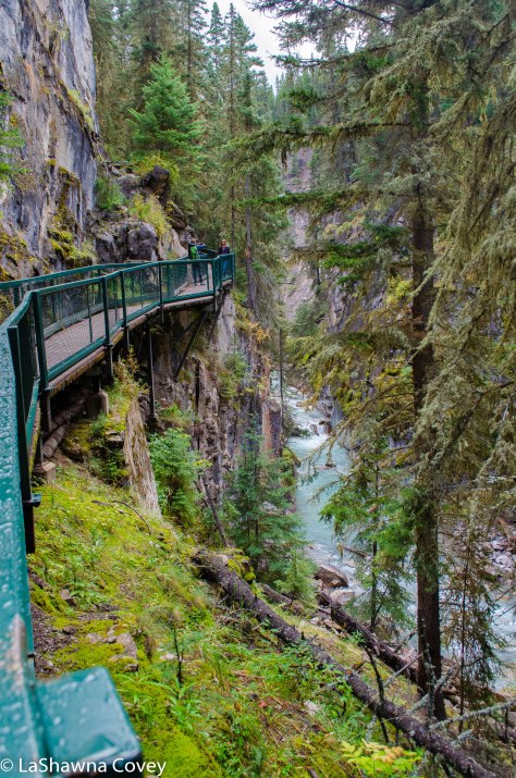
Once you get to the end of the lake, the real hiking begins as the path ascends fairly steeply, so you gain a lot of elevation pretty quickly. Every so often, I’d stop, take a breath (or many breaths), have some water, and just take in the countryside around me. The valley narrows with mountains surrounding it, and the lake view got farther and farther away as I hiked up and away. 

Plains of Six Glaciers-3

I’d be lying if I said I didn’t feel it, and even needed to break out my walking sticks, because the path was a bit rocky at times and could be steep. I kept a decent pace for me, though I was often passed by fitter and faster hiking groups. But since I had blocked the entire day for this, and wasn’t on anyone’s timetable, I didn’t mind taking my time. 

Plains of Six Glaciers-7

There was a point in the hike when the path just kept climbing up and up and every switchback would lead to another switchback, that I was starting to wonder just when this hike was going to end. I passed a descending hiker who said the tea house (the typical end point for this hike) was just a few minutes away, but I always hear that when hiking, so I didn’t know if that was actually true. But lo and behold, it really was only a couple minutes later when I emerged into the tree field and realized I had reached the tea house and could really relax.

Plains of Six Glaciers-9

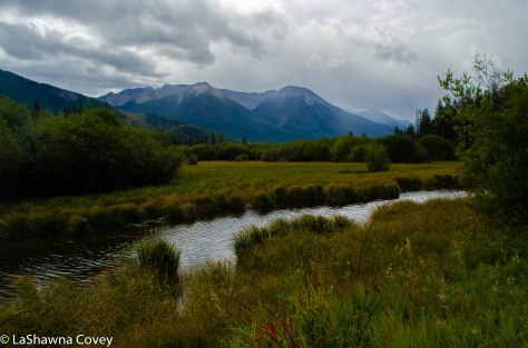
The view of the surrounding countryside was marvelous. The glacier that I could see at the start of the hike was so much closer. The larch trees surrounded me in all their golden gloriousness. The day was absolutely gorgeous with a clear, blue sky (somewhat rare for this vacation), and it all felt good and peaceful. I made decent time for me, and then I could make a decision about what to do next.

Plains of Six Glaciers-8

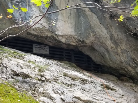
I knew that even though the hike officially ends at the tea house, I could hike even closer to the glacier along a narrow path, and even ascend a slippery, rocky moraine to enter a small cave up on a cliff. I figured that I had come this far, why not hike a bit farther to see what the views offered?

Plains of Six Glaciers-10

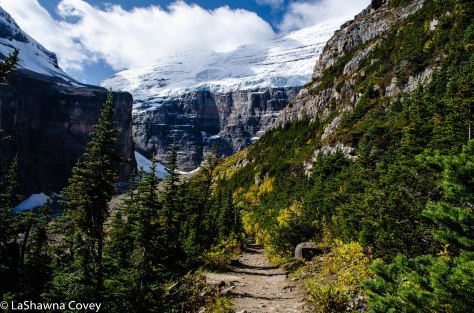
There is a sign that the official trail has ended and what lies beyond is not maintained. That means that the path narrows and there are some washouts and large rocks in places, but I kept going. I made it all the way to the rocky outcropping that gave me a commanding view of the valley and a more intimate view of the main glacier. I saw a steady line of people walking past it and along a narrow ridge line to the moraine, but I decided against it. My body was pretty tired by that point, and I just didn’t have the energy to climb up a shifting moraine of rocks, and figured the views I captured were good enough. So after getting my fill of the valley views, I made my way back to the tea house (the return hike felt so much shorter, like what always happens on hikes).

Plains of Six Glaciers-4

Once I was descending I decided not to take the connecting trail to the other hike and Lake Agnes destination. I knew the lake and tea house were supposed to be beautiful, but I also knew the connecting trail meant some serious steep uphill, and I was just tapped out. I was good and had my daily fill of larch trees, glaciers, and sunny lake views.

Plains of Six Glaciers-5

Going on a multi-day hiking vacation (not like one multi-day hike, but many days of day hikes) definitely taxed my physical fitness. I knew I was in decent (though not great) shape, and the hiking would help me. But it definitely tired me as well, and I had to make some adjustments to do shorter hikes, rather than the long slogs. 

Plains of Six Glaciers-13

If you have time and energy, I would probably recommend doing both hikes, even if they are on different days. But if you only can do one, you could do worse than the Plain of Six Glaciers. This hike will afford more Lake Louise shoreline, more glaciers, and some fabulous larch trees (a bright golden yellow in the fall). I definitely felt like I earned my dinner that night, and a very long sleep as well. 

Plains of Six Glaciers-14

The Misty Mystery of Lake Moraine

Lake Moiraine-2

If you visit the Lake Louise area, I highly recommend basing out of Lake Louise, and not doing it as a day trip from Banff. Sure, the drive is only about 30 minutes along good highway from Banff town proper, but that is extra driving you don’t really NEED to do. Plus, due to the popularity of some sights and the limited parking, you are going to have to get up even earlier if you want to get a parking spot and not have to use the shuttle. 

Lake Moiraine-1

Lake Moraine is one such tourist spot. Lake Moraine is another beautiful mountain lake set in the Lake Louise area, though at a higher elevation and in a much more remote area than Lake Louise. It’s so remote, that the road is closed from the end of October to March due to snow. It’s also an area that is popular with bears during bear season, which could affect your hiking plans if you go during that time (basically the summer time to early September). And yes, Lake Moraine has very limited parking considering its popularity. The basic guidance given in my research is to be there by 0630 if you hope to get a parking space at all. Because unlike other areas, they don’t let you park alongside the road, and the road is blocked for ingress at the Lake Moraine turnoff from the main road once the parking lot is full (and yes, there are signs and people out there guarding that road and letting you know if you can go). As it is, I got there a little after 0630, and there were only a few spots left open for normal cars (there were still some spots for RVs and tour buses). It’s one of those things you just have to laugh at and take in stride. I normally hate getting up early in the morning, but I will get up before sunrise (because at that time of year, the sun didn’t rise until after 0730) just so I could get a parking spot and have the freedom of maneuver a car brings. 

Lake Moiraine-5

So after arriving, I could sit back, relax and take a breath, and enjoy a breakfast in peace while waiting for the sun to rise. The morning I was there, the weather wasn’t that great, and there were a lot of clouds early on. Some cloud cover adds to the mysterious and remote beauty of the lake, sort of giving it a Gothic romanticism to the vista. But too much cloud cover just blocks the steep mountains that surround the lake. 

Lake Moiraine-6

Since I planned to spend most of the day at Lake Moraine, I wasn’t in any hurry. I started my day by walking along the Lake Moraine shoreline, which goes down the lake a couple kilometers before ending at a boardwalk viewpoint in front of the rushing creek that feeds into the lake. It was still somewhat grey and the clouds were lurking overhead, though the wind was quick enough that the clouds never lingered for too long.

Lake Moiraine-3

Even though it was cloudy, it was still bright enough to see the gorgeous blue water, which is formed by light reflecting off the glacial rock powder that sits at the bottom of the lake. It’s the astounding lake color, along with the surrounding mountains that makes Lake Moraine such as must do in the Lake Louise area. 

Lake Moiraine-4

After walking back, the clouds were lifting a bit, even if the sun hadn’t emerged from the clouds. Right next to the lake shore is a steep pile of rocks that you can walk up to and give you the iconic views over the lake that you have likely seen in professional photographs. The walk isn’t long, though it is on the steep side. But said steepness is still fairly short, and the view is absolutely worth it. By this point in the morning, the tour buses were disgorging hordes of tourists armed with cameras and jockeying for a good camera spot. You kind of just have to ignore them and do your own thing. And remind yourself that they will move along shortly (they are probably on a timetable if they are on a tour bus), and you will be able to take your pictures and enjoy your view. 

Lake Moiraine-7

After that, I debated whether or not to go on a hike as I intended. There are two popular hikes that originate from Lake Moraine- Larch Valley and Consolation Lakes hikes. Larch Valley is considered more moderate (which again, depending on your fitness level, could easily veer more towards the strenuous). It’s much longer, and steeper, and ends higher in the mountains among the gorgeous, golden yellow larch trees that are so prevalent this time of year in the higher mountain elevations. You can see fields and fields of these trees from good vantage points, but seeing them up close and personal requires much more hiking, since they only exist at higher elevations. 

Lake Moiraine-14

Having taken a pretty good measure of my physical fitness by this point, I decided Larch Valley was just a bit out of my fitness range, so I decided to do the Consolation Lakes hike. It is considered an easier hike, much more level, with much less elevation gain, and plenty of gorgeous views. 

Lake Moiraine-13

One of the interesting things about Lake Moraine like I mentioned earlier, is that it is popular with bears during bear feeding season when they are fattening themselves up for the winter’s hibernation. During high bear season, people MUST hike in close groups of four or more in certain areas, the Lake Moraine hikes (away from the lake shore) included. This is one of those things that is emphasized over and over again in guide books. Trails are monitored during that time of year for compliance, and hefty fines can happen for those who don’t comply. This of course can be a challenge when you are a solo hiker like myself and don’t fancy hiking in groups (who probably all hike faster than me) or just cozying up to strangers to tag along (again, people who likely walk much faster than me, since most hikers do). Thankfully, high bear season was over with by the time I got there (something I had taken into consideration when planning this vacation), and it was only recommended you hike in groups, and not mandated. 

Lake Moiraine-12

The start to the Consolation Lakes hike is a relatively narrow, very rocky path along the backside of the rock pile. It doesn’t look an obvious start to a popular hike, and if there wasn’t a sign clearly marking it, I would have assumed it was some goat trail. I personally hate very rocky paths, because I spend so much time looking at my feet, and I seem to still trip a fair amount. But the rocky path doesn’t last too long, and soon I was in the forest, where now I had roots and some mud to contend with and not just rocks. 

Lake Moiraine-11

The path is fairly level, though there are some uphills in places. The path is pretty wide and wends its way through the forest and then starts paralleling a babbling creek named Babel Creek (you hear the rushing water minutes before you can see it through the trees), that offers a few side paths to go down to the water. I kept climbing gently through the forest and left the sound of the water behind me. 

Lake Moiraine-8

I knew I was pretty much done when I entered a wide valley, surrounded on three sides by mountains that are filled with trees (including wide swaths of bright yellow larch trees up on the mountainside). The path sort of just…ends after nearly 2 miles of hiking. I mean the ostensible goal of this hike is the lakes at the end of it, but the path ends once I hit the large field of large rocks. From there, I could choose to navigate my way carefully down closer to the water’s edge, or just relax on a rock and take in the view. If I was sure footed and agile, I probably would have chosen to hop from rock to rock and get closer to the lake’s edge,  like some other fleet footed hikers. But I am not, and a field of rocks with no clear walking path is basically just asking for me to fall or sprain my ankles. Besides, the view I had by the river was pretty enough, even if it wasn’t at the actual edge of the lake. 

Lake Moiraine-10

After enjoying the view for a while, it was an easy walk back to the trail head. All those uphills that caused me to huff and puff a bit (certainly more than I would like) were just easy downhills. Even the rocky path that started (and now ended) my hike wasn’t as annoying, because the view was really pretty on the return hike, and I knew it was almost over.

Lake Moiraine-9

Since the sun had come out at this point, I decided to hike back up the short, steep path overlooking the lake again, and I did not regret it. Even in cloudy weather, the lake is a beautiful blue. But in sunlight, the blue just glistens and sparkles, and adds some real magic to the gorgeous vista. It really did look like so many of the photographs that beckon you to come and visit Lake Moraine. 

Lake Moiraine-15

If you do want to visit Lake Moraine, you could drive up yourself or take the shuttle buses that run until late afternoon. If you want to sleep in, and don’t want to get out of bed when it is still dark out, a shuttle is pretty much your only option. Unless you are willing to wait until very late afternoon/early evening when the parking lot clears enough for the road to be reopened. Just know that the sun will likely set earlier later in the season, and you don’t leave a lot of time for viewing, photographing, and hiking. Or you could do like I did, and get up super early and then congratulate yourself on getting a parking space that gives you the freedom to do what you want, when you want. Just know that you will not be doing it alone, since this is a VERY popular stop in the Lake Louise area. 

Johnston Canyon and the Ink Pots Hike

Johnston Canyon and Inkpots hike-20

Part of planning my Banff itinerary was planning it in a way that flowed well, AND minimized crowds. One of the things I hate about traveling are crowds, and I do my level best to avoid them. That might mean visiting a place in the off season, which I was heading toward with visiting Banff in mid to late September. Granted, if I wanted even fewer crowds, I could go later in the year, but I run the risk of snow closing trails and roads, and fewer services. So the other way to avoid crowds is to go early in the day, and that was definitely the advice given to visit Johnston Canyon.

Johnston Canyon and Inkpots hike-1

Johnston Canyon is about 20 minute drive from Banff off the Bow Valley Parkway (or the Trans Canada Highway 1, since both roads parallel each other from Banff to Lake Louise). Because it is so close to Banff, so accessible to many people, and so pretty, as you can imagine, hordes of crowds flock here, and everything I read said if I wanted a good parking spot (and not one a mile down the road), I needed to be there before 0900. Which of course I did, and even earlier, not that long after the sun fully rose. As it was, I still wasn’t the first one there, but still an amazing parking spot. 

Johnston Canyon and Inkpots hike-10

After reviewing the information at the trail head, I headed out, just getting ahead of most of the tour buses that were on the way. There are two main viewpoints along the Johnston Canyon- the Lower Falls and the Upper Falls. Both of them are along a mostly paved trail, though there is a bit more elevation gain on the trail to the Upper Falls (120 meters). The walk to the Lower Falls takes around 30 minutes, while the walk to the Upper Falls, takes about 30-40 minutes more. That is, not counting  how much time you take to enjoy the view along the way and at the viewpoints. 

Johnston Canyon and Inkpots hike-2

The path is paved and parallels the river, which makes for a better viewing as you walk toward the falls, rather than on your return walk, since you will be on the canyon wall side. Plus there are a fair amount of people who visit these falls, and the path is narrow, so jockeying for space to take pictures can be annoying (another reason to go early). 

Johnston Canyon and Inkpots hike-4

The Lower Falls are pretty and offer some nice views, though the Upper Falls are worth it is as well. Both viewpoints offer a decent amount of space for enjoying the view and taking photos, though of course later in the day, the crowds can prove cumbersome. Once past the Lower Falls en route to the Upper Falls, the trail ascends more, but not too steeply, and the paved trail ends with a nice view of the 40 meters long falls from both the bottom and the top of the falls (both worth your time).

Johnston Canyon and Inkpots hike-9

It is at the end of the paved path where you have a choice. Depending on your available time, fitness level, and interest, you could turn back here, go back to your car, and have plenty of nice memories and photos. OR you could continue on for another few miles to the Ink Pots, for some different, but equally beautiful views. Plus one hell of a workout.

Johnston Canyon and Inkpots hike-8

The trail to the Ink Pots isn’t paved, and is much steeper than the Johnston Canyon hike. It is considered “moderate”, but you need to consider your own fitness level to interpret if that means moderate for you. By this point, I had been in Banff for a few days and was acclimated to typical hiking in the area. But the Ink Pots are more strenuous (the most strenuous hike I had done in Banff up to that point), so it is something to consider. If uphills are a problem for you, this might not be the hike for you. 

Johnston Canyon and Inkpots hike-3

Of course I decided to press on. I wasn’t on an external time table, I had planned this hike to be my main activity for the day, and I started early enough in the day to allow me to hike the trail at my own pace. Which is definitely what I needed. You are likely to feel the Ink Pots hike in your body, unless you have a high level of fitness. Just how much you will feel the hike will vary, but you are likely to feel it. The hike to the Ink Pots is nearly uphill the entire way, though there are some flat spots, and once you start descending steeply, you know that you are almost there. It was one of those hikes I didn’t consider turning back from, because I was hiking at my own pace, and taking plenty of water and view breaks. But it was a hike that prompted me to ask a returning couple for a time estimate to the ink pots, just so I could re-calibrate my expectations accordingly. 

Johnston Canyon and Inkpots hike-12

Once I got to the Ink Pots, the strenuous nature of the hike was nearly forgotten and definitely worth it, just because the views were so gorgeous. Everywhere I looked, there was something that captured my eyes. The ink pots themselves are a series of small, clear, colorful ponds, surrounded by foliage.

Johnston Canyon and Inkpots hike-13

The foliage was in the full bloom of fall colors, so that added some nice contrast to the blue of the ponds. There were mountains and rivers to behold, and it was pretty easy to walk around and see whatever you wanted. 

Johnston Canyon and Inkpots hike-14

I certainly wasn’t alone up there, but since I started early enough, the ink pots weren’t overwhelmed with crowds, and it was pretty easy to find a space to myself to contemplate the nature around me (plus ample benches around the ponds themselves).  Since I had completed my main goal for the day, I wasn’t in a hurry to leave. I just wanted to take it all in, while mentally gearing myself up for the hike back.

Johnston Canyon and Inkpots hike-17

For the most part, the hike back is easier, since most of it is downhill, though that nice downhill I had welcomed when I was nearing the Ink Pots had now turned into a daunting uphill on the return. But thankfully that was only about 15 minutes of the hike, and rest was all downhill.

Johnston Canyon and Inkpots hike-5

Once I connected back up with the Johnston Canyon trail, I was inundated with crowds, as by this point, it was late morning, and the hordes of tourists had arrived to see the canyon. The hike down was easy, because I wasn’t fighting the crowds for picture spots. Once I saw the line of cars that seemed to stretch down the road a half mile or more for a parking spot, I was even more grateful I chose to go early. 

Johnston Canyon and Inkpots hike-6

This is definitely a hike to recommend, and suitable for a variety of fitness levels. Sure, the hike to the Ink Pots feels strenuous at times, but it can be done at your own pace, taking plenty of breaks to catch your breath and drink some water. And the view is definitely worth it. Though again, I STRONGLY recommend you go early in the day, shortly after sunrise, if you want to get a decent parking space. Why add more miles to your hike if you don’t have to? Plus fighting hordes of crowds for a decent spot to take pictures gets old after a while. 

Banff Sundance and Stewart Canyon Hikes

Sundance Canyon hike-7

One of the best things to do in Banff, and the cheapest and healthiest thing, is hiking. There are so many hikes in the area that range from short and fairly easy to long and strenuous. When planning my trip, I decided to maximize the easy hikes and make judicious choices when it came to the moderate hikes, since I knew I only had so much energy in my body.

I chose to start my hiking vacation extravaganza with the Sundance Canyon hike, which was deemed easy in my guide book (though moderate at the trail head, but often times those recommendations are a bit more cautious and geared toward the very casual hiker). The description of the Sundance Canyon hike sounded very pleasant, since about half of it is on a flat or gently uphill paved path, some of it along a nice river with mountains in the background. I thought it would be a good way to get my body ready for more difficult hikes down the road, and get my first taste of Banff scenery.

Sundance Canyon hike-1

I started the hike in the mid afternoon, figuring I would take a couple hours to do the hike, which is a loop hike up to and past a waterfall, through a forest, and down through the forest, back to the paved path. I had some concerns for my own fitness and stamina when I started off on the flat, paved path and was struggling a bit. I had been exercising in advance of this vacation to prepare, and wasn’t expecting to struggle at the outset on an easy hike. Though I didn’t realize it then (though I should have), I think this was just my body’s way of adjusting to the change in altitude. Even though I knew Banff National Park was in the Canadian Rockies, it never really occurred to me to look at the starting elevations for these hikes, even though I took careful note of elevation gain on the hike.

Banff National Park sits around 5,000 feet elevation, which is not enough to feel just walking around, but is enough to feel when doing some vigorous exercise, like fast walking. So part of me was thinking my poor performance was JUST a fitness thing, and not partially an altitude acclimation thing, but I continued the hike.

Sundance Canyon hike-8

The initial walk along the river was really nice, and there were often benches along the river to allow you to take a rest and take in the wonderful view of mountains reflected in the river directly in front of you. Once past the river, the path remains paved, but starts a gentle incline uphill. You know you are about the start the more hiking portion of the hike once the paved path ends and the dirt path takes over.

Sundance Canyon hike-2

You cross a small river almost immediately and the path starts to ascend up the river until you come to a wooden bridge going over the waterfall. This is the highlight of the hike in terms of beautiful nature. If you were pressed for time, it would make plenty of sense to stop here, get your fill of the waterfall itself and the view of the canyon from the bridge, and then turn around and go back from where you came. I was honestly surprised at how quick it was to get from the start of the dirt path to the top of the waterfall. I was expecting something more strenuous, but the short, steep hike up to the bridge is the most steep uphill of the hike.

Sundance Canyon hike-4

I decided to do the rest of the hike, even though I had heard it wasn’t as scenic as the waterfall. The path initially parallels the river as you go deeper into the canyon, but eventually the path takes you upward and through a forest. It’s at this point the path starts wending its way back, but through forest. I knew at some point, the midpoint (such as it is) was going to be a viewpoint of the surrounding valley through the trees. This view isn’t marked with any sort of sign, but you know it when you see it. It’s at the point where the trees open up, and there is a wooden fence that lines the hilltop, so you don’t go too far and slide down the hill.

Sundance Canyon hike-5

Once you reach the viewpoint, the path continues and winds its way steeply downhill through a series of switchbacks, until you find yourself back at the trail head for the dirt trail and then just take the pavement path back to your car. This is a fairly easy hike, and I think it is a good one to start with. The views are nice, but not astounding, so I think I would have been a bit disappointed if I had done one of the hikes with amazing views, and then did this one, which has comparatively fewer awe-inspiring vistas. I thought it was a good choice to start small and then work my way out to the longer hikes and better views.

Banff National Park-17

The Sundance Canyon hike started my hiking vacation, and the Stewart Canyon hike effectively ended it, at least from a hiking perspective. So these two, relatively easy hikes served as bookends for my vacation. I did the Stewart Canyon later in the afternoon, though due to a variety of reasons (mainly because I wanted to visit someplace else for sunset), I only did a part of this hike. But it was enough to see this is as a pleasant hike, though not overwhelmingly beautiful. Like Sundance Canyon, this is a good introductory hike to the area, because it is pretty easy, and doesn’t have the jaw dropping views that you will see later. So doing this hike at the end was not going to fill me with the same wonder as if I had done it at the start of my vacation. However, I chose to put this
hike at the end of my vacation, because at the start of my vacation, the area was still under bear restrictions. Meaning, that the trail was open, but if you went beyond the bridge over the river and followed the path up the canyon, you had to be in groups of four or more, because hungry bears were more likely to be prevalent in the area. The bear restriction was going to lift before the end of my vacation, so that is why I did it on my return to Banff.

The hike starts at the shores of Minnewanka Lake, which is one of the largest lakes in the Banff area, and you can take a boat tour of the lake if you so desire. By the time I had returned to Banff at the end of my vacation, it was like fall foliage was in full bloom, and the tree leaves had turned a golden yellow.

Banff National Park-19

The hike initially takes you along the lake shore and past some picnic tables and fields into a rocky, rooty path. It’s not as rocky as I have experienced, but you do have to watch your step at times (and be on the lookout for mountain bikers, because they like this path as well). The trail takes you along the lake, and then around and up the Cascade River that feeds the lake from Stewart Canyon. It is impossible to get lost on the trail, and you know have hit the end of the free portion of the hike once you hit the bridge that crosses the river. There are plenty of signs that point out the bear restriction if you go further, even though that restriction had been lifted by this point.

Banff National Park-18

After walking a bit along the canyon trail, I got the sense that while the canyon trail is pretty, I wasn’t liable to see anything that I haven’t seen before, since I had done numerous canyon hikes by this point. So I made the decision to return even though I only did about half of the hike. The hike itself is pretty easy, but keep in mind the dates for bear season, and plan accordingly if you intend to be in the area during bear season.

Banff National Park Below… (or at least close to it)

20190915_150045

Banff is one of the most beautiful places I’ve visited. It’s yet another reminder of how much beauty there is in the world, and how lucky I have been to be able to visit some of those places. One of the nice things about Banff is how easy it is to visit. It is a convenient 90 minute drive away from Calgary on a major highway, and so many of the places you would want to visit are easily accessible (with even more remote and wild beauty for those willing to hike some miles away from their car). It’s one of those places where I was consistently awestruck, even just driving down the road (thankfully there are many pull out places to stop and take in the beautiful nature).

20190915_145456

But beautiful nature doesn’t only exist above the surface at Banff, but also below it. Ever since I was a kid, I have always been fascinated with caves and underground caverns and rivers. It was always interesting and mysterious what lay beneath the surface and what sort of hidden treasures (and dangers) awaited. When possible, I love to visit caves, and over the years have visited some very interesting ones. Probably the best caving place I ever visited (pound for pound in terms of maximizing your cave loving buck) was the town of Waitomo in New Zealand. I was able to visit normal dry caves and take in the rock formations in one cave, take an underground boat cruise to see some glowworms in another cave, and even do some cave tubing, rappelling and some spelunking in other caves. For those who enjoy caving, but on the more tourist level, it is a great place to visit.

20190915_150219


So when I was looking through my guidebook to see what other activities were available beyond hiking, my eye caught on a cave expedition tour. Now-full disclosure- the cave is not within the bounds of Banff National Park, but it is accessible from the town of Canmore, which is only about a 20 minute drive back down the highway from Banff town. It’s easily done on a day trip from Banff, which is what I did. After looking through their tour offerings, I decided to go bold and do the Canmore Cave Adventure tour, which is a tour that lasts about six hours, four of them underground. It’s the most extensive tour they offer, though they also offer a shorter Explorer tour that visits the same cave, but not as much.

20190915_144353-1

Now, in hindsight, I likely should have either selected the easier tour, or waited until the last day or two of my vacation to go. But as it was, I did the tour the second full day of my vacation, which proved to be a bit of a challenge for me. I know I am not in as nearly good shape as I was several years ago when I visited New Zealand. I knew there was an advertised 40 minute hike uphill to get to the cave entrance, and I knew it was four hours underground scrambling over rock formation and squeezing through holes. But what I didn’t really appreciate until a few days in to my vacation, was the altitude.

20190915_110055

Even though I knew Banff National Park was in the Canadian Rockies, I didn’t really stop to think about the typical altitude of the town and surrounding area, which is roughly around 5,000 feet (not counting the altitude from hiking). That’s not enough to feel just walking around, but it is enough to feel when doing strenuous exercise, particularly if you aren’t in the best of shape, like me. So I have to admit that part of me wanted to turn back and go home, but I didn’t because I had no way of getting back to my car at the tour office. I really did struggle on the 40 minute hike to the cave, since it was all uphill. Sure, we took plenty of breaks, but it didn’t escape my notice that I was the only one who really needed one. At the time, I was wondering why I seemed to be out of breath so much, because even though I am not in the greatest of shape, I thought I was in better shape than my huffing and puffing would suggest. It was only later when I checked the altitude level of Banff and it dawned on me, that my body was simply becoming adjusted to exercise at higher altitudes.

20190915_113133

After a short break to water up and gear up at the cave entrance, we entered the cave. Since I am clumsy and not sure footed, I was very careful in my walking and often times would slide down the rocks on my butt. It is super easy and fun to slide down the rocks, not really thinking about what I would need to ascend (which I would realize later). After our initial short descent, we then had the opportunity to do a 60 foot rappel down the cavern. I wasn’t really scared or anything, because I have rappelled many times before, and I know the ropes hold. But even still, it was a bit unnerving at times, because the cavern wall was very slippery and uneven, and I ended up getting tangled a bit in the ropes before making my way to the cavern floor.

20190915_131338

20190915_131257

The rest of the tour was just exploring different areas where our guide took us (and later,
avoiding the groups who came later on the Cave Explorer tour). It was fun to see the different rock formations, though I was still feeling a bit embarrassed, because I was the slowest and least fit of the group. For the most part, that didn’t really mean much, though there were a few tight squeeze areas I simply couldn’t fit through. I tried my best, but I started balking when I felt like I was getting stuck.  So I didn’t force my way into areas if it wasn’t relatively easy for me.

20190915_145903

After giving my positive feedback from the guide that I felt I could do it, he took us through the Laundry Chute, which is a very tight, rock tunnel that changes direction, is a super tight squeeze for some, and can only go one way. Meaning, once you start down the Laundry Chute, you couldn’t change your mind and return. You could only go forward. There was a spot that was super tight, and for a brief moment, I had visions of getting stuck there and having to be rescued. That fear was compounded by the fact that I was having trouble just getting enough air (again due to the altitude, and my lack of acclimation and fitness at that point). I am not normally claustrophobic, but something about being trapped in a cave tube when I couldn’t get enough air was deeply unsettling to me. Thankfully however I was able to slide through it and continue the tour.

20190915_145847

The final part of the tour was exiting the same way we came, which was an interesting
challenge. What was a fun slide down the rock getting into the cave proved to be a slippery and frustrating climb up the slick rock. At this point, I was tired, dirty, thirsty, and just wanted it to be over with. But I mustered some inner strength (plus the nice boost my guide and another dude gave me) to crawl up the rock via the rope. After that it was just a matter of taking off the gear, getting lots of water, and walking down to the cars (which was obviously easier than hiking up the trail).

20190915_150209

Overall, I am glad I did it, even though in hindsight, I probably shouldn’t have chosen that particular cave tour, because it was a bit out of my fitness level. Now, the good news is that if I can do it, you probably can too. Plus I was very lucky to have a super helpful, kind and encouraging guide with the name of Max. He was definitely a positive force for me, without being annoying or cheerleady. I still love me some caves, but I probably should improve my fitness level before I do another spelunking tour. But it does make a nice day trip and change of pace from hiking if you are visiting the Banff National Park.

20190915_182432

To relax after all that exhausting caving, I spent a couple hours unwinding in the hot pools at Banff Upper Hot Springs. My tired body loved the warm heat, and my eyes loved the gorgeous view of the surrounding mountains.

Banff National Park Above…

Vermillion Lakes-11

For the past couple of years, Banff National Park in Canada has been on my must see travel list, and due to needing to burn some vacation days, I had the opportunity to visit this past September. For me, September was the perfect time to visit, because the weather is still pretty decent, the crowds are thinning (though they were still pretty strong the middle of September, but by the last week of September, they were just a shadow of their former self), services are still available (though the gondola to Sunshine Meadows shut down a few days before I arrived) and the fall foliage is out, but the snow hasn’t really hit (though it started snowing a day or two after I left, so I timed it right).  Since I had two weeks, I decided to split my time for several days in Banff city, several days at Lake Louise, and a few days up at Jasper National Park. I figured that would give me the greatest diversity of nature views and hiking opportunities in the area.

Banff National Park-4Banff National Park-5

Even though I think Lake Louise has more beauty bang for your buck, there are definitely plenty to see and do in Banff town area itself. I had originally planned on going hiking in the Sunshine Meadows area, because that is considered the premier hiking place in the area, but in my research, I somehow had missed that the Sunshine Gondola shut down a few days before I arrived, and I couldn’t see another way of getting to the summit (I was in no condition to hike the few thousand feet elevation gain to get to the top).

Banff National Park-12

Banff National Park-6

So I pivoted and decided to take the Banff Gondola up to the top of  Sulphur Mountain for an expansive view of Banff town and the surrounding valley. Since my research said that the gondola gets really popular around late morning, I went early morning shortly after it opened and had zero wait and few other tourists to contend with. So for a blissful period of time, I could take in the view in silence (though battling the at times fierce wind at the top) and without having to fight crowds for nice views.

Banff National Park-13

The view from the top was lovely, and even though there were clouds, the view wasn’t socked in, and the clouds added some personality to the photographs. From the summit, you can take a short hike on boardwalks to the weather tower not far away that gives you different views of the area. It is pretty easy to walk, since they want to make it as accessible as possible. Beyond the views and some exhibits, there are also a couple restaurants if you want to eat or snack up there, and overall, it is a good way to pass a couple hours before taking the gondola back down.

Banff National Park-10

If you like waterfalls (I happen to love them), Banff National Park is chock full of them. Most of them are accessible from a reasonable hike, but one waterfall in town is just right along the main river and easily accessible. Bow Falls isn’t a large falls (the drop is only about 30 feet), but it is a wide, pretty falls, and there are a couple of nice viewpoints to take in the falls.

Banff National Park-1

The first viewpoint I went to was on the west bank. It has a large parking lot, easy for accommodating tour buses (there were a couple when I first arrived, but they were gone shortly after). Right from the bank, you have a nice view of the falls, and a short, kind of steep hike up some stairs will take you to an even better viewpoint that overlooks the falls.

The west bank viewpoint alone is good, but if you want a different perspective, you can drive to the east bank viewpoint at Surprise Corner. This viewpoint has a smaller parking lot, but you cross the road and head to the top of a small hill for an expansive view of Bow River, Bow Falls, the surrounding hills, and a very photogenic view of the famous Fairmont Banff Springs hotel (that looks like an old castle).

Banff National Park-2

Another beautiful area worth your time is the Vermilion Lakes which are within walking distance from the town, or you can drive them. I visited them twice, once at the beginning of my tour, and once at the end. The first time I visited, it was on my first full day of Banff, and I visited them as an aside while doing the Fendland Trail hike. I started from the train station and walked to the trailhead, which was only about 400 meters away.

20190913_13084420190913_123713

The nice thing about the Banff area, is that is possible to walk most places. The Fenland trail was super easy and flat. It winds its way through the forest and alongside a river, and it was one of the best and easiest places to watch elk feeding. I happened upon a couple female elk feeding in the forest and was able to see them from a safe distance, and in the parking lot, there were more than one elk feeding, and attracting crowds of photographers. I knew wildlife viewing was possible in the area (and it wouldn’t be my only time seeing wildlife), but it is still sort of trippy to see these huge animals feeding close by.

20190913_123508

The trail to go the Vermilion Lakes is an offshoot from this trail, and the “trail” itself is not a trail but rather a road. So you can walk along the road, or choose to bike, or drive. The first time I walked, and I made it to the first two lakes. Part of it was I wasn’t sure how many lakes there were or if the road was a throughway. I had checked on a map, but it wasn’t the best map. So, not knowing everything, I decided to turn back after the first two lakes, but I certainly got to enjoy a gorgeous view.

Vermillion Lakes-1

The road is flat and easy to walk, though at times, I felt the cars weren’t as considerate as they could be to people walking alongside the road. The lakes are a series of small lakes, some of which seemed to be connected by creeks. They are set within a peaceful wetland area, with a nice backdrop of mountains. I read how gorgeous they are at sunsets, which I imagine, but of course, it would still require a colorful sunset, which was a rarer commodity when I visited, because most days were rather cloudy.

Vermillion Lakes-2Vermillion Lakes-5

At each lake, there are some benches to sit and contemplate the beauty in front of you, and there was an unhurried quality to my visit. Because I was just getting my body used to hiking multiple miles every day- and coupled with being unsure how far the Vermilion Lakes went- meant that I turned back after the second lake, but I knew I had to come back and visit. Due to travel requirements and such, I decided to come back to Banff town and spend the night on my last night in Canada (to make it an easier drive to the airport), so I resolved to stop once again at the Vermilion Lakes, but this time drive the road, and see if there was anything I missed on my first visit. And there definitely was.

Vermillion Lakes-6

First off, even though it had only been a week and a half since I visited, the fall foliage was very noticeable (all around the area, not just here), and the marsh was now awash in  reds, oranges, and yellows. And since I visiting closer to sunset on a nice day, the colors of the sunset just added to the soft autumn tones of the scenes.

Vermillion Lakes-10

There are actually two more lakes past the second one, though there is a gap between the two sets, which is more noticeable if you are walking (hence why I turned back the first visit). Plus the road ends in a turnaround at the last lake (though the bike path continues further if you were biking the trail), so there is no doubt you have reached the last lake.

Vermillion Lakes-7

I was just taken aback by the colors and the beautiful scenery and didn’t want to leave. In fact, it was more of a challenge to maximize the waning daylight and see the two lakes I hadn’t visited before (which in my opinion were a bit prettier than the first two- if I was forced to rank them), and not spend too much time at one and miss the other.

Vermillion Lakes-8

If you are in the town of Banff, it is so easy to stop at the Vermilion Lakes, that there is really no excuse not to, especially if you love gorgeous, colorful nature that is also peaceful and contemplative.

Vermillion Lakes-9