Haleakala National Park Hiking- ‘Ohe’o Gulch to Waimoku Falls (Pipiwai Trail)

Haleakala National Park hiking-1

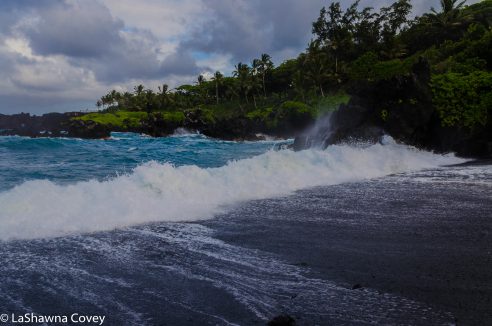
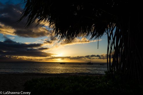
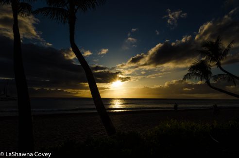
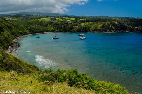
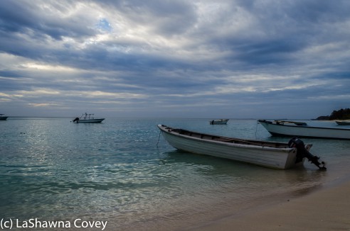
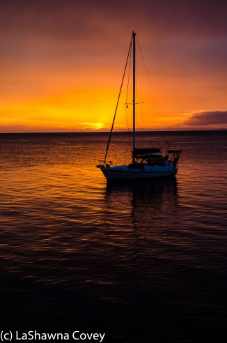
There are many pleasures to doing the Hana Highway as a two-day or more trip. I have detailed all the number of beautiful nature sights along the highway itself (the sheer number of waterfalls is spectacular, especially during the rainy season). However, there is another benefit, and that is skipping most of the tourist crush. Since most tourists do the Hana Highway as a day trip, that typically means they start early and stop mainly at the big sights or for a short time at each of the sites. That allows the multi-day trippers to start later in the morning so the sites are not as crowded when they arrive. It also allows the tourists who do stay overnight in Hana to reach Haleakala National Park before the crush of tourist vans later in the morning or early afternoon.

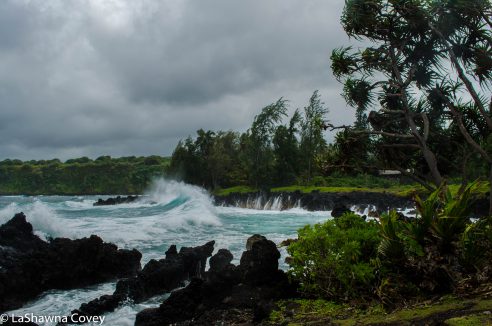
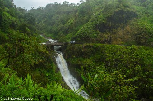
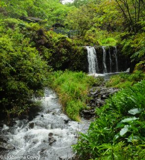
When most people hear “Haleakala National Park”, their thoughts assume it is just the mountain summit and immediate areas, but the park also extends from the mountain top down through the valley, the Kipahulu Gap, all the way to the ‘Ohe’o Gulch (also known as the Seven Sacred Pools), which is an absolutely gorgeous series of small waterfalls.

Haleakala National Park hiking-2

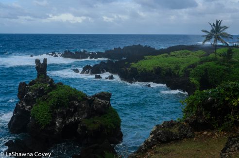
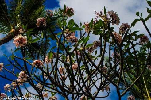
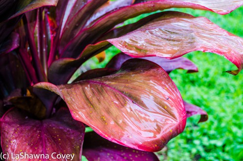
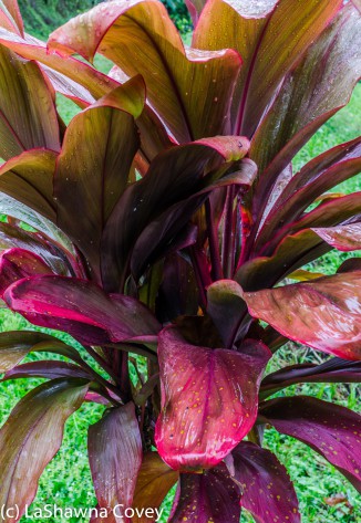
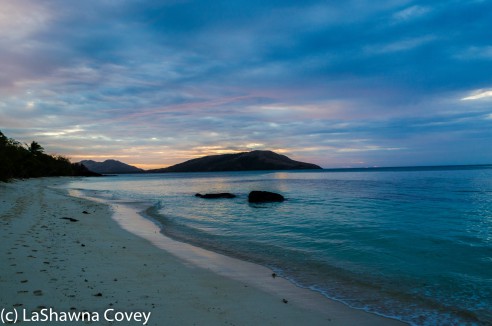
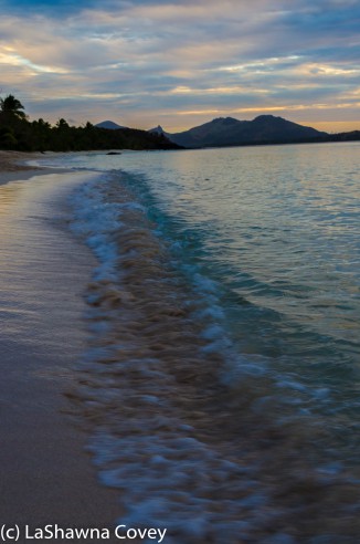
The day we went out to this area, the day was a bit cloudy, but it was still warm and a bit humid, so the scenery was not as bright as it is during a bright, sunny day. But it still felt like a lush, tropical wonderland. Since we started early in the morning, all the day trippers were still tooling along the Hana Highway, so it was not as crowded as it would become later in the day. That meant Mom and I could enjoy the waterfalls in relative peace without having to elbow gaggles of tourists aside to get a good photo.

Haleakala National Park hiking-4

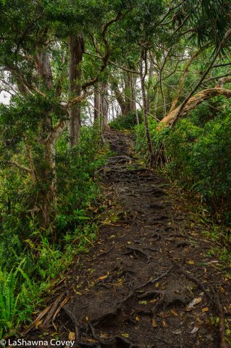
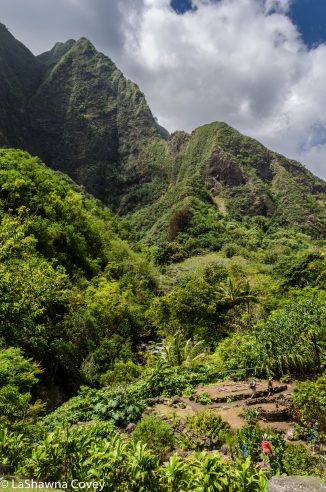
After enjoying the ‘Ohe’o Gulch, I decided to hike up the Pipiwai Trail to see the Waimoku Falls. The trailhead for this hike is off the highway toward the ‘Ohe’o Bridge near mile marker 42, and there are well marked signs from the parking lot and ‘Ohe’o Gulch to get to the trailhead. The hike is only two miles from the starting point to the falls, so I decided to ditch the water bottle, which was kind of stupid on my part. While I can easily hike four miles with minimal water, this particular day was warm and a bit humid. While I didn’t come close to passing out from dehydration, I wish I had some cool water, because I was parched by the time I returned.

Since Mom and I had a full day planned, I didn’t want to take too much time ambling up the trail, so I set a fairly brisk pace for me, with a goal of less than an hour to get to the falls. The trail on the way to the falls is nearly all uphill and gains 650 feet in elevation, some of it steeper in parts than others, so I felt it a bit at the beginning. Like many hiking trails I’ve been on, the trail ascended rapidly in the beginning through a series of steps, but the trail did level off around the first mile. Haleakala National Park hiking-8

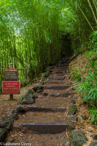
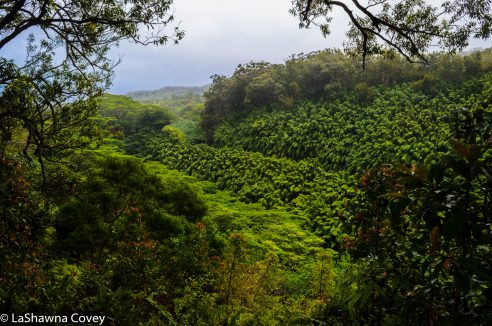
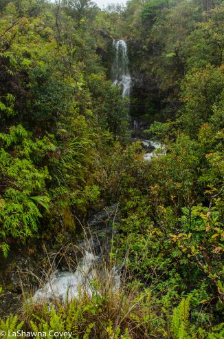
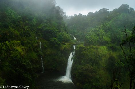
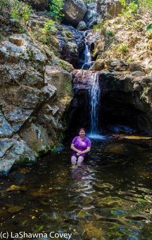
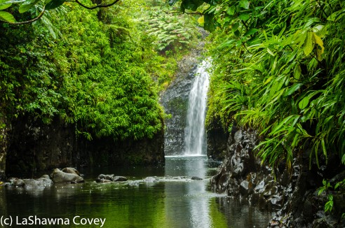
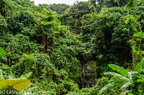
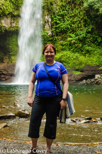
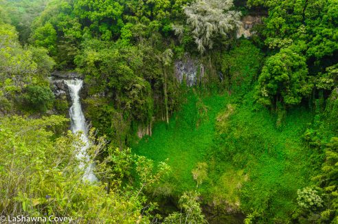
For the most part, the trail is not filled to the brim with spectacular nature. Yes, there are some very beautiful views on occasion, such as this very nice waterfall, Makahiku Falls which drops 200 feet (not obvious when looking at it from the overlook), that was located about 2/3 mile into the hike. When I was hiking the trail on this day, I didn’t see any lookout to get a very clear view of the entire waterfall, but I was able to get some reasonably good shots through the foliage.

Haleakala National Park hiking-5

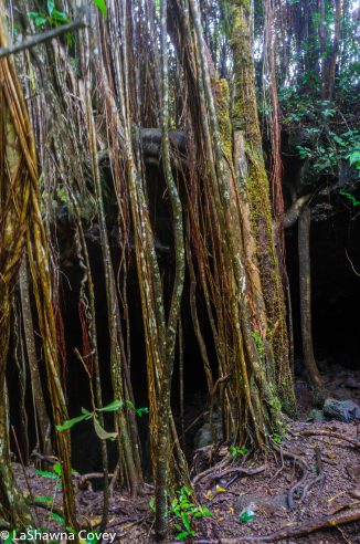
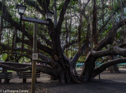
Continuing up the trail, I shortly arrived at a huge banyan tree just hanging out on the trail, which is perfect for photo ops. My guidebook detailed numerous side trips from this trail, but I didn’t see the trails for most of them and with my limited time, I wasn’t going to spend too much time hunting around for the trails.

Haleakala National Park hiking-6

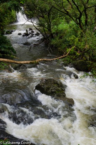
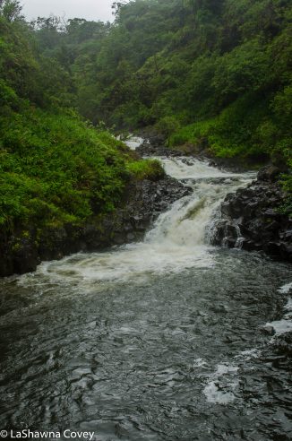
Soon after that, I came to a couple of bridges that afforded some really nice views of the stream and some small waterfalls, which makes for a nice stop for photos.

Haleakala National Park hiking-7

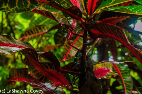
After this, all of a sudden you find yourself transported to another land in the form of a thick bamboo forest. I’ve run into these type of forests in Japan, but not as much in my travels of Hawaii. I personally love bamboo forests, as the trees are just so odd looking but streamlined and beautiful. The ground during the bamboo forest was rather muddy, so it was very good that the trail is covered in a wooden boardwalk to keep your shoes clean and make it easy to walk on the trail.

Haleakala National Park hiking-9

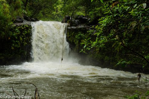
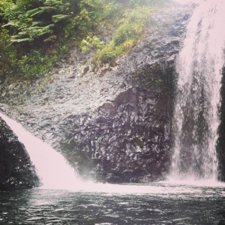
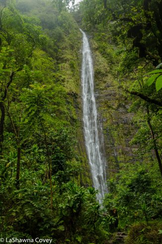
I was starting to wonder when I would reach the falls, and shortly after exiting the bamboo forest, I came to the end of the line. The trail ends at Waimoku Falls, which is a narrow 400-foot waterfall down the rock wall. There is a sign near the falls that advise against getting closer to the falls, which many people ignore to get right in the waterfall pool. I was feeling the walk up and wishing I had some water, so I just sat back with a wide view of the falls and took all the beauty in.

Haleakala National Park hiking-10

Thanks to my brisk pace, it took me about 40 minutes to hike the two miles from the trailhead to the falls, which was faster than I had allotted for myself. I took plenty of time to catch my breath and take in the gorgeous view before deciding to head back down. The hike down was even quicker going down than up, because it was all downhill. If you are out in the Hana area, you really NEED to visit this part of Haleakala National Park (which most tourists do on their day trip, so they speed down the Hana Highway to get here before it gets dark), because the nature is just astounding. If you have the time (which I recommend you budget), the Pipiwai Trail is very much worth your time. It’s not THAT difficult, and all you need is a moderate level of fitness to see really beautiful waterfalls (assuming you haven’t overdosed on waterfalls already the time you get to the park). All in all, this was a great stop on your Maui extravaganza.


Journey to Hana and Back (All the Other Beautiful Nature)

Hana Highway #1-7

The absolutely gorgeous Hana Highway is most known for the abundance and variety of waterfalls, but there is also other beautiful nature to behold as well. One of the first stops out on the Hana Highway was at the Waikamoi Nature Trail. It is located between mile markers 9 and 10, and there are a couple nature loops. I did these walks myself, because it was raining and Mom decided to guard the car while I got wet and sort of muddy. It wasn’t pouring down rain, but there was sort of a constant drizzle. Both trails are pretty easy, though like I said, they were a bit muddy when I visited. However, at one point, there was a nice view of the green valley (a common theme at many of the stops along the Hana Highway).

Hana Highway #2-1

Hana Highway #2-2

Thanks to my guide book, Maui Revealed, I knew that you could walk a bit from the main trail and come to a pretty waterfall. Yes, I did say that this post was going to be about everything but waterfalls, but just one more (since my Hana Highway waterfall post was just packed to the gills with them). I followed the directions in the book, where I took the longer trail out to a picnic area and then walked past the “End of Trail” sign. The book said to take the trail to the left and walk a few minutes, where it would lead to a stream an dam. I think I must have missed some critical step because I didn’t find myself where the book described. I took one path down a bit, but then it started getting super steep and slippery so I hiked back up and tried another wider path that was more like a road. I eventually did come to a nice view that overlooked the top of a waterfall, but I don’t think I was where I was supposed to be. However, the rain started picking up and we had many, many more stops along the way, so I turned back and walked to the car.

Hana Highway #2-3

We made a stop in Ke’anae, and the turnoff road is between mile markers 16 and 17. You pass a stand called Aunt Sandy’s selling pretty good banana bread and then come to the end of the road at the Ke’anae Peninsula, which opens up right onto the seas. In the past, there used to be a small village there, but thanks to a massive tsunami in 1946, all the buildings but the stone church were destroyed. However that church still remains standing to this day.

hana-highway-2-12

In addition, the view of the sea is absolutely marvelous from this vantage point, and the day we were there, the sea was churning mightily with some powerful waves crashing against the young lava rocks.

Hana Highway #2-7

Hana Highway #2-8

We made a brief stop at Wailua Valley State Wayside, which is just before mile marker 19. It is a short trip up the stairs, but at the top, you have a wide open view of the Ko’olau Gap with the lush green valley laid out before your eyes and a far off waterfall visible (at least at the time I visited, because it was raining).

Hana Highway #2-10

My next stop is probably the weirdest, and it is extremely easy to miss if you don’t keep your eyes out for it. But there is a small lava tube cave just off the right (mountain side) two turnouts past mile marker 23. But if you know what you are looking for, you will spot it and know you are in the right place.

Hana Highway #1-4

Yeah, on the face of it, it might seem stupid to crawl into a hole off the side of the road when you don’t know what’s down there. But Hawaii really isn’t filled with creatures that can kill you, so you are probably safe. I crawled into the cave (make sure to bring a flashlight, because it does get dark, and there are plenty of loose rocks to fall on if you aren’t paying attention). But inside, you can scramble through the 140 foot long cave and come to an opening in the forest where you can climb out and see inside. Overall, it is a different diversion and a nice break from all the waterfall beauty.

Hana Highway #1-3

Hana Highway #1-2

Just a few miles before you reach the town of Hana, there is a very nice beach stop at Wai’anapanapa Park. The turnoff road for the park is located just after mile marker 32. There is ample parking there, and plenty of signs for things you might want to see. Most of our time was spent enjoying the coastal view and sort of frolicking on the gorgeous black sand beach (sort of frolicking, because the surf was pretty rough that day- even though there were a couple local surfers riding the waves out there).

Hana Highway #2-9

There is an easy trail that leads down to the  volcanic black sand beach, known as Pa’iloa Beach and right when you get down to the beach, there is a small sea arch that looks like a cave. You can walk into it and enjoy the sea view from a different angle.

Hana Highway #1-9

We spent some time just enjoying the texture of the beach and the beautiful black stones.

Hana Highway #1-8

Hana Highway #1-11

We eventually left, because the tide was coming in and we were only a couple hours from sunset and we wanted to get to Hana and settle in at our inn before it got dark. But it was still amazing to witness the awesome power of the ocean crash into the beach. I have always had a thing for stormy beaches and crashing waves, and there was an abundance of both on this day.

Hana Highway #1-10

The town of Hana is small, but nice. There aren’t THAT  many hotels out there (since most tourists do the Hana Highway as a day trip), and most the hotel rooms are sort of inn rooms or Air BnB type rooms in someone’s house. Our particular inn room was very nice with an outdoor shower, which is one of my favorite things when visiting the tropics. We got up early the next morning to head out to Haleakala National Park for some hiking and waterfall viewing (subject of my next blog post), but we had a nice sunny morning to start the day in Hana.

Hana Highway #2-18

If you have the time, I would highly recommend staying overnight at Hana. It gives you that much more time to stop and see the numerous beautiful sights on the Hana Highway. It allows you to really enjoy the scenery rather than just zooming by it or just taking a minute, because you have a packed itinerary to complete in a day. It is also likely to help you avoid the crush of the tourists. Overall, I think taking your time on the Hana Highway will allow for a deeper traveling experience.

Hana Highway Journey to Paradise and Back (Nothing but Waterfalls Edition)

Hana Highway #2-14

When I was researching my trip to Maui, my guide book touted the Hana Highway as one of the “must do’s” on Maui. The 35 mile drive along Highway 360 is considered one of the most iconic drives in the world, since the windy, twisty road is like driving through a  remote tropical paradise, like Jurassic Park (assuming it is not overrun with tourists when you do the drive).

Hana Highway #1-5

A 35 mile one way drive to Hana doesn’t sound like that much, but the trip turns out to be longer than you might think. First off, this road is one of the curviest roads I have ever driven. Supposedly it has 600 turns, though I didn’t really keep count. What I do know is you will probably never go faster than 35 mph for very long, because you are always slowing down for a tight turn, and there are many, many one lane bridges that you have keep a watch out for oncoming traffic.

Hana Highway #2-4

Plus, this is not a road you want to speed. The drive to Hana is very much about the journey and not the destination, because while the drive to Hana (and beyond) is so beautiful, there is not anything exceptional in the village of Hana. There are so many stops of exquisite nature on the road to Hana that it seems like every few minutes, you will be stopping at something to admire and gawk.

Most people do the Hana Highway as a day trip, and it is entirely possible to do it in one day. However, know that unless you start very early and finish late, you will probably not be able to see everything (assuming you want to see as much as possible), so you will have to pick and choose what stops are the most important to you, or at the bare minimum, not allot much time at each stop. Since Mom and I weren’t in any hurry, we decided to make the trip out of Hana into a two day affair and spend the night at Hana. That allowed us to leave a bit later in the morning, thus letting any sort of tourist crush get ahead of us, and then take our time on the way out to see everything we wanted to see, knowing that we would have a full day to see anything we missed on the way back.

Hana Highway #2-5

The day we drove out to Hana was warm, but rather cloudy and rainy. Everything still looked like a lush, green, very wet paradise, but we had to balance it with taking advantage of the breaks in the rain, and in some case, going out to the views myself and taking all the pictures while Mom stayed in the nice, dry car. The nice thing about all the rain though, is that the waterfalls were full, and there were just so many waterfalls to stop and gush at.

We undoubtedly would have missed some critical stops along the highway if it was not for my trip making guide book, Maui Revealed. There are some signs for a few of the sights, but for many of them, you have to know what to look for, because they are easy to drive by and miss. The nice thing about this book is that all the sights are listed in relation to the highway mile markers, so you have a pretty good idea when something is coming up. The ONLY problem we ran into, is that some of the mile markers from 9-16 seemed to be missing, though maybe that problem has been corrected since we visited. That resulted in us having to occasionally guesstimate where to stop, but for the most part, we were able to figure it out.

Hana Highway #2-15

There are so many waterfalls to enjoy that honestly some of the waterfalls start blurring into the next, and it can get a bit difficult to keep track of where you are. If you really want to know which waterfall you are at to remind yourself later, it’s probably best to write down the photo number and the location. Every time you get out of the car, you can barely see any surrounding roads, so it just seems like you are alone in a lush, super green, and while we were there super wet paradise. When we were there, all the foliage around us was thick and green, broken up only by the white of waterfalls, the black of the seaside cliffs and the blue of the sea. And for the most part, we were on our own. I think it was because we were there in the off season, mid week, and it was raining, but we avoided the crush of tourists that are certainly possible during this drive.

Hana Highway #2-17

One of the first waterfall highlights we stopped at was Lower Puohokamoa Falls, just short of the 11 mile marker. There is a tiny pullout on the sea side of the road, and it is easy to miss (look for the telephone pole), so we had to turn around and go back. Right by the pole, there is a muddy trail (assuming it has been raining like it often is) that leads you down the hill. At first, I wondered if the short hike was worth it, but other persons I ran into said to keep going, because it is worth it. You will know when you are in the right place, because the foliage opens up and you see the falls amidst the greenery.

Hana Highway #2-6

What makes the Hana Highway such a fun drive is that a good chunk of the waterfalls are basically just off the roadway, so you can see them very easily from the road, or with just a short walk. The bad thing about all of this goodness, is that there are few very parking spots alongside the road, and the road is often narrow. You can often find a pullout for a car or two near the bridges, but other times, you might have to park a bit away from the waterfall and then walk along the road back to the site. That is when it is nice that most people (or at least most tourists) drive pretty slowly along the highway.

Hana Highway #2-11

One of the easily photographed waterfalls are the Upper Waikani Falls (sometimes called the Three Bears Falls), which are located between the 19 and 20 mile markers. These falls will vary fairly dramatically, depending on the time of year and the flow of water. This particular time, the water was flowing pretty well, so it all looked like one falls.

Hana Highway #2-12

Just short of the 21 mile marker, we drove by the Wailua Iki Falls. The falls viewable directly off the road are pretty, but the true majesty of the falls isn’t viewable until you walk (or drive) up a little further on the road toward Hana. The road twists a bit and rises a bit in altitude, and that vantage point shows the truly wondrous view of the lush valley and full falls above and below the road. That view is the title photo for this blog post.

Hana Highway #2-13

A quick and easy stop for some light and easy waterfall viewing is at Pua’a Ka’a State Park, located between mile markers 22 and 23. Unlike most stops along the Hana Highway, there is plenty of parking and even a bathroom. The waterfalls are small, but still pretty to enjoy for a bit.

Hana Highway #1-1

The Hana Highway doesn’t actually end in Hana. Highway 360 continues, though the mile markers shift and start counting down from mile marker 50 once you get past Hana. On the first day of our trip, we just went as far as Hana, because we were staying overnight. I am glad we made the choice to stay overnight, because it gave us the opportunity to just relax and take it all in. The last major waterfall we stopped at on the Hana Highway was Wailua Falls. We saw it the next morning as we were driving out to Haleakala National Park to see the sights there and do some hiking (which will be in another blog post). Wailua Falls is right off the road, right around mile marker 45 and is the bridge over Wailua Stream. This is a major stop on the highway, so there is a decent sized parking lot. However, since it is a popular stop, many tour vans and buses will stop there, so don’t be surprised if you see a crowd. Luckily they usually don’t stay there long and will disperse.

Hana Highway #2-16

If you love waterfalls, you should just adore the Hana Highway. There are just so many waterfalls in so many different configurations, and none of the waterfalls look the same.


Western Maui Driving Pleasures

West Maui driving-13

A while back, I was in Hawaii for work and I decided to take about a week’s vacation on the back end to travel to Maui. And it worked out that my mother also planned a trip to Maui for a week after I was going to leave, so she just backed up her flight to come several days early and we could pal around Maui together together before her friends arrived. Since I tend to be a combat traveler when I am on a limited time, I packed our 10 days with so much stuff that gave us a good overview of Maui (with the exception of southern Maui, since I knew she was going to be based out of there on her trip with her friends).

West Maui driving-2

The first stretch of our vacation was four days on Ka’anapali Beach. There are so many hotels on that stretch of the beach that it makes it very easy to pick a place to stay. Most of the hotels are right on the beach or very near the beach, which makes things very convenient. Ka’anapali Beach is centrally located in western Maui, so it is easily accessible to the larger town of Lahaina to the south and the more isolated stretch of land to the north. It is also a great place to walk along the long stretch of sandy beach, swim in the ocean and enjoy the sunsets.

West Maui driving-4

West Maui driving-3

We used our hotel in western Maui as our base for the first few days, and we went ziplining, snorkeling out at Molokini Island and driving up the coast to the north. It is actually possible to drive all the way around the north of west Maui, though there is a stretch of one-lane road that is supposed to make the drive a bit nerve wracking. On our trip, we weren’t able to drive all the way around on our long drive thanks to traffic congestion around the village of Kahakuloa on the one lane road. However, we were able to complete the drive from other side of the island on our last day in Maui together.

West Maui driving-5

We didn’t spend too much time in the town of Lahaina, as there were plenty of restaurants around Ka’anapali Beach, but we did make one stop early morning for breakfast. This enabled us to find a decent parking spot (it is gets extremely crowded later in the day), and made our stop at Banyan Tree Park more pleasant as there were less people crowding the park (and thus getting into my picture frame).

West Maui driving-17

I knew the tree was big, but I didn’t appreciate just how big until I was standing in front of it. When you first look at it, you think the park is a collection of smaller banyan trees, but nope, it is one large tree that has spread its roots all around. It is quite the site to behold, even if you can’t climb it.

West Maui driving-16

For this particular drive, I pretty much followed the suggestions from the travel guide, Maui Revealed: The Ultimate Guidebook by Andrew Doughty, which was filled with lots of great tips on places to stop, both of larger interest and more niche interest. The book also provides some very good tips on directions and parking and the like, which is very helpful for some of the stops.

West Maui driving-10

After leaving our hotel, we drove north on Highway 30 and our first stop was Makaluna-puna Point that had the Dragon’s Teeth, located in the village of Kapalua. Parking was limited out there, but we were there early enough to get one. From the parking lot, it is only a short walk out to the point. The rock shapes out here are rather different than other rock formations on the island, due to the salt spray from the ocean.

West Maui driving-8

The day we were out there, it was fairly windy and not too crowded, but the site itself was rather entrancing to behold, just because it was another example of the power of nature.

West Maui driving-7

West Maui driving-6Just a short walk away from the point is the view to Oneloa Bay, but the most interesting thing was this sacred maze on the ground made out of rocks.

West Maui driving-9

Continuing the drive north, we stopped at Honolua Beach, because it was considered to be good for snorkeling. There is limited parking along the side of the road (again, good thing we were early), but the walk is short down to the beach. The view was pretty, and the water was pleasant on this sunny day, so we decided to do some snorkeling. You had to swim a bit ways from shore to get any decent snorkeling, but once you got into deeper water, there were some good sights out near some reefs. It certainly wasn’t the most amazing snorkeling, but it was fun, with a variety of fish.

West Maui driving-11

The drive north around the western part of Maui was definitely uncrowded when we did it, so we stopped plenty of times to enjoy the view of the cliffs and of the ocean.

West Maui driving-12

One of the views was of the Olivine Pools, which are these beautiful and swimmable tide pools (sort of, but not really) right near mile marker 16 on Highway 30. Mom and I decided not to venture down to the pools, as they certainly were not without people, and neither of us relished the idea of scrambling down the rock to get to them and then scrambling back up.

West Maui driving-15

Like I mentioned at the top of the blog post, our original intention was to drive all the way around the peninsula and then come back to our hotel. Alas it was not to be. The road turns one lane around the village of Kahakuloa, and apparently there was some sort of traffic congestion (we heard one of the tourist drivers had a panic attack from the narrow road and had to be coaxed to turn around, but I have no way of knowing if that was true) that formed a long line of cars at least a half mile long. Not wanting to wait, we turned around and went back to our hotel.

West Maui driving-14

However, on the last day of our trip, we were able to complete the circle by driving it from the eastern side and Wailuku. The first stop we made was at the Iao Valley, which is a short drive off the junction of highways 30 and 330. It is pretty easy to get to, though I warn that the parking lot is not THAT big (and costs $5) and we ended up having to park along the road and walk in.

West Maui driving-18

The stop isn’t an exceptionally long one at Iao Valley, but it is very attractive, even though it is the site of a tremendous amount of death during a war over three hundred years ago. Today, it is set up as a short walk around the valley, looking at the beautiful views and the abundant plant life. The scene reminded me of Kauai at times.

West Maui driving-19

After that stop, we still had some time to kill, so we decided to drive around to Kahakuloa village from the eastern side. We were tempted by the promise of delicious banana bread that was heavily touted in our guide book. Sure there are numerous banana bread stands in Maui, but this one called Julia’s was reputed to be the best. For the most part, the drive is pretty solitary, as there weren’t too many places to stop, and I was grateful for the lack of vehicle traffic in some part, as part of the road is rather narrow.

We very much enjoyed our time in western Maui for a few days and then prepared to head eastward out to Hana and upcountry to complete our trip. One of the best things to do in western Maui is just to leisurely drive around the peninsula, stopping every so often to admire the view, walk along the beach, or even go for some snorkeling in some of the more protected areas.

West Maui driving-1

Fiji Islands Beautiful Flora and Plants

Fiji Flora-13

Fiji is located in the South Pacific, so it has a very tropical climate. Hot and sunny, but also plenty of rain in some spots (like Tavenui Island) to produce lush vegetation and bright, colorful flowers. These flowers just inspired me to want to turn them into watercolor and pastel paintings.

Fiji Flora-10

Fiji Flora-4

Fiji Flora-9

Fiji Flora-11

Fiji Flora-8

Fiji Flora-14

Fiji Flora-7

Fiji Flora-15

Fiji Flora-6

Fiji Flora-12

Fiji Flora-5

Fiji Flora-3

Fiji Flora-2

Pineapples don’t grow on trees. They grow in bushes. And these are tiny, but sweet local pineapple.

Fiji Flora-16

Fiji Flora-1


Fiji Viti Levu- Mainland fun

Viti Levu-2

My last four days on Fiji was spent on the “mainland” island of Viti Levu. There were a lot of things I wanted to see and do on Viti Levu, but it is a large island, and it is not as easy to just base yourself in one area to see many different sites.

Viti Levu-1

I decided to stay on the southwestern side of Viti Levu at the Intercontinental Fiji Resort. Or I should say my travel agent recommended it, and since it sounded suitably extravagant, I figured why not? It is a very beautiful resort, though a bit more geared toward families and golfers, rather than single travelers.

Viti Levu-11

Due to a number of circumstances, I ended up not doing much of what I wanted to do while on Viti Levu (which just gives me an excuse to return). For the most part I relaxed by the pool, slept in, and some spa stuff (including an absolutely heavenly, decadent, four hand massage).

Viti Levu-12

And of course, I enjoyed a variety of beautiful sunsets (a theme of this trip). My favorite sunset was the one pictured in the title picture. That was also the night the resort hosted a fire ceremony on the beach, which was a beautiful backdrop to see the fire jugglers while the colorful sun dropped below the horizon.

Viti Levu-3

As per usual, the other sunsets were not AS spectacular, but still colorful and beautiful nonetheless.

Viti Levu-13

My last full day on Viti Levu, I had wanted to do a day long adventure on the Navala River. Unfortunately, the tour operator I hoped to use had lost the access rights to the upper Navala River, due to a land dispute with the owner. Then to compound my disappointment, my last day happened to be election day in Fiji. It was actually a pretty big deal, because this was the first democratic election in Fiji since the military coup in 2006. An interesting quirk about Fijian elections was that all eligible adults were required to vote or receive a fine. So since voting was mandatory, most tour operators were not offering any tours that day.

wpid-img_20140917_110550.jpg

However, one of them was. I decided to do a zipline/waterfall hike out in a nature reserve north of the capital city of Nadi. It was pretty fun. There were about eight ziplines, most of them on the shorter end of the runs I’ve done in the past, but they were set in a very lush forest.

Viti Levu-6

After ziplining and lunch, we headed out on a hike to a couple of waterfalls. Along the way, we passed some very beautiful rope-like tree roots, and also some small pineapple bushes.

Viti Levu-4

Viti Levu-5

The waterfalls were small, but the pools were cool and refreshing and you were able to swim in them. I hadn’t realized this particular part of the trip, so I had not brought a swimsuit, but it was so warm and sunny, that my clothes dried quickly.

Viti Levu-8

Viti Levu-7

All in all, I didn’t get to see as much of Viti Levu as I wished. There is a lot to see and do on the island, and when I get back to Fiji, I will definitely take more time to explore it all.

Viti Levu-9

Viti Levu-10

Fiji Nacula Island- Hiking Trails

Nacula Island hiking-14

Even though it was tempting to just lay by the beach in a hammock or cool off by snorkeling, I did take advantage of my time on Nacula Island to do some hiking. This island (and I think most of the smaller islands) didn’t really have much in the way of roads, so there were no cars to worry about. People got around by boat or by walking. I decided to check out two different parts of the island by hiking to them.

Nacula Island hiking-8

The first hike I did was a basically flat hike out to the south eastern part of the island. This hike only took me about a leisurely 30 minutes (maybe more) to get to my final destination of the beach by Nabua Lodge. This hike wasn’t marked with specific trail signs, but I did have a map from the Blue Lagoon Resort that showed me the basic way from the resort to the mud flats on the southern coast. Navigating was basically following the largest trail and hoping I was right (I was). Even though the trail was flat, it was definitely muddy in parts, but there were large branches to help me traverse the deeper muddier area.

Nacula Island hiking-7

The trail emerges onto the mud flats, and with the tide out, the beach was huge with some local natives hunting for shellfish in the mud. After that the “trail” was basically just walking along the shoreline. There were some very beautiful reddish-purplish rocks on the beach, rocks that I had never seen before.

Nacula Island hiking-5

Since it was rather hot and sunny on the day I went hiking, I didn’t start off until the later afternoon, hoping it would cool off a bit. So, I was mindful of both the incoming tide and the setting sun, because I did not want to get caught out on the island at night. Sure it wasn’t dangerous or anything, but I didn’t have a flashlight with me, nor are any of the trails lit up. Fumbling around in the dark is not my idea of a good time.

Nacula Island hiking-10

Nacula Island hiking-2

Once I rounded the beach point, I came upon a relatively wide sandy beach. It certainly wasn’t as wide, or as nice as the beach fronting the Blue Lagoon Resort, but it is home to a couple other more budget lodges. It is also home to the Traveller’s Tea House. I had read about that place in my guidebook, and one of the other reasons I timed my hike when I did was to hit the tea house when it was open (only 3-5 pm in the afternoon) so I could indulge in some local cake. The cake that day was a very tasty chocolate coconut cake made right on site, and it was delicious. So thick, so rich. It just melted in my mouth as I enjoyed the beach view.

Nacula Island hiking-3

Nacula Island hiking-4

After the cake, I walked a bit farther down the beach to Tadrai Point, which was an open rock sea arch. There really wasn’t much more of note on the other beach around the point, and the sun was getting low on the horizon, so I headed back.

Nacula Island hiking-6

Before heading inland back to resort, I made a quick stop at a mangrove forest right in the mud flats on the beach.

Nacula Island hiking-9

My second hike was to the one of the highest points on the island, where it afforded me a 360 degree view of the entire island. Since this hike would afford me no shade, and I needed enough time to get there, enjoy the view, and get back before I passed out from heat exhaustion, or at least exposed me to a sunburn, I decided to do this hike early in the morning. Not so early that I would miss breakfast (which would be stupid, because it was free and it was a plentiful breakfast buffet), but I started right after, around 0800.

Nacula Island hiking-1

This was another one of those hikes that didn’t have clearly marked signs, but I looked at the map at the resort beforehand, and basically knew where I needed to go. The most confusing part was right after leaving the lodge and guessing which trail I needed to take. Since I knew I needed to head up the hill, I followed the trail that ascended. The trail ascended very quickly, and even though it was early in the morning, and the sun wasn’t fully overhead, I had to stop multiple times to take a breather, drink some water, and look at the view.

Nacula Island hiking-11

Once the trail hit the ridgeline, it was simply a matter of walking along it to the highest point. There were times when I was sure I was at the highest point, only to see the trail keep heading higher. Eventually though, I did hit the highest point and could enjoy the tremendous views looking down on the island around me. The view of the eastern side of the island was highly lit with the rising sun.

Nacula Island hiking-16

The western side allowed me to look down at the extensive coral reefs and the differing colors of the water, views you simply can’t see when you are at sea level.

Nacula Island hiking-15

After enjoying the views, I headed back down, and not surprisingly, the trip down was much quicker and easier than walking up. All told, this hike took me less than two hours, and that included the number of stops I made to look at the views. It is a moderately easy hike. The hardest part is at the beginning when the trail sharply ascends to the ridgeline. But basically anyone with moderate fitness and wearing some good shoes can do this hike. I would just recommend you do it in the morning before it gets too hot and sunny, and make sure to bring some water with you. You will need it.

Nacula Island hiking-12

Nacula Island hiking-13

Fiji Nacula Island- Isolated Beauty

Nacula Island beaches-21

My second stop on my Fijian extravaganza was Nacula Island. I wanted to experience as wide of a variety the country had to offer as possible. So that meant I wanted to visit one of the islands in either the Mamanuca or Yasawa island groups. This one took some research and hard choices to make, because there is such a wealth of opportunities among these small islands. The Mamanuca Islands are much closer to the mainland of Viti Levu, and many of them can actually be visited on a day trip (and many people do). The Yasawa Islands are much more remote, and really can’t be visited on a day trip, at least not one that can make for a full day.

Nacula Island beaches-25

Nacula Island beaches-34

After careful consideration, I chose to stay on Nacula Island. Nacula Island is actually fairly far northwest of Viti Levu. There are islands that are farther north, but don’t offer the wealth of possibilities. Nacula Island is pretty big, with a wide variety of beaches, hikes, and small villages to occupy your time. There are some nice resorts on the island, particularly the one I chose, the Blue Lagoon Resort. This resort has a wider variety of expense options, from the cheaper dorm beds, all the way up to your own beachside bure which fronts Long Beach, a long stretch of sugar white, super soft sand with easy swimming and snorkeling in warm water. In addition to what was offered on-island, the Blue Lagoon Resort also has regular trips up to Sawa-i-Lau Cave, which is this weird and beautiful limestone cave where you can swim in the sea. I really wanted to go there, so which resorts offered that trip played a great deal into my final decision on where to stay.

Nacula Island beaches-18

Nacula Island beaches-29

Nacula Island beaches-30

There are two ways to get up to Nacula Island: sea plane or boat. I took a sea plane out to the island, but to save money I took a boat back. Knowing what I know now, I would just cough up the additional funds for a sea plane back to the mainland.

wpid-img_20140911_121505.jpg

wpid-img_20140911_125901.jpg

A boat trip out or back takes about half a day (at least) at around five hours minimum. At first, the boat trip was interesting as we stopped at different islands. But after a while, the trip just became repetitive because the islands looked the same from the boat, the sea got rougher, and the boat got more crowded. I was over it by the time we rolled into Viti Levu and was kicking myself for being too cheap to get a sea plane back. A sea plane trip is only about 30 minutes as opposed to five hours and it took me right to Nacula Island and offers a beautiful view over the islands.

Nacula Island beaches-37

Nacula Island beaches-15

I was out on Nacula Island for about five days, and that is plenty of time to relax and see a wide variety of stuff. One of those mornings was the trip out to Sawa-i-Lau Cave, which was delightful, and thankfully we were the first group to the cave, so it wasn’t that crowded. I also did some hiking (subject to the next blog post), snorkeling and just plain relaxing on the beach. I also took a group trip to one of the local villages, Nacula. It was a small village but it was interesting to see.

Nacula Island beaches-6

Nacula Island beaches-7

Nacula Island beaches-9

We saw the island-wide school all the different villages sent their children to, that also housed a solar panel electricity set funded by the European Union.

Nacula Island beaches-4

Nacula Island beaches-5

For a small village, there were a couple of churches: both the older Catholic Church and the newer Protestant Church.

Nacula Island beaches-8

Nacula Island beaches-10

Nacula Island is a good place to kick back and relax and enjoy “Fiji Time.” I spent many hours doing that. My bure opened right onto the beach, and I had my own beachside chairs to relax. The beach itself was very beautiful with soft sand. The snorkeling off the beach was pretty good as well. There was a small coral reef that house a wide variety of colorful fish. It was so easy to just wade into the water at high tide and paddle around a bit looking at the fish. I also took another snorkeling trip through the resort out to another island. This part of Fiji is amazing for snorkeling. The water was warm (not hot like the Caribbean), though winter was just ending so it probably gets warmer in the summer. The water is clear and the colorful fish are plentiful. The seas up in this area are pretty calm, so it is easy to snorkel and you don’t have to fight the ocean currents. Seriously, Nacula Island looks just like you imagine a tropical paradise island could look like.

Nacula Island beaches-1

Nacula Island beaches-24

Nacula Island beaches-27

This island is also a good place to view the sunset since the resort faces to the west. Not every night had a beautiful sunset, of course. In fact, every night looked a bit different depending on the quality of the light and the clouds. My favorite sunset was the one in the title picture. This was my second or third night on the island, since the sunsets had been pretty gray and nearly non-existent up to this point. But this night was amazing. The colors were a mixture of orange, pink and magenta, and they just got brighter as the sun dropped toward the horizon. But the best part was when the sun did drop below the horizon and the whole sky lit up for a couple minutes. It’s like the clouds had a major color explosion and filled the whole sky. It was rather awe-inspiring to behold.

Nacula Island beaches-20

Nacula Island beaches-19

Nacula Island beaches-36

Subsequent sunsets were never quite as spectacular as that one, but they were definitely lovely to look at, with most sunsets taking on a golden yellow tone contrasted beautifully with blue sky and sea.

Nacula Island beaches-31

Nacula Island beaches-32

Nacula Island beaches-33

Nacula Island was definitely worth my time, and I would absolutely come back on a second trip. I would just suck it up and pay for a sea plane both ways to save time. Sometimes it is worth it to spend some extra money to maximize your travel time.

Nacula Island beaches-17

Nacula Island beaches-16

The Astounding Beauty of Fiji- Tavenui Island

Tavenui Island-20Last year as I was getting ready to move from Korea, I knew I had to take one final vacation somewhere in Asia. My first choice was originally Thailand, because it has been on my list for years. However, just as I was getting ready to make some travel arrangements, the military coup happened, and travel was restricted. So I quickly cast around for a “consolation prize” (if you will, but not really) and latched onto Fiji. I knew I wanted to visit the South Pacific at some point, and in fact had looked into going to Fiji one New Years weekend, just for the pleasure of being one of the first to experience the new year. That didn’t happen, but I relooked into going there. What cemented it for me was the travel time. I had envisioned something like 24 hours worth of travel with at least one stop. But much to my delight, I learned that Korean Air flies directly to Fiji from Seoul, and it was only a 10 hour flight (less time than it took me to get to New Zealand).

wpid-img_20140905_153908.jpg

So I started researching in earnest. and decided to book everything through my favorite Asian travel agency, Asia Transpacific Journeys. I had great success with them several years ago when they put together my vacation for Vietnam and Cambodia, and figured it would be good to use them again. This time, I decided to go a bit more high end. Usually I stay in hostels or budget hotels, because I travel alone and just need a place to stay, but nothing fancy. But I figured that if I was going to fly to Fiji, I wanted to do it up special. So that opened up a world of possibilities to me that would have not been AS COMFORTABLE with a budget trip.

Tavenui Island-15

Tavenui Island-14

After careful research, I decided to confine my trip to three places: Tavenui Island, Nacula Island and Viti Levu. I figured this would give me a good cross section on what Fiji has to offer. I decided to start my trip with Tavenui Island since it was a bit more out of the way, and is really only easily accessible from the “mainland” (i.e. the island of Viti Levu) by plane. Tavenui reminded me like a less developed Kauai Island in Hawaii. It is very green and lush, and not heavily populated. As a result, only part of the main road is actually paved. From the airport to past the main town is paved, and it is paved around the housing complex that houses foreign visitors (of course), but the rest of the road is dirt. So, distances that don’t seem so great on paper actually can lead to fairly long journeys.

Tavenui Island-18

My travel agency booked me at Paradise Tavenui, which was mentioned in my travel book, but didn’t go into great detail. This resort is on the southwestern side of Tavenui, not that far from the town of Vula. I have to say, staying at this place was LUX. It pretty much had everything I want in a high end tropical resort. I had my own bure (or thatched cabin) with a very comfortable bed and nightly turn down service, and a nice bathroom, including my favorite tropical “indulgence”, an outdoor shower. I love showering outside at night in the warm air with the tropical breezes blowing by. This resort also has its own spa section, and there are few things more deliciously decadent than getting a massage right by the ocean.

Tavenui Island-16

This resort is sort of all inclusive, or can easily be. My package gave me so many meals, and all the soft drinks I could consume (booze was extra, and who doesn’t want to enjoy a tropical paradise with tropical liquor?) Every meal was outside, and the dinners in particular were very nice. One of the nights I was there we had a traditional Fijian lovo, sort of like a Fijian barbecue or luau, where all the meat was wrapped in local banana leaves and cooked over an open fire. It was interesting to see them prepare the meat and starches and then get to indulge in it afterward.

Tavenui Island-4

Tavenui Island-5

Tavenui Island-7

Tavenui Island-8

Tavenui Island-9

Tavenui Island-13

I went on a couple of excursions from the resort. One of them was an all day trip to do the Lavena Coastal Walk (subject of the next blog post) and some snorkeling. Fiji is considered one of the top dive sites in the world, with Tavenui hosting some of the best Fijian diving. I didn’t have my diving certification at the time, so I was just going to do some snorkeling. Most dive trips will take snorkelers, so it was pretty easy, and this excursion was done directly through the resort’s dive shop and not another tour company. The particular trip I did was out to the Great White Wall, which is really  more of interest to divers, though there was plenty to see for snorkelers as well. I saw a wide variety of colorful fish, including some turtles, and beautiful coral and underwater plants. It was a really great trip, with a couple different snorkel (and dive) sites, and a stop for lunch on a nearby beach. The interesting thing is that because I went in September, it was the tail end of winter, soon to be spring. So it was a bit cooler than it can get, and that included the water. I personally didn’t need a wetsuit just for snorkeling, but I did need snorkel fins (I avoid wearing them, unless the ocean currents pretty much mandate them).

Tavenui Island-19

Tavenui Island-17

While I was there, I decided to take advantage of the Discover Scuba program, just because I always wanted to see what SCUBA diving was like. So for an afternoon, I got lessons on the proper way to SCUBA and use the equipment. The lesson was capped off with a beginning dive just off the pier by the resort. My dive instructor Mark was very professional and taught me a lot. In fact, I left Fiji resolved to get my dive certification (I haven’t yet, but I still want to), because when I go back to Fiji (and I know I will go back, unless I die an untimely death), I want to be able to experience the majesty that is diving in Fiji.

Tavenui Island-11

Tavenui Island-12

About half the time I was on Tavenui, it was sunny and beautiful, and half the time it was cloudy. On the days it was sunny, the sunsets were absolutely gorgeous. The resort faced west, so we got full view of sunsets. It was a wonderful and relaxing to end the day by the seaside pool with a drink in hand, taking in all the beautiful colors of the sunset. What was amazing is how the sunset colors differed by day. Some days the sky exploded into a sea of bright pink and orange, and other days, it was more orange and blue (at least the water), and others gave off a more of a silver and blue cast.

Tavenui Island-6

Tavenui Island-10

Normally I am go, go, go on my vacations, but I made a conscious effort to just relax more on Fiji. It helped that I didn’t have a car in Tavenui, and the resort is not really within easy walking distance of anything. So it forced me just to slow down, do an excursion per day, nap in the afternoon, and just take in the beautiful scenery. All told, I was on Tavenui for almost a week, and it was a wonderful start to a delightful Fijian vacation.

Tavenui Island-21

wpid-img_20140914_193422.jpg