The Panoramic View of Iguacu Falls- Brazil side

I was pleasantly surprised when I discovered the majority of Iguazu Falls was in Argentina, because when I first learned about the falls from the Brazil side. Of course, the travel completist in me wanted to see both sides. But when I was imagining going to Iguazu, I was under the assumption that Brazil and America still had a fairly restrictive reciprocal visa policy in place, where it cost a decent chunk of money to visit Brazil, and Americans have to get a visa in advance. So when I had to make my pivot to incorporating Iguazu into my Argentina vacation, I assumed I wouldn’t be able to readily visit Brazil, because I wouldn’t have enough time to secure a visa. However, when I was talking with someone I met on my cruise and he was saying he was going to visit Brazil after the cruise, I asked about the cost of the visa, and he said that policy had been rescinded and you didn’t need a visa beforehand to visit Brazil as an American.

That opened up another whole day of possibility for my Iguazu excursion. It was easy to incorporate a day trip to Brazil on a guided tour to see those falls. Only about one third of Iguazu Falls are in Brazil, so I knew a trip there wouldn’t necessarily take all day. In fact from what I have seen, most of the day trips from Argentina to Brazil to see the falls are really only about a half day. Literally three countries converge at the meeting point of the Iguazu and Parana rivers, so Brazil is just across the bridge. Because we aren’t locals, we did need to clear passport control when entering Brazil to get our passports stamped, but that process only took about 20 minutes of waiting while our guide got them all done at once. That was actually a relief, because when I was talking to a woman the day prior on the Argentina guided tour, she had gone to Brazil the day prior on a guided tour, and it took her group 90 minutes of waiting to get their passports stamped.

So we were off and running a lot sooner than I feared, and the entrance to the park isn’t far from the border. As usual, you have to buy your own entry ticket (unless the ticket is included in the price of your excursion, which in my case, it wasn’t). Luckily the line wasn’t long. We arrived not long after the park opened, and again, this wasn’t peak tourist season for falls visiting.

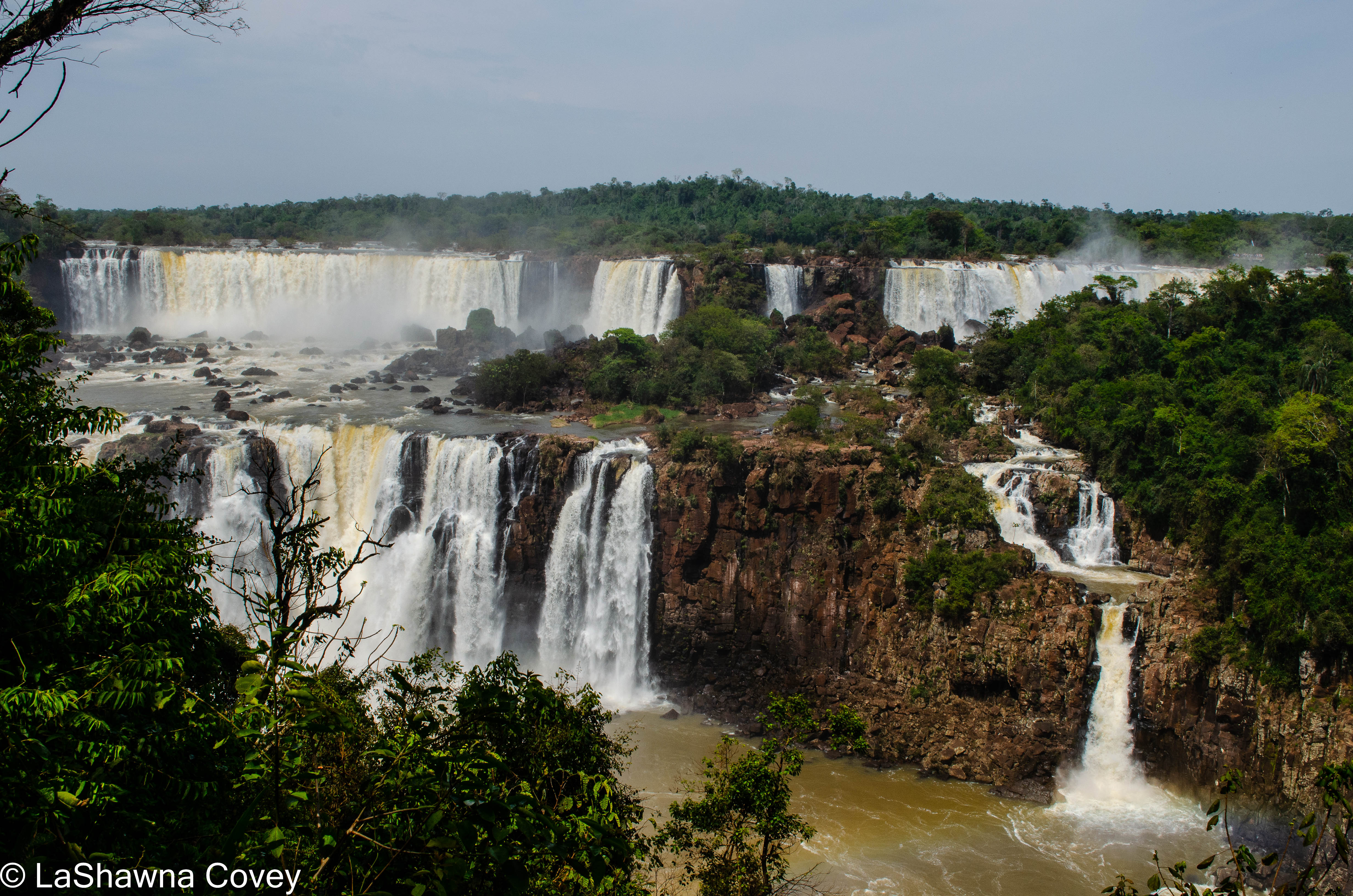
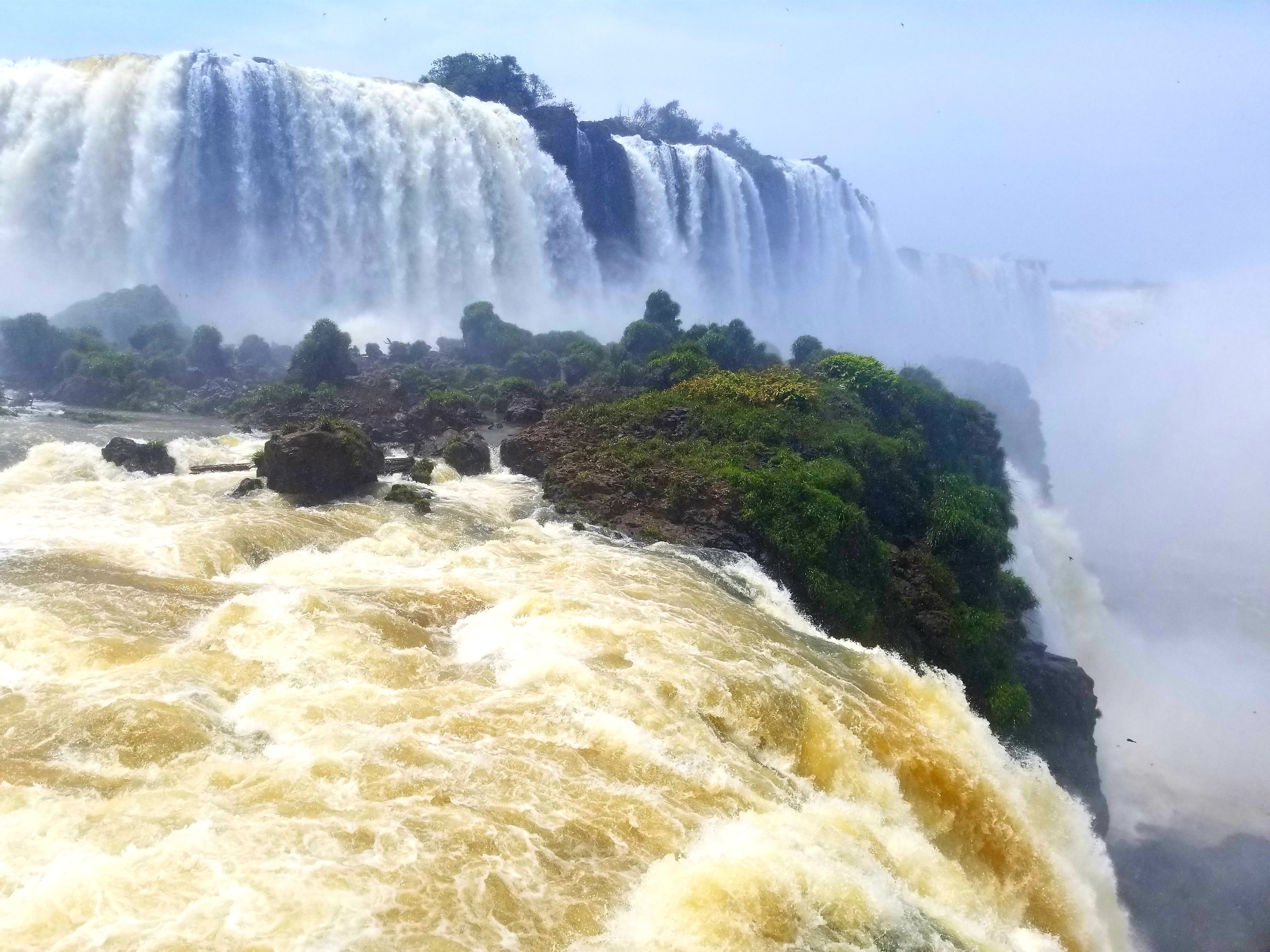
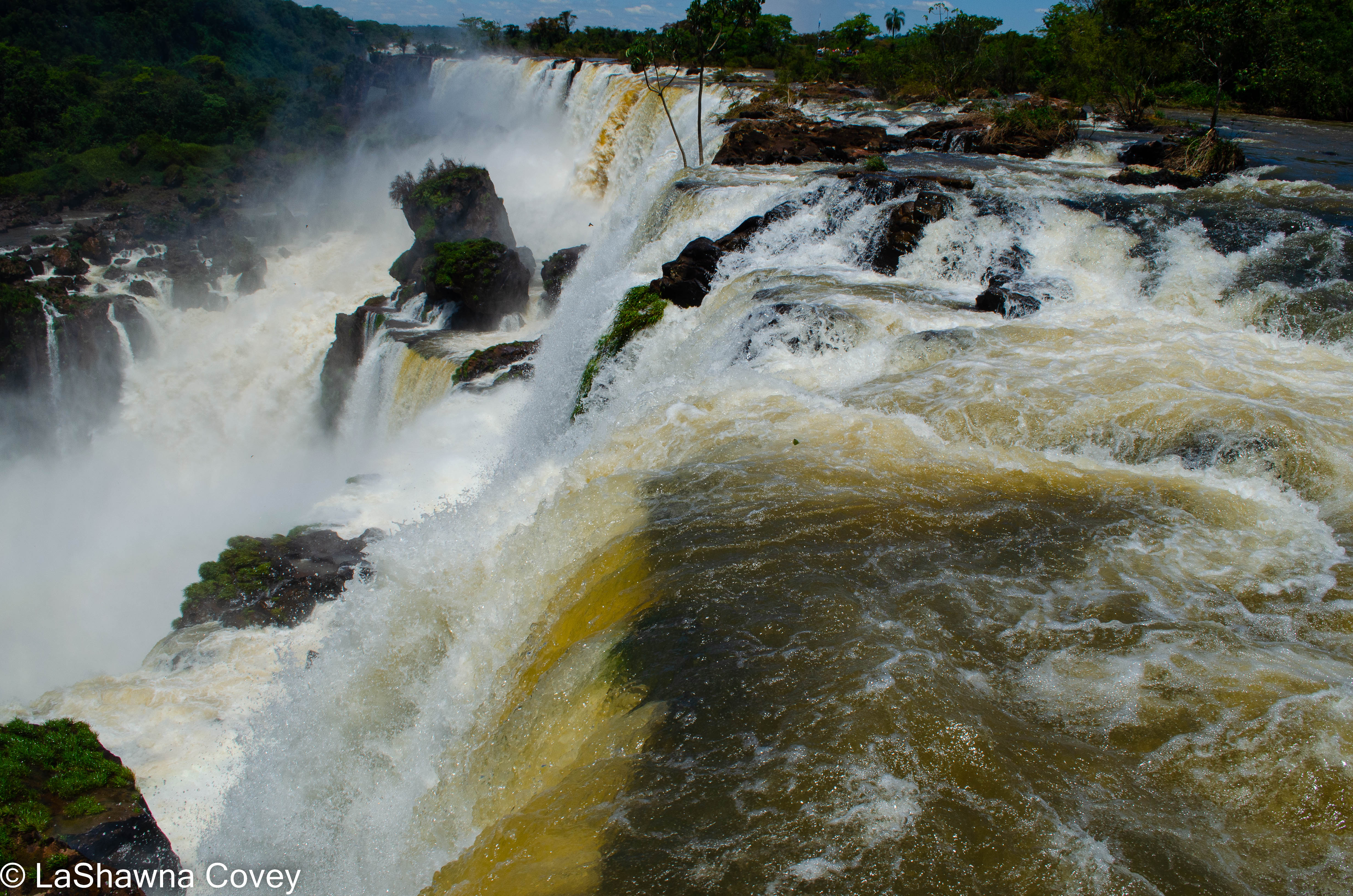
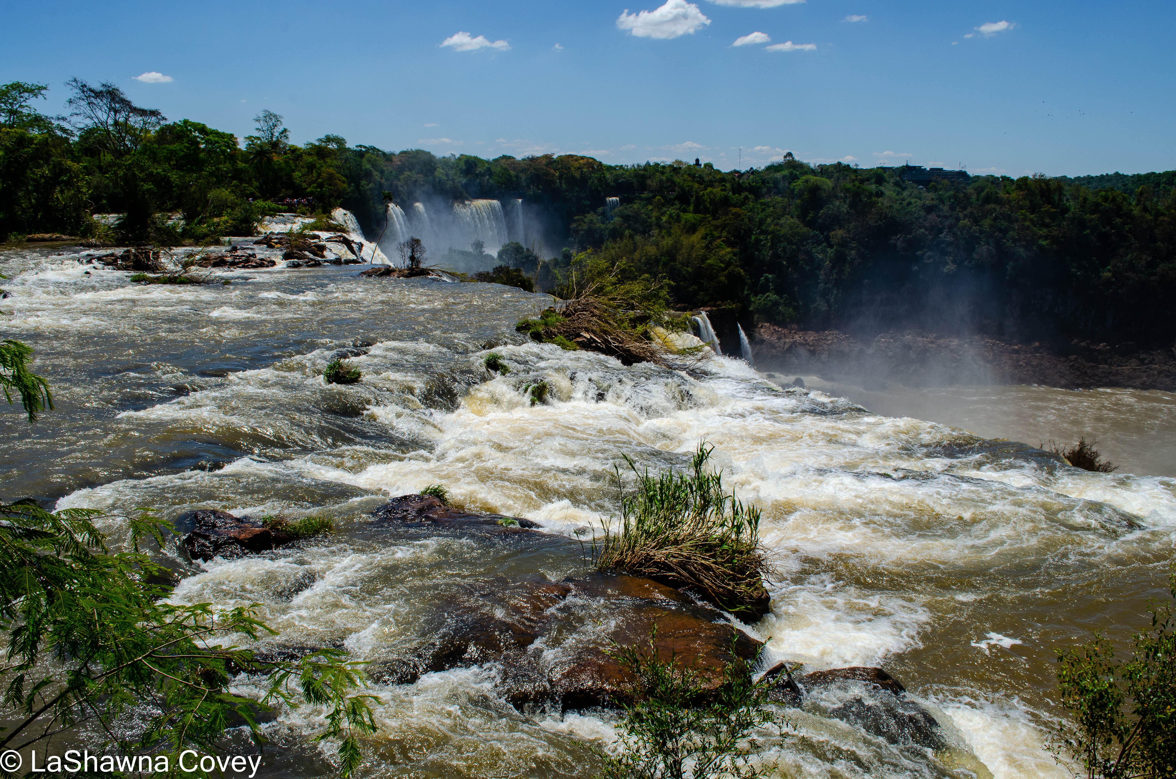
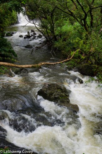
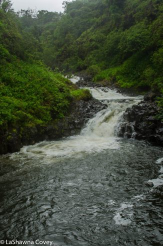
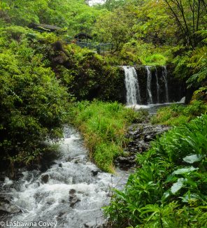
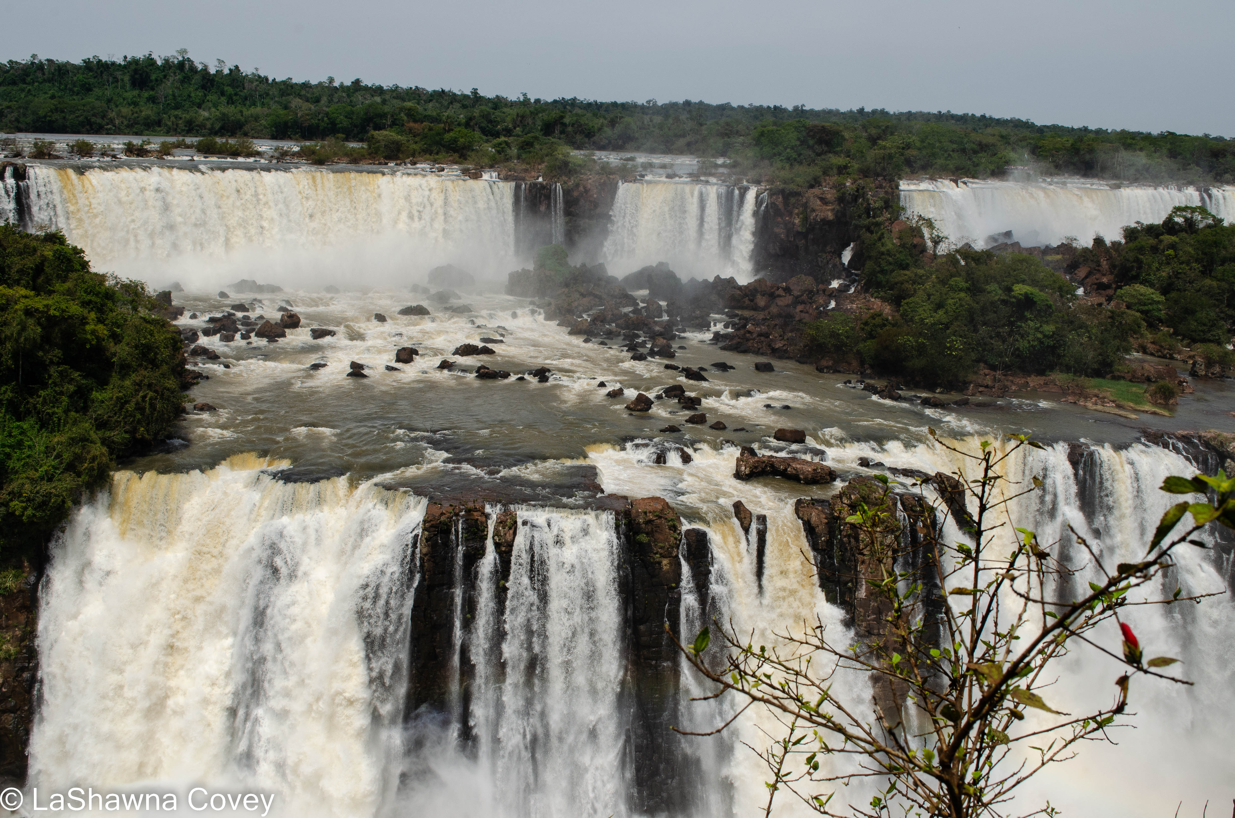
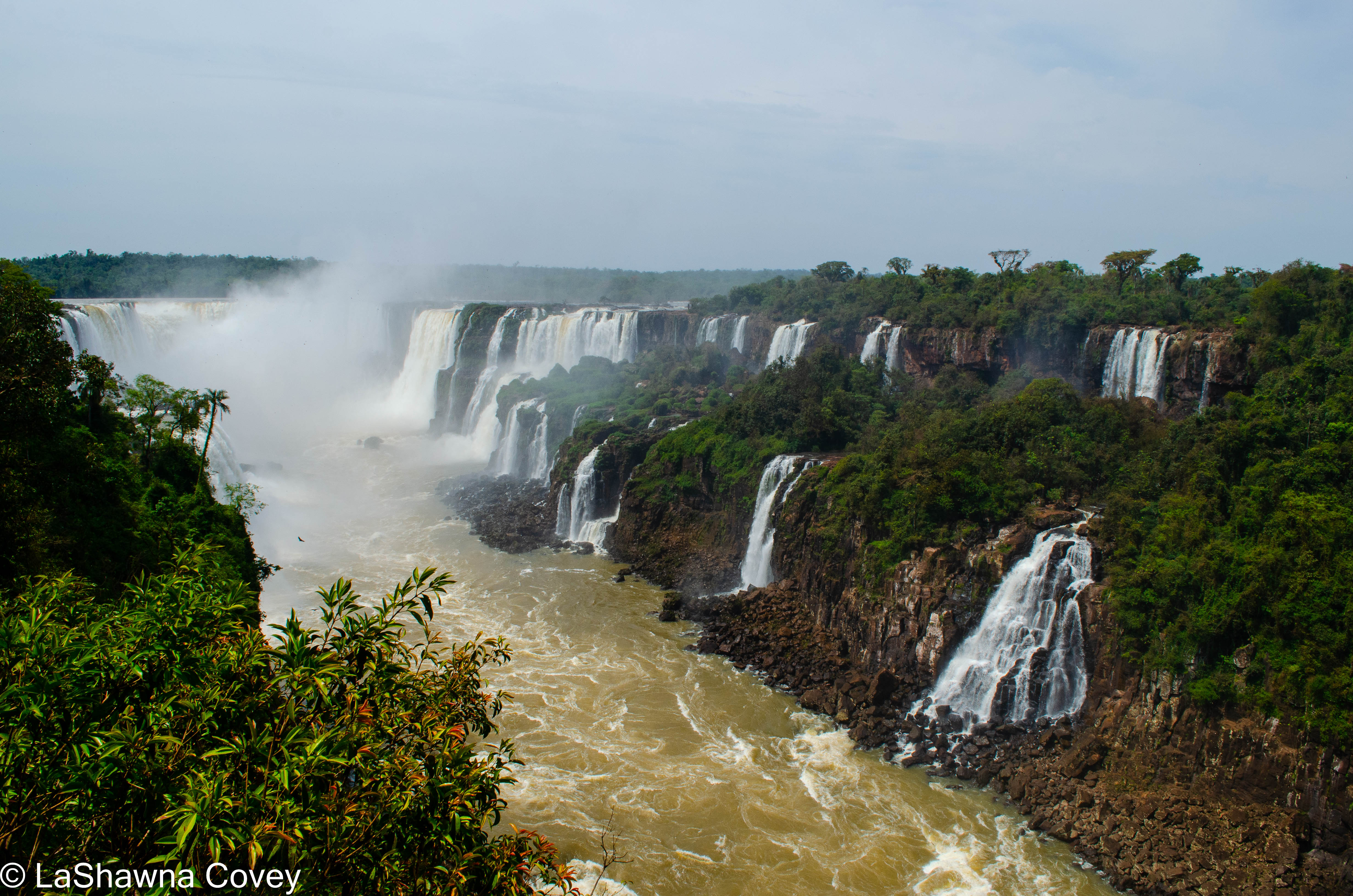
After that, you get on a park bus that will stop at a variety of places. Brazil has a complementary river adventure to the falls like Argentina, and there is a trail you can access the pier. But the majority of people will get off at the bus stop across from the large pink Hotel Belmond Das Cataratas. The vast majority of visitors will traverse the 1.5 kilometer paved trail that starts with a frontal view of Tres Masqueteros falls and moves up the river, culminating in a close up view of Garganta del Diablo. Like with my visit to the Argentine side, I kept having to stop and gawk at the view and take pictures. The water flow was high so that provided a lot of visual drama when observing the falls. The rock formations and trees around the falls added to the picturesque nature of the site. However, unlike my independent trip to the Argentine side, I was part of a group tour, and even though we didn’t have to stay together as a group, I was mindful of how long we had before we were expected to meet back up at the bus stop. Not wanting to lose time on seeing the grand finale of the walk, I tried not to stare too long in any one place.

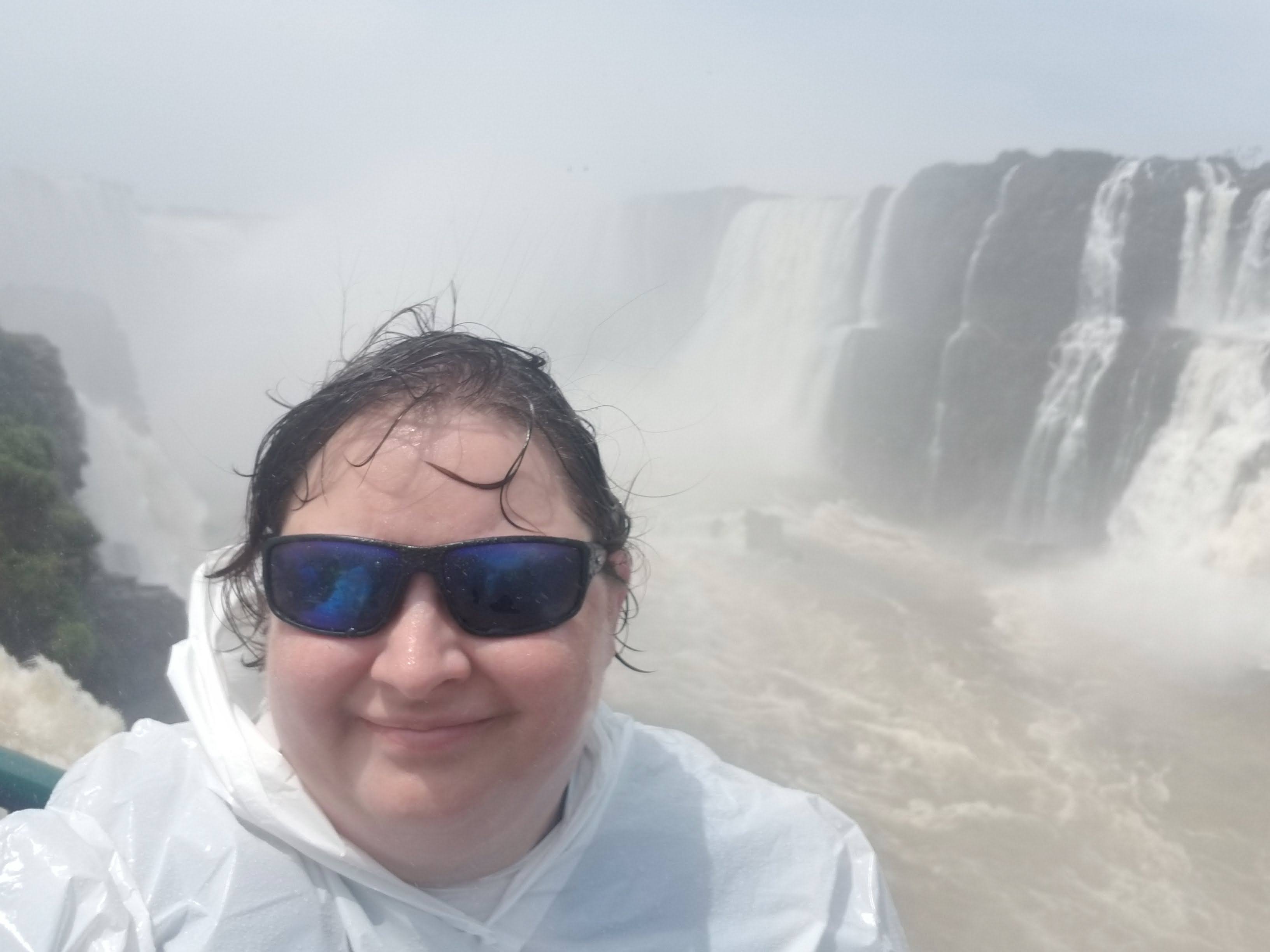
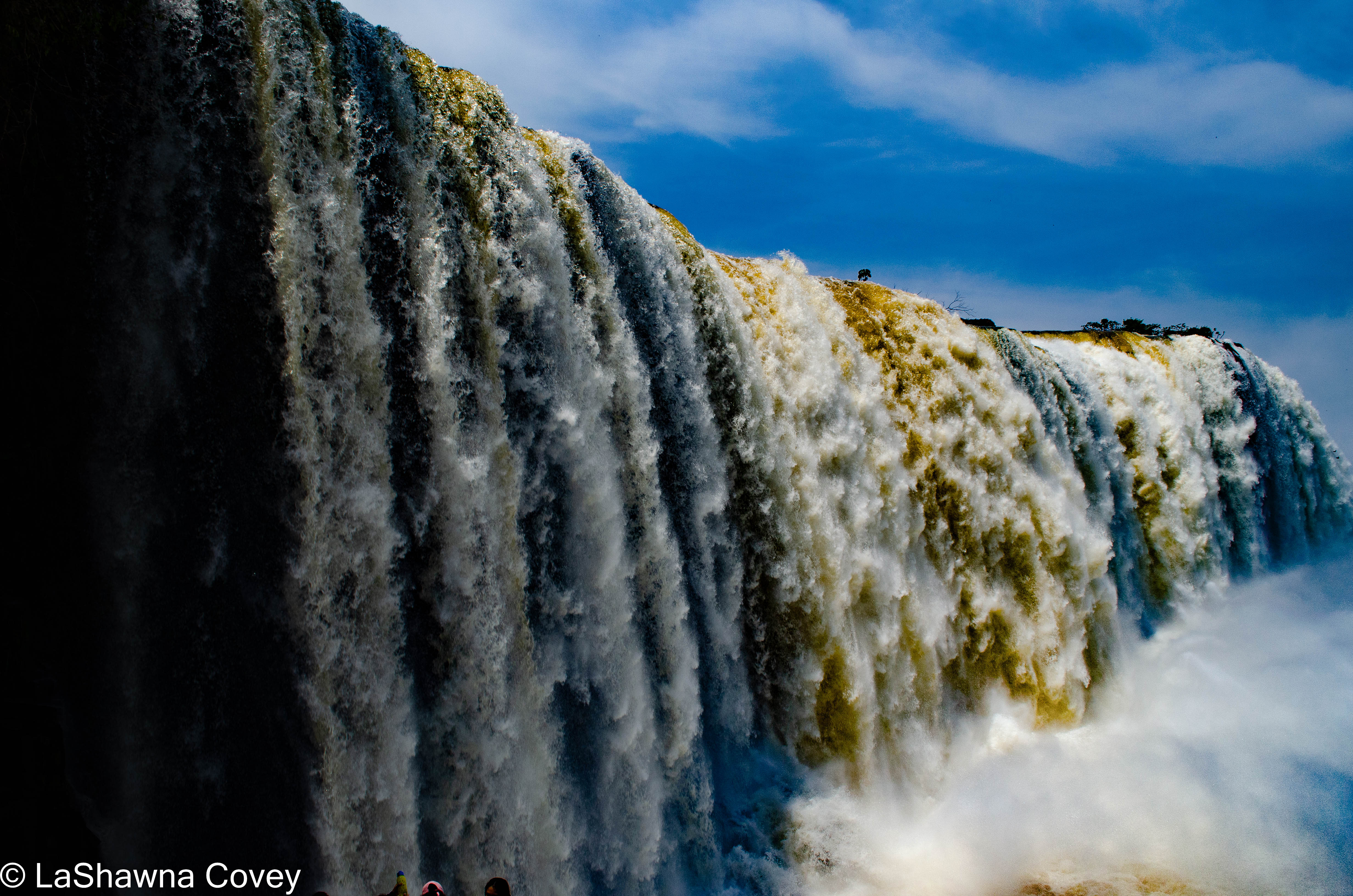
The culmination of the walk is the boardwalk out so you are facing Garganta del Diablo head on. I honestly didn’t have a super clear view of that part (which is the most thunderous part of the falls), because the mist from the spray and the wind was so strong as to obscure the view. This is also the part where you can get pretty wet if you want to. If you don’t, it’s probably best not to go far out on the boardwalk (you’ll know when you are about to get wet). But if you do go out, you can either just get pleasantly drenched, or you can don a plastic raincoat (they are sold everywhere in the park) to stay somewhat dry. I originally pooh poohed the idea of a raincoat, because I didn’t mind getting wet. However, I really didn’t want to get my backpack and all its stuff wet, so thankfully one of the fellow tourists on my trip gave me their throwaway rain poncho when they were done using it.

The walk out on the boardwalk is very scenic, as this is the closest you are to the waterfalls on the Brazil side, and you are looking up at the falls flowing down in front of you. And yes, you can get super wet if you walk all the way out to the end. As much as I wanted to stay longer, the mist constantly blowing in my face was a bit distracting, so I walked back to a drier vantage point.

Once you have had your fill of this view, that is pretty much the end of the path. There is an elevator that goes up to the top where the bus stop is, or there is a paved path that will go up. Since the wait for the elevator was long, and I was running short on time, I elected to take the walking path, which wasn’t as steep as I feared, even though it is all uphill. Honestly, anyone of moderate level of fitness should have no problem with that. Whether you take the elevator or the path, you will end up in the same place, with an overlook at the far left part of the falls.

That is pretty much it for the visit to the Brazil side of Iguazu Falls. It made for a nice half day excursion. Even though we were on a timetable, I didn’t feel overly rushed or feel like I missed any view. There is a lot to take in, but there is enough time to do so.

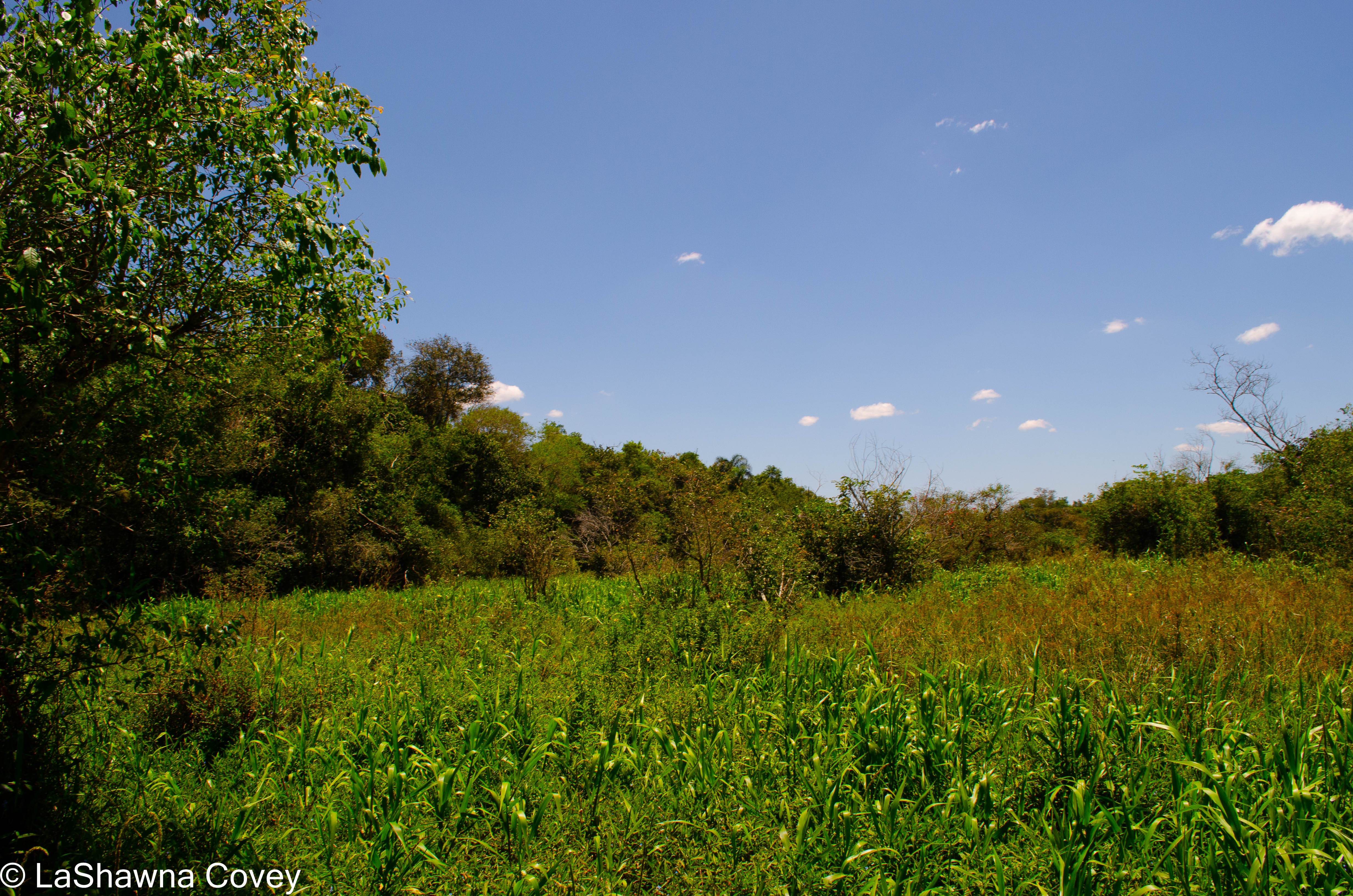
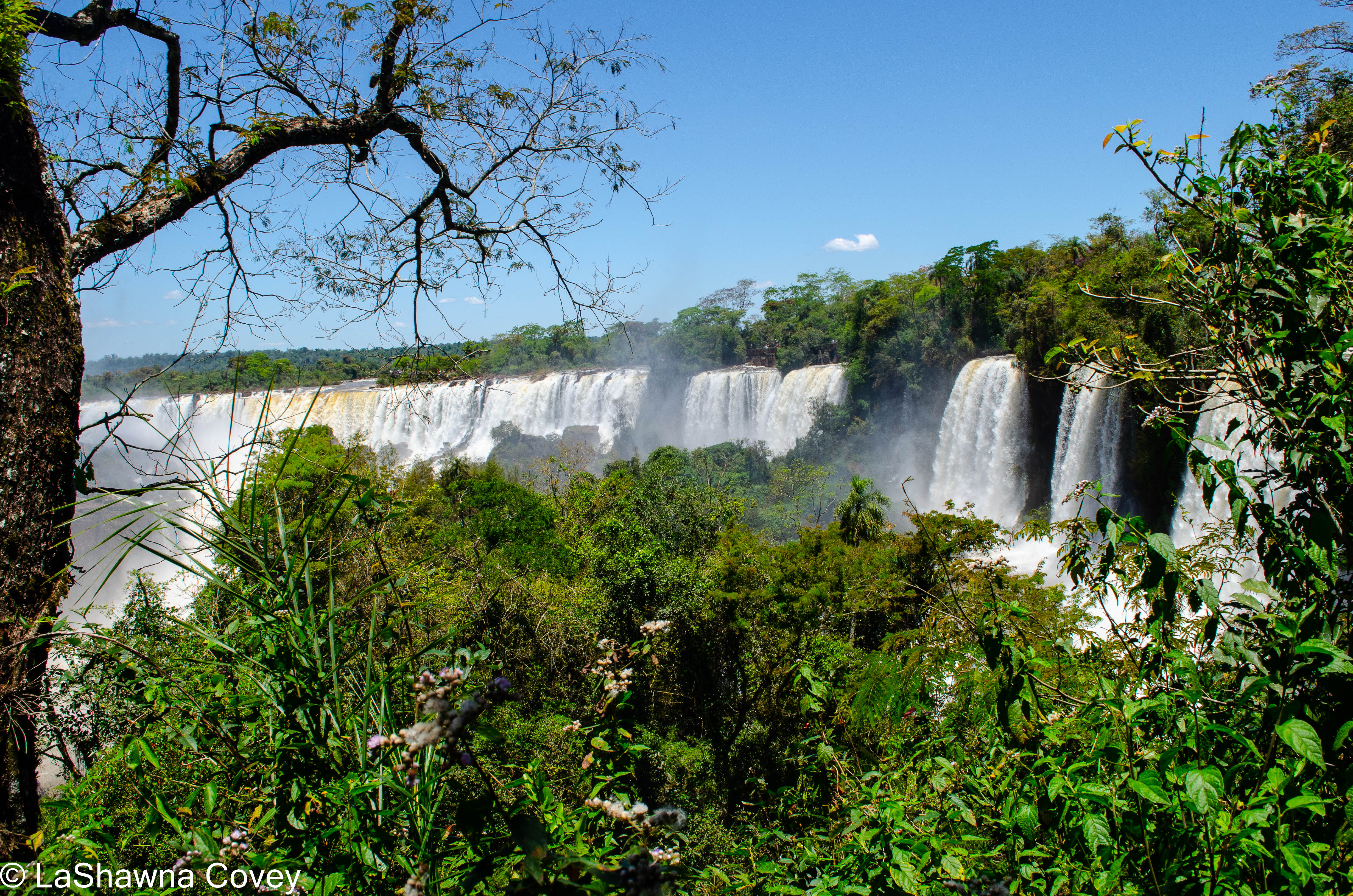
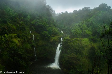
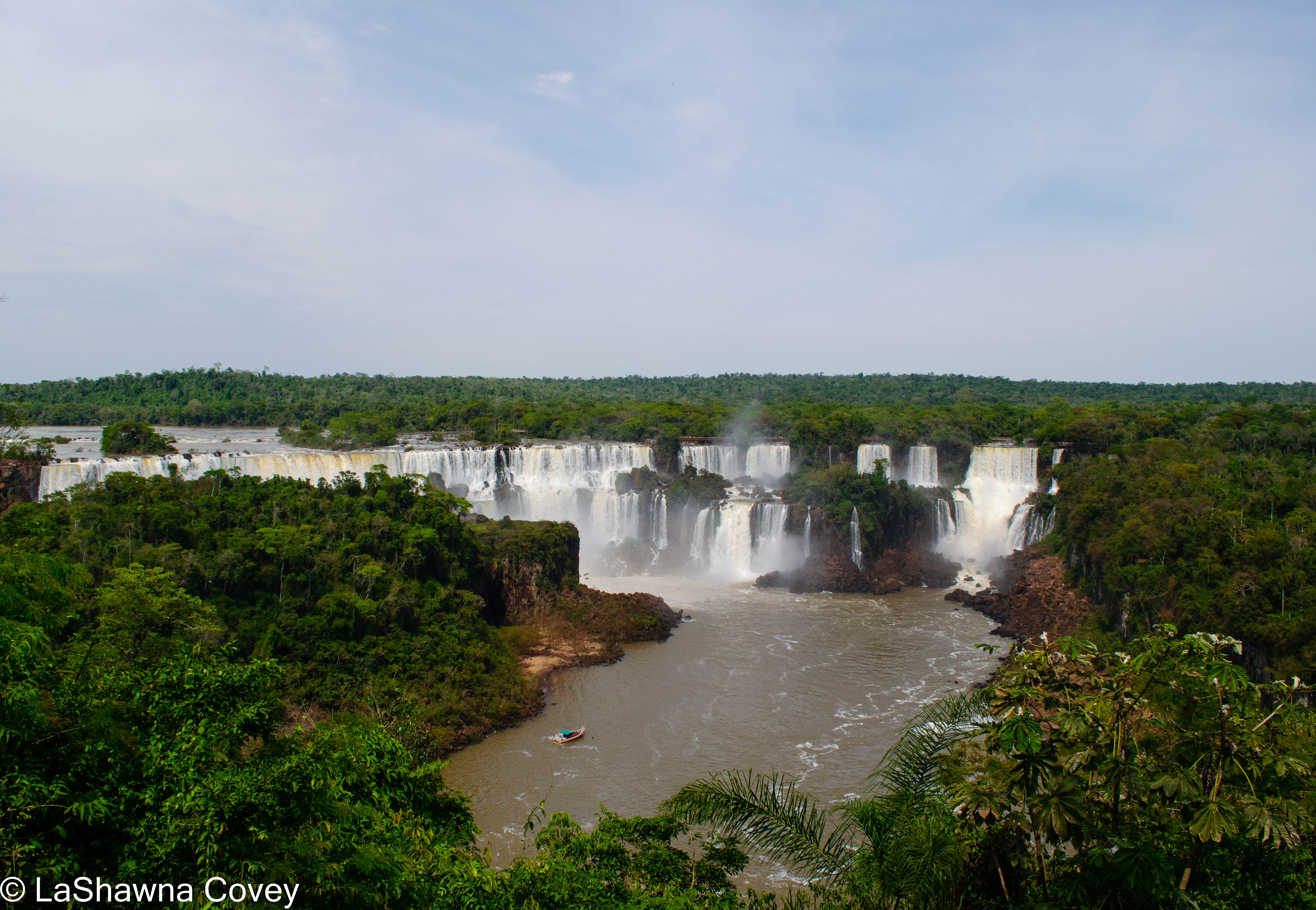
Visiting the Brazil side of Iguazu National Park is a rather different experience than visiting the Brazil side. In Argentina, the trails take you much more up close and personal with the falls, and much of the trail is just over the falls, so you can see them close up. Brazil is the place to see the falls from a distance and take in the wide panoramic view of the falls. It is a good companion piece to Argentina. From Argentina you see the falls and the rushing river from a more personal vantage point, but Brazil gives you the full breadth of the expanse of the falls, which are almost three kilometers wide. The visits are complementary, and I would recommend visiting both (on different days, otherwise you feel rushed trying to fit in both parks with a border crossing before the park closes at 1800). Of course if forced to choose only  one, I would recommend Argentina, just because of the closer view of the falls. I was very pleased I had the opportunity to visit Iguazu, and take advantage of the change in my itinerary to do so. Even with the heat (I pretty much hate heat and humidity), the trip was a delight. Though keep in mind if you visit Argentina, the Iguazu area has a much more tropical rain forest climate, so pack accordingly, if you are going to other, rather different climates in Argentina, like Patagonia or Tierra del Fuego.

The Verdant and Steamy Iguazu Falls- Argentina side

My first day in Iguazu was an early one. I had an early morning flight from Buenos Aires to the town of Puerto Iguazu. It was the base for my three day excursion to see Iguazu Falls. I first learned about Iguazu Falls when I watched season 2 of The Amazing Race, and I was entranced and wanted to visit them. I absolutely adore waterfalls, and seek them out whenever I can. It was doing my research about Argentina, when I realized that the bulk of Iguazu Falls are actually in Argentina (The Amazing Race featured the falls from the Brazil side, so that is where I figured you had to access them).

The first thing I felt when I got off the plane was the strong heat and humidity, even at 0900 in the morning. It was a definite shock to the system. I had come from Ushuaia, and previously the Pacific Northwest, where the highs were in the 50s at best, and the fierce wind could make it feel even colder, to Puerto Iguazu, where the highs were in the 90s and the humidity was cooking. I had to scramble for appropriate clothes, because I had packed plenty of long sleeved shirts and warm pants to layer against the cold and wind, but only about two T shirts. But I made it work, even if the sweat was pouring off me at times.

Since I got to Puerto Iguazu early in the day, and I didn’t have any excursions planned that day, I decided to spend the afternoon visiting Iguazu National Park on my own. My taxi driver was more than willing to come back to the hotel to drive me to the park, and pick me up at the agreed upon time (for the right price of course). I knew I had an excursion in the park the next day, but I didn’t know if it consisted of a park tour. In any case, I like to do things at my own pace when possible and not under the direction of a guide (at least for things that don’t absolutely require a guide).

Now the afternoon is the not the BEST time to visit from a weather perspective, because the sun is at its peak heat. But there are also fewer crowds at that time, and the park has plenty of shade to hide from the sun. So I bought my ticket and headed in. There is a train that can take you from the main gate to the center of the park, but there is also a nice, fairly short nature path that takes you to the same destination but allows you to see some of the flora and fauna of the park. My one disappointment when I got to the park, was realizing that the Garganta del Diablo (or Devil’s Throat) was closed. It is a boardwalk that goes out to the center of the waterfall and overlooks the most thunderous part of the falls. I was really looking forward to seeing it, but spring meltoff had raised river levels so high, that it took out part of the boardwalk. So you could only see that part of the waterfall from afar.

But even with that closed, there were still ample things to see and do in the park. Argentina has about 2/3 of Iguazu Falls within its borders, and its boardwalks and trails give you a closer, more intimate view of the falls. The trails are very well marked and easy to use, and in the case of one trail, it is supposed to be one way only to better control visitor flow.

If you have the time, I would recommend you see all the main trails in the park, because they provide different views of the falls. But if you only have time for one trail, make it the Superior Circuit. It is the longest trail, because it has the most views of the falls. There are many viewpoints along the trail that give you a variety of awe inspiring views of the waterfalls. The trail itself is a well maintained boardwalk so you are on the side of the falls, and is flat and easily traversable.

The hardest thing about the trail was tearing myself from the viewpoints. It felt like every viewpoint was better than the last, and I was constantly taking pictures and taking the time to take it all in. This is when I was glad to have done this park on my own. I didn’t have to worry about keeping up with the group or afraid of pissing off the tour guide, because I was too slow. I had allowed myself nearly five hours of excursion time before my agreed upon pickup time with my taxi driver, so I had no need to hurry. Iguazu Falls were the best waterfalls I had ever seen, and I wanted to really take it all in.

It is hard to pick a favorite viewpoint, because they are all different, but spectacular. The crowds weren’t overwhelming, which is probably partly because it was the afternoon and many of the tour groups had left, but also because it was November, and the peak tourist season hadn’t hit yet. I heard the crowds get ridiculous in December and January, and I try to avoid peak travel time for most of my vacations.

I was definitely feeling the heat, but the nice cool water bottles helped a lot. The Superior Circuit has a clockwise travel pattern, so you see all the waterfall viewpoints first, and then the trail turns inland through the lush, verdant forest before bringing out near to where you started. I still had time on my hands, so I decided to do the Inferior Circuit, which is a shorter trail, and different viewpoints of waterfalls.

This circuit doesn’t have an established traffic pattern, maybe because the entire trail wasn’t open. The trail was open in two different directions taking you to different waterfall viewpoints, but the interior of the loop trail was closed down due to trail erosion. The first waterfall viewpoints I stopped at was Dos Hermanas Falls and Chico Falls. These views were from the bottom of the waterfall looking up, and were a counterpoint to the overhead falls views from the Superior Circuit trail.

Then I backtracked and followed the trail down past a couple other small waterfalls to an expansive lookout of San Martin Island in front of you in the Iguazu River. The view is wide and nice, though it feels a bit bifurcated by the terrain, since the island view divides the waterfall in half.

By this point, I was tired and sweaty and getting close to my pick up time. Instead of taking the train back to main gate, I decided to take the nature trail back, and it was a pleasant way to end my day. The park was getting ready to close in about an hour, so there were substantially fewer tourists, and it felt so much quieter than the din earlier in the day. I am very glad I took the opportunity to see the park at my own pace, because it is truly worth a full day of your time.

Maligne Canyon Hike- A Verdant Canyon of Waterfalls

Maligne Canyon hike-9

One of the frustrating things when on a hiking vacation is being subject to the vagaries of the weather. Sure I can game it as best as possible by scheduling a vacation during the best weather window, but that also tends to correspond with the window of high tourist season (for obvious reasons). When going off season or even in shoulder seasons, the weather is much more variable. So all I can do is hope that the weather will be good ENOUGH on the day I plan my activities.

Maligne Canyon hike-16

For a good chunk of my Banff vacation, the weather was on the cloudy and occasionally rainy side. For the most part, that didn’t really throw off my vacation plans, since I just rolled with it, and was glad the weather wasn’t worse. But as much as I love rain in my normal life, I do like my vacations to be rain free as much as possible. 

Maligne Canyon hike-13

The weather the day of my Maligne Canyon hike was decent enough. It was on the chillier side and cloudy, but the rain wasn’t really a factor. When planning this hike, it was a matter of where I wanted to start, since there are many possibilities, depending on how far I wanted to hike, and what I wanted to see. 

Maligne Canyon hike-3

I decided to start at the Sixth Bridge, which was the farthest trailhead out, and then hike up the canyon to the First Bridge. That would make my trail start flat and level along the Maligne River, and then gradually ascend through the canyon, passing the different bridges, and a series of waterfalls. It also meant that when I was hiking downhill on the return hike, which is always preferable for me than hiking uphill. 

Maligne Canyon hike-2

Like usual, even though I started my hike early, I wasn’t the only car in the parking lot, though there were less than a handful at that hour. I crossed the Sixth Bridge immediately and started the hike. It’s a pleasant, flat hike along the river, with the trail sometimes paralleling the rushing river, and sometimes veering more into the forest. But always the path would lead along the river. 

Maligne Canyon hike-1

Parts of the trail were soaked in water from the underground springs bubbling into the river, but there were always blocks, logs or stones to carefully make my way and keep my feet dry. The trail is signed when it needed to be, though I made a bit of a mistake once I hit the sign for the Fifth Bridge, which is another trailhead. I assumed that we would have to hike over every bridge on the trail, but quickly realized that it was just another trailhead and turned around. I should have not followed the sign for the Fifth Bridge, which lead to the trailhead, but rather the signs to the Third Bridge. 

Maligne Canyon hike-4

Maligne Canyon hike-10

The trail starts climbing immediately after the sign, and follows the top of the canyon. The ascent widened my view and gave a good photo op of the Fifth Bridge. The initial part of the hike from the Fifth Bridge has a pretty, but not astounding view, as it is a high view of the canyon and the river. For some reason, the trail is not flat and level at this point, but rather heavily slanted by the rock, which made it a bit of a challenge to walk. Soon enough the trail drops down much closer to the river, and there are even some side trails that go right to the river’s edge, though I needed to be cautious, because the rocks can be slippery, and the river is full of churning rapids. Maligne Canyon hike-5

Maligne Canyon hike-11

The stretch of trail from this point to the Third Bridge is probably the most scenic of the trail. The trail follows the contours of the canyon, so sometimes it rises a bit above, but then drops down to be closer to the river. I loved the close views of the river and the verdant green, narrow canyon. The rapids are scenic, and the waterfalls plentiful, though you are much more likely to get wet from the water spray. 

Maligne Canyon hike-6

Maligne Canyon hike-12

Unlike the Fifth and Sixth Bridge, the Fourth Bridge doesn’t lead to a trailhead, but rather just a bridge over the river that provides nice views, but ultimately doesn’t go anywhere. The Third Bridge brought me from one side of the canyon to the other, as the trail continued up to the main parking lot. The waterfall at the Third Bridge is the most towering and beautiful, though any photos taken are better from a nearby viewpoint than from the bridge itself, because the view from the bridge is a bit blocked by the canyon walls.

Maligne Canyon hike-7Maligne Canyon hike-8

If you are feeling rather tired at this point, turning around at the Third Bridge would be perfectly fine, though you can proceed upward. I am often a completest when it comes to my hikes, so I forged on ahead. The trail ascends sharp and steep from the Third Bridge to the Second Bridge. My body was definitely feeling the elevation gain and needed to make use of the benches by the Second Bridge. At this point, I was at the top of the canyon, but because the elevation gain is so great, I was looking WAY down into the canyon and not more intimately closer to the river. At that vantage point, I could see the river way down below, but only in glimpses, because the canyon rock is much drier and curvier. It’s a pretty view of the mysterious ways water can twist and shape rock, but it’s not as beautiful as the waterfalls and the rushing river, and a bit of a letdown after coming from the crashing waterfall at the Third Bridge. 

Maligne Canyon hike-14

After resting, I descended the trail and returned to the Sixth Bridge trailhead, pausing again to take in the gorgeous views from Third to Fifth Bridges (the best parts of the trail in terms of beautiful nature). The trail is fairly easy overall, though there are some moderate stretches of elevation gain, and the trail can be wet and muddy in parts. But if you love beautiful canyons, river rapids and an abundance of waterfalls, this is a great trail to start your day. 

Maligne Canyon hike-15

Icefields Parkway- One of the Most Beautiful Drives in the World.

Icefields Parkway-36

There are many, many beautiful drives in this world, and one of the best is undoubtedly Icefields Parkway, the colloquial name for Highway 93 that heads north from the Lake Louise area in Banff National Park in Canada, and ends at Jasper National Park. The entire drive is roughly 143 miles, which can take at least three hours but can be much longer, depending on how many places you stop, and how much time you spend in each location. And believe me, there are many, many places to stop along the way. Some of them are just pull outs alongside the road, overlooking a beautiful view. Other places are opportunities to get out and stretch your legs on a short hike. But trust me, you will almost overdose on beautiful nature by the end of this drive (in the best way possible). You will definitely get your fill of mountains, lakes, waterfalls, and in the fall, colorful fall foliage. Roughly half of the drive is still within the confines of Banff National Park, while the other half is within the confines of Jasper National Park. 

Icefields Parkway-17

I had the opportunity to drive the Icefields Parkway twice, once out to Jasper National Park, and upon my return to Banff. It enabled me to maximize my sightseeing. There are many things to like about Icefields Parkway, one of which is that large commercial trucks are banned, which makes for a more peaceful drive. During the high tourist season, the drive is likely to be packed with cars, but during my visit in late September, it was blissfully free of cars. Of course it wasn’t empty by any stretch of the imagination, especially mid day, but there were stretches I didn’t see too many cars, particularly in the morning as I was heading north. It made for a very pleasant day. The drive was my only activity for the day, and I was staying in Jasper National Park, so it wasn’t like I had to rush back to Banff. I could take all the time I needed to see what I wanted. 

Icefields Parkway-18

The weather for the drive out to Jasper National Park was clear and sunny, the perfect day for this drive. It made the lakes that much bluer, the fall foliage that much a brighter yellow, and the mountains just stand out. I started early in the morning, because I wanted to maximize my time, and leave time to do a few short hikes out to waterfalls. Plus starting early meant that much more time encountering few tourists. 

Icefields Parkway-14Icefields Parkway-15

My first stop was at Hector Lake. The sun was up, but the temperature was still cold, so that some steam rose off the lake, producing some very picturesque morning views. 

Icefields Parkway-16

Another short stop was at the roadside pullout opposite the Crowfoot Glacier lookout, so see the glacier nestled among the folds of Crowfoot Mountain. The glacier originally had three toes, but one of them melted away by the 1940s. 

Shortly after, I passed the turnout or Peyto Lake Lookout, which apparently is one of the most popular places to stop along the parkway. However, there was construction in the parking lot, so it was closed. However that didn’t stop many tourists, who just pulled off the road onto the wide shoulder and walked up. I debated stopping, but decided not to, since there were so many other places I intended to stop along the way, and figured that I would consider stopping on my return trip, if the weather was good.

Icefields Parkway-19

My first short hike of the day was down to Mistaya Canyon. The trail head is off the large parking lot. The trail is only .3 miles down from the pullout. The trail was reasonably easy to negotiate, though it was a bit rocky in places. It was a bit steep going down, and I knew I would have to hike it back up on the return. 

At the end of the main trail ends at the bridge over Mistaya River. The river runs rapidly in this area, and the steady pounding of water has eroded the limestone walls over many, many years to form the picturesque, curving walls of the canyon. 

Icefields Parkway-20

My legs were feeling refreshed now, I kept driving down the road. I would often feel compelled to stop along the way, and pull off to admire the beautiful nature. I was especially taken with the frequent scenes of statuesque mountains, topped with snow and ice, and fronted by bright yellow trees, in the full bloom of fall foliage. Luckily, most of the shoulders along the road are wide, so I could easily pull off. Plus the traffic wasn’t overwhelming, so I didn’t feel I was impeding anyone’s travel. 

Icefields Parkway-22

About ⅓ of the way along Icefields Parkway is the only gas station for the entire drive, at Saskatchewan River Crossing. It also has a small restaurant and gift shop, which makes for a nice place to get out and stretch your legs, and get some snacks. The demarcation point between Banff and Jasper National Parks is around the Columbia Icefields Centre, which provides trips to Athabasca Glacier (detailed in an earlier blog post). Since I had already visited the glacier, I just kept driving north into Jasper National Park. 

Icefields Parkway-23Icefields Parkway-25

Among the nice places to stop alongside the road are the numerous waterfalls that are easily viewed from the road. One of them is Bridal Veil Falls, which is a steep, narrow waterfall. It can be reached by a hike, but it can also be viewed from the parking lot (assuming you have good zoom). Another one is Tangle Falls, which is viewable from the road not far north of Athabasca Glacier. To view the falls, the parking lot is just off the road across from the waterfall and I walked across the road to enjoy the splashing waterfall. 

Icefields Parkway-26

As nice as those waterfalls were, they weren’t the highlight of my drive. Those were Sunwapta Falls and Athabasca Falls. Both of these are closer to Jasper, and very popular with tourists. The first one I came to was Sunwapta Falls, which is about a 30 minute drive south of Jasper. This is a very popular stop along the parkway, and next to the Sunwapta Falls Resort.

Icefields Parkway-28

There are viewpoints at the Upper Falls, which is just a short jaunt from the parking lot. The falls are beautiful and rushing. There are viewpoints right at the top of the falls, and at a bridge overlooking the river and falls. If my body was feeling up to it, I would have hiked down to the Lower Falls, which are supposed to provide more solitude among the waterfalls, but I was feeling a bit tired, and my feet were a bit sore for the walk back up the trail.

Icefields Parkway-29

My final stop of the drive was at Athabasca Falls. If you love waterfalls like I do, it can be hard to get enough of them, and all the falls look different, so it doesn’t start to feel repetitive. Athabasca Falls are hugely popular, with a very large parking lot for cars and tourist buses, and the short trail to the falls is filled with tourists, particularly later in the afternoon when I visited. 

Icefields Parkway-32

The trail to the falls is easy and flat to reach. I knew I was getting close to the falls, because I could feel the spray from the falls. There were numerous viewpoints to take great photos of the falls, some of them on the bridge overlooking the falls, and some of them closer to the top of the falls, which produced some beautiful rainbow views.

Icefields Parkway-33

After looking at the top of the falls, I took the trail that descended along the top to the canyon. It provided some nice views of the Athabasca River flowing through the curvy limestone canyon, where it widens out into a wide, blue river. 

After that, my day’s journey was set to come to an end as I approached Jasper. While I didn’t stop at every possible pullout and viewpoint along the way, I saw plenty to fill my appetite for beautiful nature. I was glad I took all the time I did on the drive out, because when I returned just a few days later, the clouds had rolled in, the snow was drifting down at some of the landmarks at a higher elevation, and the naked mountaintops were now dipped in pure white snow. If you have the opportunity to drive Icefields Parkway, definitely take advantage of it. While the road is officially open year round, it can often be closed due to excessive snow between November and March. The road will be clear during summer time, but it can be filled to the brim with tourist cars and buses. But in the shoulder season of September, especially late September, it is a great opportunity to see all the sights the parkway has to offer, with incipient fall foliage, and fewer tourists. Just gas up beforehand, and go. The open road awaits you. 

The Wonderful Waterfalls of Iceland

Iceland Waterfalls-3

As I’ve written in many other blog posts, there is so much beautiful nature in Iceland. It’s like an embarrassment of riches if you love nature, and the sheer diversity packed on that small island, means you get major bang for your buck during a visit to Iceland.

I’ve talked about other major waterfalls previously, such as Dynjandi and Dettifoss, but there are so, so many other waterfalls. Many of them are super famous for visitors in the first place, and many of them are easily accessible, just off a major road (so they are catnip for tour groups). Of course there are some other beautiful waterfalls I wanted to see, but either didn’t have the time to hike to them, or the type of car I needed to get to them. But there are enough diversity of waterfalls and ease of access, that you can satiate any thirst for waterfalls. I know I got my fill while I was there, and I can never visit too many waterfalls.

Iceland Waterfalls-2

On our very first day in Iceland, literally just a few hours off an overnight flight to Iceland, we were standing at the edge of probably one of the most famous waterfalls in Iceland, which is Gulfoss. It’s not necessarily the best waterfall in Iceland (though I don’t know how you would determine which waterfall is “best”), and it’s not the biggest, but it is the most famous. Gulfoss is one stop on the super popular “Golden Circle” day tour of different sites around West Iceland (the other stops being Geysir, Pingvellir and usually a geothermal power plant). I daresay that the vast, vast majority of tourists to Iceland will see Gulfoss, either on an organized tour bus group or on an independent tour.

Most visitors probably don’t venture very far outside of the Reykjavik daytripper radius, so it is easy for tourists to take bus tours to see sites outside of Reykjavik, but not that far outside of Reykjavik. On my first trip to Iceland, I did the Golden Circle day trip, because it was just easier, and I hadn’t decided to rent a car to travel around Iceland at that point.

Iceland Waterfalls-5

But planning this tour, I knew we would rent a car for a couple weeks, and would avoid Reykjavik altogether, simply to maximize time in the outer sites. But even though both my mother and I had been to Gulfoss, I wanted to see it again. Since both of our visits to Iceland were in the winter, we wanted to see the waterfall in warmer weather. A winter visit was really nice, because the surrounding area was covered in snow and ice, but the ice also meant that the trail to get closer to the waterfall was closed, but this time, we would be able to get up close and personal with the waterfall.

If you want to do your own self drive Golden Circle, it is super easy to do, since all the sites are located within a reasonable drive of each other, and all sites are well marked. That is one of the many nice things about driving in Iceland. Once you get outside of the Reykjavik metro area, there are usually only a few roads, and everything is well marked, so it is so easy to drive and not get lost.

Iceland Waterfalls-4

Since Gulfoss is super popular, you are guaranteed plenty of crowds when you visit (unless you visit really early or really late in the day). The waterfall is an odd and interesting setup, which only adds to the beauty of the site before you. You can view the waterfall from an overlook to get a wide expanse view of the falls and the canyon. The falls aren’t just one single falls, but rather multiple level falls. You can also hike down some stairs and a path down to stand right on the edge of some of the falls. The amount of water pouring through the canyon throws up a lot of mist that can obscure the canyon view, only to be exposed when the wind picks up.

Iceland Waterfalls-8

Another beautiful falls that is easily accessible is Godafoss, which is a nice, horseshoe-shaped falls that is located just off the Ring Road east of Akureyri on the way to Myvatn. This falls can be seen from the road, and there are two viewpoints on either side of the falls. Both sides provides a bit different view of the falls and the river, so it is worth it to stop at both viewpoints if you have the time. You can either drive the short distance between each waterfall side, or walk the easy path and bridge over the river.

Iceland Waterfalls-6

Both viewpoints require a tiny bit of scrambling over rocks, but it’s not that difficult if you are careful. Like all of the waterfalls in Iceland, there aren’t any guardrails. So it is incumbent upon visitors to be careful and not do stupid stuff that might result in them falling off high cliffs.

Iceland Waterfalls-7

The view of Godafoss from up close and personal and from farther down the river are really nice, and provide many picture worthy settings. Godafoss is also worth your time. You are liable to see some tour buses at this site, but since you see far fewer tour buses outside of Reykjavik, it doesn’t overwhelm visitors trying to push their way through crowds for a good view.

Iceland Waterfalls-9

The next set of waterfalls I want to talk about don’t have any individual names (that I know of), but if you have time, they are absolutely worth your time. And I don’t think this site is really popular, so you have to know about it in advance (though it is known enough, that you won’t be on your own when you visit).

If you happen to be in South Iceland (and chances are, you will spend some time in South Iceland, either on your own or as a tour group), I would recommend making the time to visit Fjardargljufur, which is a picturesque, twisty, somewhat narrow canyon that houses some nice waterfalls.

Iceland Waterfalls-19

Reaching the car park for the canyon is rather easy. It is on Route 206, off the Ring Road, east of the town of Kirkjubaejarklaustur. Like all routes in Iceland, it is well marked  with a sign. The road to the car park is about 3.5 kilometers down a rutted, bumpy road. But by this point in our Iceland vacation, I was wearily used to bumpy gravel roads, so I just slowed down and knew I would get there.

IMG_1035

On the road, we finally got to see one of the things we had been hoping to see up close in Iceland, and that was a black sheep. Even though most of the sheep in Iceland are white, there are occasional sights of black sheep and mixed black and white sheep, but most of them were always off in the distance. The few times we had tried to approach a group with black sheep, they always ran away, because they seem so shy. But finally, we saw a white and black sheep just hanging out together just off by the side of the road. Here was our chance to photograph a black sheep. I was hoping to get a good photo, but by the time I got out of the car and got my camera out, they were running away like little sheep teases. However, my mother just had to roll down the car window and was able to snap a nice picture of the cute little sheep couple.

Iceland Waterfalls-15

We knew we were at the car park, because we saw the long line of cars down the side of the road. Amazingly since this is not a hugely popular site, there is a nice bathroom right at the trailhead. The canyon is only about two kilometers out, the walk is very nice. The path is very well maintained, though there are some hills  since it follows the topography of the surrounding canyon.

Iceland Waterfalls-16

The trail is along the top of the canyon, and there are numerous viewpoints along the way that provide beautiful looks down into the canyon. The canyon walls were covered in moss, with a nice river flowing through it. My favorite views were the couple waterfalls, that were nice shapes and provided a different view of the canyon.

Iceland Waterfalls-17

Again, I highly recommend a stop at Fjardargljufur if you have the time. The walk is short and pretty easy, and a good excuse to get out of the car and stretch your legs. The canyon is a bit different than other places we visited in Iceland, and is almost like a glimpse into Middle Earth.

Iceland Waterfalls-18

The last two waterfalls I will mention are two rather popular waterfalls, and extremely accessible, as in they are both viewable from the Ring Road. And since both of these waterfalls are found  in Southwest Iceland, well within the Reykjavik tourist radius, you can count on seeing hordes of tour buses and rental cars. Which is fine. Just know before you go.

Iceland Waterfalls-10

Both of these waterfalls are a short drive between each other, so you can easily see them in one day. And to make it even nicer, both of these waterfalls look different and provide different views, so stopping at both waterfalls provides different viewing pleasures and don’t feel redundant.

Seljalandsfoss is a long, thin waterfall located not far from Porsmork, so it is often a quick stop for Porsmork day tours. In fact, that is where we picked up our tour group, since we were coming from South Iceland. This waterfall must be popular enough to justify paid parking. It is only the second place I have seen paid parking (Skaftafell National Park being the other).

Iceland Waterfalls-12

The view of the waterfall from a short distance is nice, but you also have the opportunity of walking around the waterfall and seeing the view from the back. Most people approach the back side of the waterfall from the right side, and from here, the waterfall mist will likely blow into your face if it is windy. Once you get behind the waterfall, the view of the falls is beautiful and the curtain of water adds the scenery. I made the mistake of following the path around the waterfall, instead of turning back from whence I came. The path from the right side is wet, but it is all rock. However, if you follow the trail behind the waterfall to emerge at the left side, you will find that the path is very muddy, slippery. I managed to scramble up the rocks, but I ended up with wet muddy boots and muddy clothes (thankfully you can wash yourself off in the river).

Iceland Waterfalls-11


The last waterfall, Skogafoss is just down the road from Seljalandsfoss. This waterfall is a different look, because it is a wider, more traditional looking waterfall. There is a big parking lot and an easy path to the bottom of the waterfall. You can walk right to the edge of the pool, though expect to be showered in waterfall spray. The day we visited the waterfall, the weather forecast was supposed to be a nice, sunny day (and it ended up being that way in the end), but for the brief time we were at the waterfall, the sky just opened up and dumped down on us.

Iceland Waterfalls-13

The nice thing about the rain is that it cleared out most of the tourists, including my mother who high tailed it back to the car. But since I was there and outfitted in a good rain jacket, I was determined to get some pictures from the top viewpoint. You can get a nice view of the top of the waterfall and the surrounding countryside by ascending the very steep set of staircases. Skogafoss is 62 meters tall, so it is not an insignificant distance, and you really feel it ascending to the top. The stairs are really nice and easy to ascend, but the sheer steepness required me to stop a few times and catch my breath.  But keep at it, and you will get to the top eventually.

Iceland Waterfalls-14

The view was good, even with the cloudy weather, since the rain had stopped by this point and the sky was brightening up. If you wanted, you could continue hiking from the top of Skogafoss to Porsmork, which is about a 23.5 kilometer trail. I elected not to do that, but the option is there if you so desire.

Like I said before, Iceland is an amazing wonderland of all sorts of nature, and if you love waterfalls in general, you will be in ecstasy while visiting this country. I wish I had been able to see a couple more waterfalls, but what I did was more than enough to keep me satisfied for a while.


Waterfalls and Other Natural Wonders in Jokulsargljufur National Park

Vatnajokull National Park-9

Staying around the Myvatn area not only has its own local pleasures (detailed in my previous two geothermal posts), but it also serves as a great base for seeing sights further afield. One of the ones I most anticipated visiting was Vatnajokull National Park. The park itself is rather large, and the result of merging two previously separated parks- Jokulsargljufur and Skaftafell National Parks. Jokulsargljufur is in the north east of the Myvatn area, and Skfaftafell is in the south, both accessed by different parts of Ring Road 1.

The highlight of Jokulsargljufur, and one of the highlights to any Iceland trip (especially if you are a waterfall aficionado like me), is Dettifoss. While Dettifoss is not the tallest waterfall in Iceland (that would be Glymur, which is located off the head of Hvalfjordur in the west, north of Reykjavik), it is considered to be the most powerful in terms of water volume. It has been featured in numerous movies, and I just really wanted to see it. I had hoped to see it on my first trip to Iceland, but the snow reared its ugly head again. Sure, the main road to Dettifoss is paved, but it is 24km from the Ring Road to the parking lot, and that is a lot of road to plow in the winter, with fewer visitors to justify it. Though again, that was in 2011, and with the increasing number of winter tourism, hopefully the government is keeping the roads to the more popular attractions plowed.

Vatnajokull National Park-1

My mother and I got started early on our day trip to Jokulsargljufur for a couple reasons. First, we wanted to beat the crowds to Dettifoss and see the waterfall without a lot of people around. Second, Dettifoss was not our only stop in the park. There is lots more to see and do in the area, and I wanted to drive up the park road to the northern edge around Asbyrgi in the north and do a lot of short, but scenic walks along the way.

Like I said, Dettifoss is easily reached from Ring Road 1, and it is about a 20 minute drive east of Myvatn. There are actually two roads you can access the falls, one on the west side of the falls and one on the east side of the falls. The western access point is the more popular site and is called Route 862. This route is paved all the way to the Dettifoss parking lot. I’ll talk about the eastern access in a bit, because that is a story in and of itself.

Vatnajokull National Park-2

We did get there early, and there were only a handful of cars already there, which gave us great relief. Based on the sheer size of the parking lot, along with the numerous tour bus parking spots, it is obvious how popular it is. I can only imagine the hordes of crowds in the tourist peak summer.

From the parking lot, it is about an 800 meter walk to the falls viewing site, but you can see the spray rising in the distance. The walk to the falls is easy and flat and well marked. We went straight to the falls first to get our first view of Dettifoss and it did not disappoint. The western side has more dedicated viewing platforms, but it also has more fencing to protect visitors. Even so, you are still pretty close to the falls. The sheer volume of water spilling over the falls is astounding to behold, and the sound is thunderous. We could just stand there and take it all in. The water is a milky white, because it is being fed by a glacier upstream.

Vatnajokull National Park-3

Dettifoss may be the biggest and most famous waterfall in Jokulsargljufur, but there are others. One of them is called Selfoss, and is located about 1 kilometer north of Dettifoss. Again, the path is well marked, flat and easy to follow. After we had our fill of Dettifoss, we headed out to that falls. Selfoss is a much smaller, though still pretty, horseshoe shaped falls. Unlike Dettifoss, the best view of the falls (at least on the western side) is from a distance a few hundred meters away. Even though you can get close to the falls  near the head, just the configuration of the land and the large width of the pool feeding the falls prevents any better view of the falls close in.

Vatnajokull National Park-6

Vatnajokull National Park-7

By the time we got back to our car, the tourists were starting to come more en mass, so we smirked at how we beat most of the crowds. Our intention was to continue driving north on Route 862, with our next planned stop around Vesturdalur, which is a nice camp site halfway through the park that was supposed to have some beautiful rock formations. However, that was not to be. Most of Route 862 north of Dettifoss to Asbyrgi is gravel, but the government is making steady progress paving the whole way. So much progress, that they were paving the road at the time of our visit, and had blocked it off to the rest of traffic. So we were forced to turn around.

At that point, it became a debate about how best to see the rest of the park. My first instinct was to drive ALL the way around to the north, but that would have taken at least an hour (probably more), even though the roads itself would be paved. OR we could take the alternate route to Asbyrgi, which is the eastern route called Route 864. I had been hesitant to take it, because our guide book emphasized how rocky and rutted the gravel road was. But considering it said the same thing about the roads in the Westfjords and I felt it overstated the road conditions, we figured we would at least see how bad the road was, because using the eastern route could save on a lot of useless time driving.

Vatnajokull National Park-4

So even though I had not intended to use the eastern route, now I found myself navigating the road. However, I figured there was an upside to taking the eastern route, and that was visiting the eastern side of Dettifoss. More on that in a bit, because we first had to get there, and at some point in the 24 kilometer drive to the Dettifoss parking lot, I almost gave up and turned around. While I have not driven every road in Iceland, I can say with confidence that Route 864 from the Ring Road north to the eastern Dettifoss parking lot, is the worst road I drove in Iceland. I could barely get above 10 kph, because the ruts and potholes were so frequent. Now granted, this would not be a problem for all vehicles. We got passed by numerous larger, SUVs who barrelled by us with their bigger tires, 4WD, and higher clearance, while we putted along in our tiny, low clearance car that shook with every rut and pothole we encountered. So as tempted as I was to just chuck it all in at certain points, I kept going. Part of it was out of sheer stubbornness, since we had started this adventure. Part of it was now out of a desire to see the eastern side of Dettifoss and Asybyrgi. And part of it was because I did not want to drive back on that road if I didn’t have to.

We both breathed a sigh of relief when we finally arrived at the parking lot. By this point, it was midday, so the parking lot was full of cars, but not near as many cars as on the western side. Since Route 864 is so bad, it discourages many tourists, and honestly, it is for the better.

Vatnajokull National Park-5

The path from the parking lot to Dettifoss is about the same distance as on the western side, but it is mainly downhill (so it will be uphill on the return to your car). The path is not as well maintained, and when you get closer to the falls, it is basically just walking over large rocks. The views from the eastern side are different, and provide a more expansive view of the surrounding canyon.

But the BEST part of visiting the eastern side of Dettifoss, the main reason I would recommend it if you have the time and patience to drive the horrible road, and the main reason why I think the government allows the road to stay horrible, is because you can literally stand on the edge of the waterfall. I mean, there is NOTHING between you and the falls. No fence, nothing. You could easily just stick your hand in the water and feel its power. Of course, you could also do something reckless and stupid that could ensure you fall to your death, but I would like to think anyone who would drive to the eastern side of the falls, has enough common sense and protective instincts to respect Dettifoss and not do anything stupid.

Vatnajokull National Park-10

The view is so amazing, just because you are so close to the falls and can REALLY feel its thundering power, that I didn’t want to leave. But leave we must, so after getting back to our car, we had a decision to make. Do we take the devil we know- the potholed road from hell back to the Ring Road- or the devil we didn’t- the rest of Route 864 north. We decided we would at least try  the road north, figuring we could turn around at any point if it became too hellish.

Vatnajokull National Park-11

And wouldn’t you know it, but the road north of Dettifoss is MUCH better . I mean, light years better. Sure there are still some potholes, but overall, it is better maintained and graded. We could even pick up some speed as we headed north. There is no access to Vesturdalur from the eastern side, but there are other views to be had.

Vatnajokull National Park-8

We saw our third waterfall of the day called Hafragilsfoss. It is located a short ways downstream from Dettifoss, and can actually be reached by a trail from the Dettifoss parking lot. But if you don’t want to walk to it, there is a marked car park that overlooks the falls. You aren’t particularly close to the falls from the car park viewpoint, but it is a very pretty, expansive view of the falls and the canyon.

Vatnajokull National Park-12

After Hafragilsfoss, we pretty much sped up Route 864 until we hit the main road of Route 85. Even though driving up the eastern road to Dettifoss took a lot out of me mentally (yeah, I know), we still wanted to see Asbyrgi.

Vatnajokull National Park-13Vatnajokull National Park-14

Asbyrgi is the northern edge of Jokulsargljufur, and it is an enclosed canyon that is filled to the brim with verdant foliage. You can easily drive in the canyon on a paved road from the visitor’s center. We took the road all the way to the end (only 3.5 kilometers) to the car park. From the car park, there are a variety of short hikes. We elected to take the trail to Botnstjorn, which ends at a scenic duck pond at the head of the Asbyrgi canyon.

Vatnajokull National Park-16Vatnajokull National Park-17Vatnajokull National Park-15

It was nice to see that a lot of foliage was turning colors for fall, and the whole surroundings were just peaceful. At this point, we had our fill of the canyon for the day and headed back to the main road, with only a short stop to photograph Eyjan, which is this odd and large rock outcropping in the middle of the canyon.

Vatnajokull National Park-19

I highly recommend a full day trip to Jokulsargljufur. Sure you could just see Dettifoss (from the western side) and be done with it, but there are plenty more natural treasures within the park. There are many short walks, none of which are exceptionally difficult, though this park also plays host to a beautiful two day walk all the way up the canyon from Dettifoss to Asbyrgi. But even a car trip is worth it. Hopefully Route 862 will be completely paved soon enough, though even the gravel road is probably fairly well graded. But you shouldn’t regret taking the time to see as much of the park as you can.

Vatnajokull National Park-18

Driving in Iceland- Westfjords Day 2

Westfjords Day 2-20

Day two of our Westfjords side trip started early, because we wanted to take advantage of the nice, sunny weather. Iceland weather can be very turbulent and unpredictable, and rain and clouds are common year round. Our first day was really nice, and the early morning was looking like this would be another great day for nature gawking.

Westfjords Day 2-5

Our first stop of the day was actually revisiting a stop from the previous day, Raudasandur. I was deeply frustrated with what happened the first day, and I figured we missed something critical somehow (though again, this was not specifically addressed in our guide books), and I really wanted to see this beach. So I went searching online for any sort of information that could clear up where we went wrong, and I finally found it in some blog posts.

Westfjords Day 2-1

Westfjords Day 2-3

Apparently what visitors are supposed to do to access the beach is park at the parking spots by the church (which we had passed on more than once the previous day), and then walk about 1.5 km down a nature path to access the beach. It was all so simple, but not immediately intuitive if you didn’t already know, that I wonder why guide books didn’t add more specific information.

Westfjords Day 2-2

In any case, it was early morning, so there was only one other car down by the church, and we started the easy, pleasant walk to the beach to get in our morning walk. The trail is through some beach grass and has a good view of the beach off in the distance, and the surrounding hills. We eventually reached where the beach is, though we weren’t really able to walk on the sand, because the tide was in. This is a beach that is really only walkable at low tide, because there are tidal inlets that prevent access to walking on the sand (unless you want to wade through ice cold water of unknown depth). So while we weren’t able to go out on the beach itself, we could see that the tide was going out, and the reddish sand was visible to us, and we could see how nice this beach would be to walk.

Westfjords Day 2-4

By the time we left Raudasandur, there were more tourists walking about, so we picked the right time to visit. We made our way back up the steep, windy gravel road to head off on our new itinerary. Our first stop was at the small town of Bildudalur. I had been hoping to visit the Icelandic Sea Monster Museum, because it just sounded like a fun place to visit. Alas, the museum  is only open during the summer season, and the last day was literally the prior day. So no sea monsters for us, but we had plenty more beautiful nature to see.

Westfjords Day 2-7

Shortly after this town, the road turned from paved to gravel and would remain so, for most of the rest of the day (until we hit the town of Pingeyri). Our second day was our longest stretch of gravel road in the Westfjords, and for the MOST part, the road was reasonably good. Sure, it is gravel, but most of the road was grated to an extent, though there were places that were annoyingly rutted and potholed. Again, there seems to be no rhyme or reason to why the road is the way it is. I would drive for long stretches on well-graded gravel and then a series of potholes would emerge, sometimes on only one side of the road. It’s can be frustrating, but it’s just the price of admission for visiting the Westfjords.

Westfjords Day 2-8

Westfjords Day 2-10

The road in this part of the Westfjords generally snake along the topography of the fjords, with some occasional steep climbs to go over fjords and cut off driving time. My prior reading into self driving in the Westfjords talked about how the roads are often gravel, but also talked about the steep mountain roads you would have to climb. And that is true, FOR Iceland. The hills in the Westfjords are higher than many parts of the country (outside of the central Highlands), BUT “steep” is really grading on a curve. If you have any experience driving in any steep mountain ranges (e.g. the Rockies or Cascades), the roads aren’t THAT steep. We’re only talking a few thousand feet elevation. It was only annoying for me, because of that small car I chose didn’t have a lot of acceleration power, so I had to slowly make my way up the hills in low gear. But we got there nonetheless.

Westfjords Day 2-13

Westfjords Day 2-12

The highlight of our visit was an extended stop at the waterfall called Dynjandi. It is the tallest waterfall in the Westfjords, and one of the most famous waterfalls in the country. Of course this waterfall isn’t visited as widely as others, such as Gulfoss, because this waterfall is found deep in the Westfjords where the roads surrounding it for kilometers on end are gravel. This is NOT a waterfall you can visit on a day trip from Reykjavik, and in fact, in our three days in the Westfjords, we only saw one tour bus, because it is not as popular of a place to visit, and we were heading into the off season.

Westfjords Day 2-18

Westfjords Day 2-16

Dynjandi is also a waterfall that isn’t really accessible six-eight months of the year, because the road isn’t plowed in the winter, and snow tends to accumulate. But if you are in the area during the visiting season, I would consider this waterfall a “must do”, especially if you like waterfalls. It isn’t an exceptionally tall waterfall (only about 99 meters), but it has a pretty and unusual triangular shape, and is actually a series of several smaller waterfalls.

Westfjords Day 2-17

Since this is the highlight in this part of the Westfjords, it’s no surprise that this is where we saw the most people. You can get a good view of the waterfall(s) directly from the parking lot, but you can also walk up a trail to get closer views. If you are so inclined, you can even do the short, but somewhat steep hike to the base of the main falls and stand directly in the spray of the waterfall. I was feeling the hike a little bit, but it felt good to get out and exercise after driving for several hours by this point.

Westfjords Day 2-19

After this stop, we were basically through with touring for the day, and made our way to our hostel for the evening. This hostel, Korpuldaur HI Hostel, was on a farm tucked into a fjord. It was only a 20 minute drive from the “big city” of Isafjordur, but it was quiet and peaceful  in a beautiful setting. We hit the gravel road a short drive from our hostel, and I wanted to get out and kiss the ground. Sweet, sweet pavement was a welcome sight to behold after bumping around on gravel all day.

Westfjords Day 2-11

Since the clouds were clearing up and there was little light pollution, I was hoping to see the Northern Lights. Auroras are visible in Iceland from approximately September- April (and even some other times during the year), so I was hopeful. Our hostel room had a window that directly overlooked the fjord, and I spent a fair amount of time looking out the window in the dark, and then standing outside, hoping to see some auroras. While I didn’t see any bright Northern Lights like you see in the pictures, I did see some fainter versions of the lights, so it fed my fix just a bit.

Westfjords Day 2-9

Overall, this was a really good day of great weather, beautiful nature, and peaceful near isolation, from the few tourists we encountered  during the day. Our Westfjords trip was turning out to be a very pleasant success.


Hawaii Waterfall Fun- Big Island and Kauai

Big Island waterfalls and caves-1

I have always been drawn to running water, such as rivers, streams and the ocean. I just found something so fascinating and peaceful about running water. I could listen to it for hours. But my favorite natural water will forever and always be waterfalls. The best waterfalls never cease to amaze me, and they are one of my favorite places to visit when I hike or go on vacation.

Luckily for me, Hawaii is rife with waterfalls that will astound you with their beauty, and a good chunk of them are easily accessible from the road. We had visited most of the waterfalls on our first visit to Big Island, but of course we wanted to see them again.

Since the Hilo side of the Big Island is much greener and wetter than the Kona side of the island, because of all the rain, it stands to reason that the Hilo side of the island has the best waterfalls. And a few of the best ones are all within short driving distance of each other.

One of the best ones is Akaka Falls. This waterfall is 422 ft and set within a lush, green park. The trailhead to the waterfall is close to the road with pay parking within the parking lot, though if you don’t want to pay, there is plenty of parking on the road as well. Usually, there are a couple ways to access the viewpoint, because there is a trail that goes down and around and affords multiple views and obstructed views of another waterfall. However, at the time we visited, part of the lower trail was blocked off, due to trail maintenance, so only the most direct trail was available to the viewpoint. It’s less than .5 mile from the trailhead to the viewpoint, and the path is paved and pretty easy to traverse. You can’t miss the wide viewpoint that looks at the waterfall from the distance. The most challenging thing is jockeying for the best view among the throngs of tourists and their cameras.

Big Island waterfalls and caves-2

Another readily accessible waterfall is Rainbow Falls. How powerful this waterfall is, depends on the time of year, since after plenty of rain, the waterfall with naturally have more water than during drier periods. This one is also very popular, so there is a large parking lot and the walk is short to the viewpoint. A farther away view of the falls is right off the parking lot, whereas there is a short hike that takes you to the overlook of the top of the falls. I saw some people walking out on the rocks to the top of the falls, but my fear of slipping and falling off the cliff prevented me from doing the same.

Big Island waterfalls and caves-3

Since we were already in the area, we decided to drive the short way up the road to view Wai’ale Falls. They aren’t heavily advertised, and I wouldn’t consider them a “must do.” However, if you like waterfalls and are in the area, the falls are worth the minutes it takes to drive there on Waianuenue Avenue, past the junction to Hwy 200 (Saddle Road), and then just past the Wailuku River Bridge.

Big Island waterfalls and caves-5

The view of the falls are located right off the road, with parking available just off the road. There is supposed to be  a faint trail to get closer to the falls, and apparently the locals like to swim in the falls pool.

Big Island waterfalls and caves-4

Even though it isn’t a waterfall, the last stop of the day before heading back to our hotel was a local lava cave, easily accessible off the road. The lava cave is called Kaumana Caves, with a well marked parking lot located between mile markers 4 and 5 off Hwy 200. If you like lave caves, it is worth your time, and the visit doesn’t take too long.

Big Island waterfalls and caves-8

Even though the parking lot is across the street from the caves, we didn’t see too much traffic on Hwy 200, so it is pretty safe to make your way across. Once across the street, the sign for the cave is well marked, and there is no admission to the caves. Stairs lead down into the cave. There are actually two parts of the cave.

Big Island waterfalls and caves-7

The left side of the cave is more like a small ampitheater and the opening has plenty of green plants.

Big Island waterfalls and caves-6

The right side of the cave affords the opportunity to walk a bit ways into the cave before the way becomes too small. If you do want to make your way into the cave, make sure you have a light source, because there is no light in the cave.

Big Island waterfalls and caves-9

Over on Kauai, a good chunk of the most beautiful waterfalls are easy to visit, though there are plenty of waterfalls that aren’t readily accessible to the viewing public.

Kauai waterfalls-4

Wailua Falls are probably the most beautiful waterfalls on Kauai, and there is a well marked road (Hwy 583) that literally ends at the parking lot for Wailua Falls. There isn’t a ton of parking spots considering how popular the falls are, but there are parking off the road, and turnover is usually pretty quick. However, if you are visiting Kauai during high tourist season, it might be worth your while to go earlier in the morning or later in the afternoon.

Kauai waterfalls-3

We had the opportunity to see a couple other Kauai waterfalls during a half day kayak and waterfall adventure. Mom and I enjoy kayaking, and there are opportunities for both sea and river kayaking on Kauai. We decided against sea kayaking, just because of some of the strong ocean currents in places, and river kayaking sounded very pleasant.

Even though you can do guided or unguided river kayaks on different rivers, we elected for a guided tour, the Kayak Waterfall Adventure offered at Island Adventures tour company, just because in many ways it was easier, and it also afforded an opportunity to view a couple of pretty waterfalls that are located on private property, so they aren’t accessible to the public.

After kayaking a few miles up the Huleia River (a generally easy and peaceful trip among a lush green setting), we were transported to the overlook site and hiked down to the waterfalls. The first waterfall was the 30 foot Bamboo Falls. We only had a side view of the falls, but they were pretty nonetheless.

Kauai waterfalls-1

After hiking a short time past that, we came to our destination, the 60 foot Papakolea Falls. We were able to sit and relax by the falls, swim in the pool, or climb up partway for pictures on a ledge behind the falls. The company also offers another tour that involves rappelling down the falls. I thought about doing the rappel tour, but since I figured my mom wouldn’t be into rappelling down the waterfall (I was right), we went with the gentler trip instead.

Kauai waterfalls-2

The last waterfall I visited on Kauai was Ho’opi’i Falls. These falls were a bit harder to find, and aren’t really considered a “must do”. However, I was looking for an easy hike, and this one fit the bill and was a short drive from our hotel. The falls are located just up the road from the town of Kapa’a. I initially had a hard time finding the trailhead. It is located on Kapahi Road in a residential area. However, the trailhead isn’t really well marked, and my guide book gave some confusing directions. Just when I was about to give up and go back to my hotel, I looked on other hiking sites for better directions, and realized where I went wrong. The trailhead might not be marked, but you can see the yellow gate on the side of the road, that is overgrown with vegetation, and a short way before the road ends. Just past that is the parking area on the side of the road. You aren’t supposed to park on private property, because your car will be towed, but there are enough spaces for several cars off the side of the road.

Kauai waterfalls-6

From the trailhead, it was an easy walk down to the river. Once you hit the river, take the trail to the right and a short ways after that, you will come to a turnoff that will lead you down to the upper Ho’opi’i Falls. These falls are nice and the viewing area affords some nice views and places to sit on the rocks. My guide book talked about lower falls, so I continued to follow the directions from my book, but I never did find the falls. At some point, I came to a fence blocking the trail and marked private property. I tried walking down to the river, but the trail along the river was hard to follow and eventually petered out. I tried walking around the blocked path, but never did find the lower falls. Eventually I turned back, because I was afraid of getting cited if I was caught on private property. Even though I didn’t see the lower falls, the hike was still pleasant enough.

Kauai waterfalls-5

So if you like waterfalls, the whole state of Hawaii affords so many gorgeous views, and Kauai and the Big Island have some of the best waterfalls. Don’t miss them if you are on the island.

Hana Highway Journey to Paradise and Back (Nothing but Waterfalls Edition)

Hana Highway #2-14

When I was researching my trip to Maui, my guide book touted the Hana Highway as one of the “must do’s” on Maui. The 35 mile drive along Highway 360 is considered one of the most iconic drives in the world, since the windy, twisty road is like driving through a  remote tropical paradise, like Jurassic Park (assuming it is not overrun with tourists when you do the drive).

Hana Highway #1-5

A 35 mile one way drive to Hana doesn’t sound like that much, but the trip turns out to be longer than you might think. First off, this road is one of the curviest roads I have ever driven. Supposedly it has 600 turns, though I didn’t really keep count. What I do know is you will probably never go faster than 35 mph for very long, because you are always slowing down for a tight turn, and there are many, many one lane bridges that you have keep a watch out for oncoming traffic.

Hana Highway #2-4

Plus, this is not a road you want to speed. The drive to Hana is very much about the journey and not the destination, because while the drive to Hana (and beyond) is so beautiful, there is not anything exceptional in the village of Hana. There are so many stops of exquisite nature on the road to Hana that it seems like every few minutes, you will be stopping at something to admire and gawk.

Most people do the Hana Highway as a day trip, and it is entirely possible to do it in one day. However, know that unless you start very early and finish late, you will probably not be able to see everything (assuming you want to see as much as possible), so you will have to pick and choose what stops are the most important to you, or at the bare minimum, not allot much time at each stop. Since Mom and I weren’t in any hurry, we decided to make the trip out of Hana into a two day affair and spend the night at Hana. That allowed us to leave a bit later in the morning, thus letting any sort of tourist crush get ahead of us, and then take our time on the way out to see everything we wanted to see, knowing that we would have a full day to see anything we missed on the way back.

Hana Highway #2-5

The day we drove out to Hana was warm, but rather cloudy and rainy. Everything still looked like a lush, green, very wet paradise, but we had to balance it with taking advantage of the breaks in the rain, and in some case, going out to the views myself and taking all the pictures while Mom stayed in the nice, dry car. The nice thing about all the rain though, is that the waterfalls were full, and there were just so many waterfalls to stop and gush at.

We undoubtedly would have missed some critical stops along the highway if it was not for my trip making guide book, Maui Revealed. There are some signs for a few of the sights, but for many of them, you have to know what to look for, because they are easy to drive by and miss. The nice thing about this book is that all the sights are listed in relation to the highway mile markers, so you have a pretty good idea when something is coming up. The ONLY problem we ran into, is that some of the mile markers from 9-16 seemed to be missing, though maybe that problem has been corrected since we visited. That resulted in us having to occasionally guesstimate where to stop, but for the most part, we were able to figure it out.

Hana Highway #2-15

There are so many waterfalls to enjoy that honestly some of the waterfalls start blurring into the next, and it can get a bit difficult to keep track of where you are. If you really want to know which waterfall you are at to remind yourself later, it’s probably best to write down the photo number and the location. Every time you get out of the car, you can barely see any surrounding roads, so it just seems like you are alone in a lush, super green, and while we were there super wet paradise. When we were there, all the foliage around us was thick and green, broken up only by the white of waterfalls, the black of the seaside cliffs and the blue of the sea. And for the most part, we were on our own. I think it was because we were there in the off season, mid week, and it was raining, but we avoided the crush of tourists that are certainly possible during this drive.

Hana Highway #2-17

One of the first waterfall highlights we stopped at was Lower Puohokamoa Falls, just short of the 11 mile marker. There is a tiny pullout on the sea side of the road, and it is easy to miss (look for the telephone pole), so we had to turn around and go back. Right by the pole, there is a muddy trail (assuming it has been raining like it often is) that leads you down the hill. At first, I wondered if the short hike was worth it, but other persons I ran into said to keep going, because it is worth it. You will know when you are in the right place, because the foliage opens up and you see the falls amidst the greenery.

Hana Highway #2-6

What makes the Hana Highway such a fun drive is that a good chunk of the waterfalls are basically just off the roadway, so you can see them very easily from the road, or with just a short walk. The bad thing about all of this goodness, is that there are few very parking spots alongside the road, and the road is often narrow. You can often find a pullout for a car or two near the bridges, but other times, you might have to park a bit away from the waterfall and then walk along the road back to the site. That is when it is nice that most people (or at least most tourists) drive pretty slowly along the highway.

Hana Highway #2-11

One of the easily photographed waterfalls are the Upper Waikani Falls (sometimes called the Three Bears Falls), which are located between the 19 and 20 mile markers. These falls will vary fairly dramatically, depending on the time of year and the flow of water. This particular time, the water was flowing pretty well, so it all looked like one falls.

Hana Highway #2-12

Just short of the 21 mile marker, we drove by the Wailua Iki Falls. The falls viewable directly off the road are pretty, but the true majesty of the falls isn’t viewable until you walk (or drive) up a little further on the road toward Hana. The road twists a bit and rises a bit in altitude, and that vantage point shows the truly wondrous view of the lush valley and full falls above and below the road. That view is the title photo for this blog post.

Hana Highway #2-13

A quick and easy stop for some light and easy waterfall viewing is at Pua’a Ka’a State Park, located between mile markers 22 and 23. Unlike most stops along the Hana Highway, there is plenty of parking and even a bathroom. The waterfalls are small, but still pretty to enjoy for a bit.

Hana Highway #1-1

The Hana Highway doesn’t actually end in Hana. Highway 360 continues, though the mile markers shift and start counting down from mile marker 50 once you get past Hana. On the first day of our trip, we just went as far as Hana, because we were staying overnight. I am glad we made the choice to stay overnight, because it gave us the opportunity to just relax and take it all in. The last major waterfall we stopped at on the Hana Highway was Wailua Falls. We saw it the next morning as we were driving out to Haleakala National Park to see the sights there and do some hiking (which will be in another blog post). Wailua Falls is right off the road, right around mile marker 45 and is the bridge over Wailua Stream. This is a major stop on the highway, so there is a decent sized parking lot. However, since it is a popular stop, many tour vans and buses will stop there, so don’t be surprised if you see a crowd. Luckily they usually don’t stay there long and will disperse.

Hana Highway #2-16

If you love waterfalls, you should just adore the Hana Highway. There are just so many waterfalls in so many different configurations, and none of the waterfalls look the same.


Fiji Viti Levu- Mainland fun

Viti Levu-2

My last four days on Fiji was spent on the “mainland” island of Viti Levu. There were a lot of things I wanted to see and do on Viti Levu, but it is a large island, and it is not as easy to just base yourself in one area to see many different sites.

Viti Levu-1

I decided to stay on the southwestern side of Viti Levu at the Intercontinental Fiji Resort. Or I should say my travel agent recommended it, and since it sounded suitably extravagant, I figured why not? It is a very beautiful resort, though a bit more geared toward families and golfers, rather than single travelers.

Viti Levu-11

Due to a number of circumstances, I ended up not doing much of what I wanted to do while on Viti Levu (which just gives me an excuse to return). For the most part I relaxed by the pool, slept in, and some spa stuff (including an absolutely heavenly, decadent, four hand massage).

Viti Levu-12

And of course, I enjoyed a variety of beautiful sunsets (a theme of this trip). My favorite sunset was the one pictured in the title picture. That was also the night the resort hosted a fire ceremony on the beach, which was a beautiful backdrop to see the fire jugglers while the colorful sun dropped below the horizon.

Viti Levu-3

As per usual, the other sunsets were not AS spectacular, but still colorful and beautiful nonetheless.

Viti Levu-13

My last full day on Viti Levu, I had wanted to do a day long adventure on the Navala River. Unfortunately, the tour operator I hoped to use had lost the access rights to the upper Navala River, due to a land dispute with the owner. Then to compound my disappointment, my last day happened to be election day in Fiji. It was actually a pretty big deal, because this was the first democratic election in Fiji since the military coup in 2006. An interesting quirk about Fijian elections was that all eligible adults were required to vote or receive a fine. So since voting was mandatory, most tour operators were not offering any tours that day.

wpid-img_20140917_110550.jpg

However, one of them was. I decided to do a zipline/waterfall hike out in a nature reserve north of the capital city of Nadi. It was pretty fun. There were about eight ziplines, most of them on the shorter end of the runs I’ve done in the past, but they were set in a very lush forest.

Viti Levu-6

After ziplining and lunch, we headed out on a hike to a couple of waterfalls. Along the way, we passed some very beautiful rope-like tree roots, and also some small pineapple bushes.

Viti Levu-4

Viti Levu-5

The waterfalls were small, but the pools were cool and refreshing and you were able to swim in them. I hadn’t realized this particular part of the trip, so I had not brought a swimsuit, but it was so warm and sunny, that my clothes dried quickly.

Viti Levu-8

Viti Levu-7

All in all, I didn’t get to see as much of Viti Levu as I wished. There is a lot to see and do on the island, and when I get back to Fiji, I will definitely take more time to explore it all.

Viti Levu-9

Viti Levu-10